interkriti®
YOUR GATEWAY TO CRETE
|
Crete
List Grid Map
Found
120
- Showing :
21 - 40
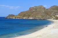 Agios Vassilios, South Rethymnon at 16.4km (E) One of the nicest sandy beaches of Crete Damnoni is around 6km to the east of Plakias. There are some facilities like umbrellas, sun beds and sea sports and a couple of taverns for drinks and food. Accommodation is also available. Within walking distance to the east there are two smaller beaches nested in small coves. A little farther is the beach of Shinaria which is very popular with the divers.
Image Library
 Rethymnon at 16.8km (NE) Zouridi is a village of the county of Rethymno, located 19,5 km away from the city, built at 260m a.s.l. with 90 inhabitants. Here excavations unearthed findings from the post palace period, and the Roman period as well as many venetian houses. Nowadays the village is characterized as a preservable settlement, and buildings such as the old high school are going to be restored.
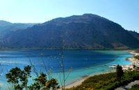 Apokoronas, Hania at 17.4km (N) Crete's only freshwater lake, Lake Kournás (GR: Λίμνη Κουρνά), is relatively large, with a perimeter of 3.5 km. Although almost all touristic leaflets say that it is possible to walk around the lake, that is not true. At least not at the end of the rain season (winter). There is a nature preserve on the Southwest of the lake. But there is a rustic road from the North of the lake to the Hills on the West of the lake too. Image Library
 Rethymnon at 17.5km (NE) The village stands 17km away from Rethymno and 6km from Episkopi. It has 160 inhabitants, farmers and stock breeders. The first university of Crete, called VIVI'S ACADEMY operated here in 1540 AD. There are remnands of many Venetian Houses, such as Villa Barocci, a mint, a fountain etc.
 Rethymnon North at 18.8km (NE) Episkopi is a small town of the prefecture and county of Rethymno. It is located at the old national road of Rethymno - Hania, 17 km away from the city of Rethymno. The town is built at 120 m a.s.l. overlooking the northern coast of Crete, and the green and fertile valley of Mousselas river.
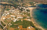 Apokoronas, Hania at 20.1km (N) Georgioupolis lies at the northern coast of Crete, about 35km away from Hania and 20 km from Rethimno. It is a nice coastal village situated at the bay of Almiros, in a lovely green scenery. It has a sandy beach and attracts quite a few visitors in the summer time. It provides all the necessary facilities to the tourists.
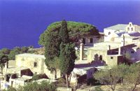 Agios Vassilios, Rethymnon south at 20.3km (E) It stands 37 km south of Rethimnon, in an imposing landscape which is mentioned at the mid-19th century diary of Th. Spratt (admiral of the British Royal Navy), as "one of the happiest places to withdraw from trials and responsibilities of life".There are lots of legends concerning the foundation of the monastery, which is believed that started during the Venetian occupation of the island. A number of its monks activities made the monastery one of the richest of western Crete and due to its isolated position it played important role in Cretan revolts against the occupying forces. A substantial number of icons and other items is kept in the Museum of the Monastery of Preveli amongst them the miracle - working Eulogistic Cross of Efraim Prevelis.
Image Library
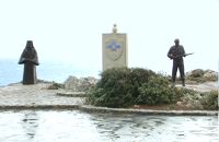 Rethymno (South) at 21km (E) The Holy Monastery of Preveli, to mark the occasion of the 60th anniversary of the Battle of Crete, decided to erect privately and under its supervision, an international memorial dedicated to the Resistance of the Cretan Population and Peace. The Memorial was erected on the monastery's own land, on a site with a stunning panoramic view, overlooking the Libyan sea. The site is alongside the main bitumen road to the Monastery, and just 1.8 kms before the Monastery itself. 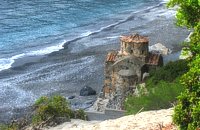 Sfakia, South Hania at 21.6km (W) Ágios Pávlos (GR: Άγιος Παύλος)is a beach on the shores of Sfakiá between Agia Rouméli and Loutró. The pine trees from the high cliffs above almost reach the sea and form a unique landscape. The beach is sandy with pebbles with no facilities except for a small tavern. It can be reached only on foot ( about 1 hour walk from Agia Roumeli) or by boat. The picturesque small church of Agios Pavlos (Saint Paul) a byzantine basilica of the 10th century A.D. with frescoes, lies just a few meters from the sea. It is built with stones from the beach itself on the spot where Saint Paul reportedly baptised people on his way to Rome.
Image Library
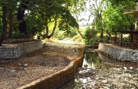 Apokoronas, Hania at 21.7km (N) The traditional little village of Vrisses lies approx. 35 km from Chania town. The old village square with its tall plane trees, the tavernas and kafenions is the perfect place to relax and enjoy the lush green landscape by the river Vrissanos and taste the renowned and particularly delicious local yogurt.
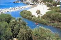 Rethymno (South) at 22km (E) The gorge that forms the river "megapotamos" ends at the Libyan Sea creating a small lagoon at its mouth. This lagoon, which the locals call "Lake" (limni , Gr:Λίμνη), is surrounded by palm trees and rich vegetation and is one of the most attractive places in Crete. In the past it used to be the ideal place for camping and naturalism. The sea is clean with a dazzling range of green and blue colors and the beach has fine white sand. Image Library
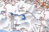 by Richard Ellis at 23.8km (NW) 31th August - Katsiveli to Kallerghi via Pachnes- The day dawned with a cloudless blue sky. I was lucky. The route starts with a gentle two km warm up across the Niato plateau before turning more vicious. The next phase is a very steep 700 meter climb up the north east ridge of Kastro. One of the pluses is that you are doing this in the relative cool of the morning - one of the minuses is that you will probably be carrying something like five litres of water. Distance Total (with Pachnes climb): 25.3 km Time: 9 hrs. 30 mins. Mov av 3.3 km/hr Height overnight: 1,518m.(Kalergi) Max. height: 2,453m.(Pachnes) To Pachnes and back:12.1km, time 4hrs 10mins. 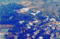 Apokoronas, Hania at 25km (N) Vámos (GR: Βάμος) is the capital of Apokoronas district is an exceptionally interesting village that the Ministry for the Environment, Physical Planning and Public Works has classed as traditional. It is more like a small town, very well preserved, with folk and neoclassical architectural elements. The initiative of a group of inhabitants to create an association for the preservation of the village as well as alternative tourism strategies is already paying off while constituting a model for further local progress. The famous art and cultural festivals are good opportunities for everyone to experience the hospitality and entertainment Vamos can offer.
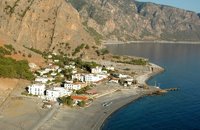 Sfakia, South Hania at 25.1km (W) Agia Rouméli (GR: Αγία Ρουμέλη)is a small fishing village, approximately two kms from the ending of Samaria Gorge. It is accessible only by boat from Paleohora, and from Hora Sfakion. It serves mainly as a stopover for visitors coming down the Samaria Gorge, and waiting for the boat to take them to Sfakia or Paleohora. However those who decide to stay for a couple of days or more will find apart from the unique scenery, a great beach with crystal clear water, plenty of interesting walks and a good choice of accommodations, taverns, cafés and stores. The place is also rich in history as it was inhabited since the antiquity. It is the site of the ancient city of Tárra (GR: Τάρρα), a famous cult place, that flourished from the Classical to the Roman times. Image Library
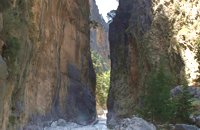 Samaria National Park at 25.3km (W) Pórtes (GR: Πόρτες - Gates) or Sideróportes (Iron Gates) is maybe the most striking point of the canyon. Here the canyon walls rise nearly 300 meters while the width is only 3.5 m. At this point the water runs almost all year round. The stratified limestone, the dominant rock of the canyon, forms specific geological formations, showing all the geological history of the canyon in the eyes of connoisseurs. Portes are 11 km away from the entrance of the Samarian gorge at Xylóskalo and 4km from the beach at Agia Roumeli.
Image Library
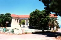 Apokoronas, Hania at 25.4km (N) The community of Kefalas (GR:Κεφαλάς) is situated in Apokoronas, Hania, approximately 4 km to the east of Vamos. During the Venetian occupation higher and lower Kefalas were classed as two separate villages, however, today they have become one. It is a large village built in an outstanding position facing the sea with architecture dominated by the influence of the early and late years of the Turkish occupation. This influence is well preserved despite the existence of other architectural styles. The church of Timios Stavros (16th century) is the oldest building of the village while the more recent churches of Panagia, Agios Antonios, and Michael the archangel, works of the reputed Kefalas craftsmen, are examples of folk architecture of the 19th century. A further example of the work of the same craftsmen is the Public School of Kefalas, which in accordance with the decision of the county council of Hania will house the Environmental Educational Centre of the prefecture, a foundation that will play a definitive role in the development of the municipality of Vamos. Other interesting communities are Paleloni and Drapanos in the direction of Kokino Horio. The road from Paleloni leads to Embrosgialo, a relatively easily accessible place, along the steep coastline, which extends to Georgioupoli. 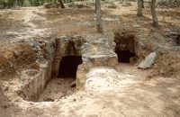 Armenoi, Rethymnon at 25.7km (NE) The site was first discovered by a teacher who noticed that two pupils were playing football using a minoan vase as a ball!. He mentioned the fact to the authorities and the excavations that followed unearthed about 300 tombs of the Late Minoan III period (1450-1100 BC). As the tombs had not been yet looted, the archaeologists found significant treasures like vases, weapons, statuettes, jewels etc. It is obvious that such a big cemetery should belong to a big city which, despite the extended investigations of the archaeologists, has not been discovered yet. Image Library
 Gonia, Rethymno at 25.9km (NE) The Municipality of Nikiforos Fokas is located in the north of Rethymnon Prefecture. The area is known for its outstanding natural beauty and its historical tradition and architecture. All of the municipality's settlements are steeped in history and contain fine examples of architecture, featuring stone buildings with vaulted entrances (known as "diavatika") and magnificent thresholds. The municipality's jurisdiction extends over the fourteen former community wards of Agios Konstantinos, Ano Valsamonero, Atsipopoulo, Gerani, Gonia (Athanatos), Zouridi, Kalonyktis, Kato Valsamonero, Malaki, Mountros, Prines, Roustika, Saitoures and Frantzeskiana Metochia, which comprise a total of 21 villages. 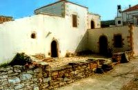 Gavalohori, Vamos, Apokoronas at 27km (N) The exhibition of the objects takes place according to the contemporary museum conception, with explanatory texts, photographs, plans, models, and is enriched with new exhibits every year. The Museum is divided into seven rooms, according to the following units: The Arched House, Silk, Pottery, Lace-making, Masonry and Stone carving, Church and Woodcarving.
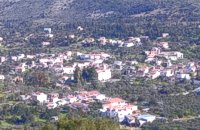 Apokoronas, Hania at 27km (N) Gavalohóri (GR: Γαβαλοχώρι) is an old big traditional village, with fine examples of traditional rural architecture and stone buildings that are well preserved. The village has been declared a traditional settlement and is awarded a protected status. Many interesting buildings still stand, such as the 18th century olive press, the church of Panagia (Virgin Mary) and that of Agios Sergios, the old school and the complex of the wells from the period of the Venetian occupation.
|
||
|
| ||
C
O
N
T
E
N
T
S
O
N
T
E
N
T
S


