interkriti®
YOUR GATEWAY TO CRETE
|
Crete
: Towns & Villages
List Grid Map
Found
74
- Showing :
41 - 60
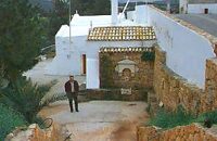 Gouves, Iraklion at 28.7km (N) At a height of 140m. above sea-level, this village has 142 inhabitants and is 22.5 kms away from Iraklion. According to the villagers, the name comes from the church of Aghios Nikolaos Skotino at the entrance of a cave. It was built at the end of the Venetian period. Today an extra wing has been added, dedicated to Aghios Charalambos. This church of Aghios Nikolaos Skotino presumably functioned as a "Hedge School" (or "Hidden School") under Turkish rule when education had been banned. When the locals said: "We are going to Skotino (which also means "darkness")", they meant they were going to school. Turkish administration refers to this place as Skotino Perasma in 1671. Very close to the village (1.5 km) the cave of Aghia Paraskevi draws crowds of tourists and is well worth a visit. 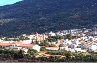 Mirabello, Lassithi at 28.8km (NE) Neapolis is located 15 km westwards of Agios Nikolaos on the way to Heraklion from where it is roughly 50 km far. Neapolis is built in the green valley of Mirabello. In the period of the Venetian domination its two settlements were named "New Village". But when the seat of the Prefecture was transferred from Fourni to the “New Village” this last was renamed to Neapolis. Neapolis was maintained as the capital of the prefecture of Lasithi till 1904. After that date Agios Nikolaos became the new capital. 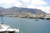 Pediada, North - East Iraklion at 29.3km (N) The most popular tourist resort in Crete. Nice beaches, sights and facilities for all tastes and ages. Together with Malia, are the party places for young visitors. Close to Hersonissos there are three small traditional village, those of Piskopiano, Koutouloufari and Old Hersonissos.
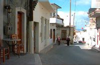 Gouves, Iraklion at 29.9km (N) Pano Gouves (GR: Πάνω Γούβες) is a village of the district of Pediada in the prefecture of Iraklion at a height of 100 metres above sea-level. It lies twenty kms away from Iraklion, to the right at 17.3 kms on the National Road to Aghios Nikolaos. The village is built on the western flanks of the Ederi hill (322 m.). The name comes from "edera" which means ivy and symbolises affection. The name Gouves, on the other hand, comes from Gouva and means a hollow in the earth. It also means, in Crete, a hole in which during the middle ages, people stored their wheat. The earliest reference we have of the village is that of "Guves" in 1387 documents of the Duke’s archives in Chandax. Later on, in 1577, Fr. Barozzi mentions "Guvos" in the district of Pediados, and then "Guves" in the 1583 Register, with 252 inhabitants. Finally, in 1630, Vassilikata refers to "Vuves’. This is the birthplace of the poet Ioannis Konstantinidis. There are several outstanding churches in the village, among them: Zoodochos Pigis, Aghios Giorgos, Aghios Ioannis and Panayia (dedicated to the birth of Our Lady).  Mirabello, Lassithi at 30.1km (N) The village of Sissi, a picturesque village 40 km east of Heraklion and 25 km west of Ag. Nikolaos. Sissi is a beautiful fishing village with strange nature. On one side of the village the nature is wild, with a small river flowing into the sea, a number of palm trees on its banks, ducks and geese swimming peacefully. On the other side there are sandy and gravel beaches, caverns in the rocks and deep clear water, full of many kinds of fish. A place that gathers the nature of different places of Crete.
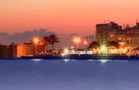 Ierapetra, Lassithi at 30.9km (E) Ierápetra (GR: Ιεράπετρα), the southernmost town of Crete, combines a brilliant past with a present of economic growth and extension. The temperature seldom falls below 12°C, and the mean annual temperature is 20°C, also it is the sunniest and hottest region of Greece. It has a long sandy beach and clean blue sea, a picturesque port with the castle "Kales", an archaeological Museum, and many more attractions. Visitors will find a wide range of accommodation facilities and lots of interesting things to do and see in the town and the wider area as well.
Image Library
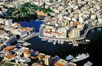 North East Crete, Lassithi at 32km (NE) Agios Nikólaos (GR: Αγιος Νικόλαος), with 9.500 inhabitants, is the capital of the Lassithi province of Crete. It is built around a picturesque lake at the north-western side of the Mirabello bay, the biggest bay in Crete. Major administrative, cultural and communications center, Agios Nikolaos is one of the most developed tourist areas, not only in Crete but in Greece in general. Thanks to the beautiful coasts, the great sights and the cosmopolitan life, this lively city hosts every year thousands of visitors without losing one bit of its tranquility and traditional hospitality.
Image Library
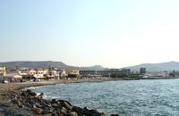 Gouves Beach, North - East Iraklion at 32.8km (N) Káto Goúves (GR: Κάτω Γούβες or simply Gouves) is a modern tourist resort with a complete tourist infrastructure to meet all demands. Organised beaches, large modern hotels, family apartments, restaurants, small tavernas, recreation centres, sports centre, shops, car and motorbikes for rent, small ports (marinas) for small boats, in a word Kato Gouves provides everything the visitors require to spend an agreeable and carefree holiday, enjoying the sunshine by day and the thrilling night-life in the numerous bars in the area. Just a few kilometers inland there are picturesque traditional villages, historic monasteries, caves and other natural beauties. Image Library
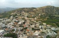 Iraklion at 32.8km (NW) The town of Profitis Ilias (GR: Προφήτης Ηλίας), or Roka for the locals, is found 20km south of Heraklion It is built on the top of two hills offering an unforgettable view to the surrounding areas. A natural fortification, due to its position, it has been suggested that ancient Lycastos was built here. It is also known as Kandli Kasteli due to the castle located at the summit of a rock southeast of the town. Nikiforos Fokas built the Byzantine castle of Temenos in the same location in 961 when he freed the island from the Saracens. His objective was to bring the city of Hantaka (Heraklion) into the castle of Temenos. However, this did not materialize and the city remained were it was. In the thirteenth century the castle of Temenos was occupied by the Genoese Pescatore, and later by the Venetians. The name Kanli Kastelli in Turkish means blood-painted castle, and took its name from a massacre of Turks by the Venetians and Greeks that took place here in 1647.  Kenouriou, Iraklion at 32.9km (W) Doúli (GR: Δούλι) is a village in Kenouriou county, located 38 km from Iraklion at an altitude of 440 m above sea level. The earliest reference to it, is to be found in the Duke's Archives of 1372, where it is mentioned as the feudal property of Nic. Venerio. The name figures in all the Venetian censi of the 16th and 17th centuries, as well as in the Turkish (1671) and Egyptian (1834) censi. In 1881, Douli forms part of the municipality of Megali Vrisi with about 170 inhabitants, and again in 1900 with only 21 inhabitants. As of 1920, Douli is a commune in its own right, and today Douli has about 240 residents. The patron saint of the village is Aghios Panteleimonas and the feast of the Saint is celebrated on July 27th.A visit to the old church of Aghios Nikolaos is also a must. For those interested in paleontology, there are fossils to be found at the location 'Pirgos'.  Kenourgiou, Iraklion at 35.5km (W) Agios Thomás (GR: Αγιος Θωμάς) lies at 530 m above sea level. It is 30 km away from Heraklion and has a panoramic view over the whole area to the SE of Aghia Varvara. Agios Thomas is a very old village and the first reference we have of it, is in a document of 1371, where it is quoted as a feudal property of Petrus de Medio, and again in a document dated 1380. Later, it figures in all the Venetian censi of the 16th and 17th centuries. In 1881, and in 1900, it figures as part of the Megali Vrisi municipality, with 344 inhabitants. From 1920, it figures in all the censi as a community with a continuously growing number of inhabitants. Nowadays there are over 800 inhabitants. 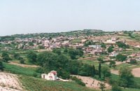 Kenouriou, Iraklion at 36.5km (W) Megali Vrissi (GR: Μεγάλη Βρύση) lies 32km south of Heraklion, at 620 m above sea level. In the Barozzi document of 1577, it is mentioned as forming part of the province of Monofatsi and, in the Archives of Megalo Kastro (Heraklion), it is quoted in 1583 as having 71 inhabitants; there is also a reference to the village in the Basilicata document of 1630. The Turkish census records it with 47 families in 1671, and in the Egyptian one in 1834, it figures with 27 families. In the censi of 1881 and 1900 it is mentioned as a municipality in its own right with, respectively, 240 inhabitants and 307 inhabitants. As of 1928, it becomes a commune and today it counts over 900 inhabitants. Saint Constantine is the patron saint of the village. The churches of Aghia Anna and of the Panagia Almiri are worth visiting. The Aeolian Park, one of the islands pioneering projects, has been installed in Megali Vrisi and produces electricity of 5MW. 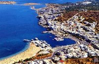 Mirabello Bay, Lassithi at 36.7km (NE) The area is touristic developed with many shops, restaurants on the shore, bars and several excellent hotels famous for their comforts and the variety of amenities offered. The lagoon of Elounda is shaped between the coast and a small peninsula of 7-8 km length ... Spinalonga, since antiquity, has protected the harbor of ancient Olous.
 Kenourgiou, Iraklion at 38km (W) Agia Varvára (GR: Αγία Βαρβάρα) is a town built along the road between the Messara plain and the Malevizi region at the highest point (580 m). The town enjoys a unique location with a splendid view into the Malevizi region, and a cool climate, particularly pleasant during the hot summer months. It produces first-rate fruit and vegetables. Because of its strategic location on the main north-south axis, the town was often exposed to fierce battles. A famous warrior, Mathiou Kapitakis or Mathioudakis was born here: he fought side to side with Karaiskakis and was killed at Faliro. His comrade-in-arms, Logios, was the hero of Aghios Thomas. As you reach the village, on the north side there is a rock with a chapel dedicated to Profitis Ilias. On this rock -which used to be twice as large but part of it fell off at the beginning of the 19th century- there used to be an ancient temple. Nowadays, the visitor can find every kind of commodity and facility on hand at the modern town of Aghia Varvara. In summer a special 'tsikoudia' feast, and in early spring a carnival feast are organized by the Cultural Association of the town. At the centre of the town, there are two churches - one old and one new - both dedicated to the patron saint, Aghia Varvara. Three Byzantine churches are also well worth a visit: Profitis Ilias, Aghios Giorgos and Aghios Ioannis, and of course the old monastery of Aghia Pelagia by the cemetery. 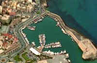 North - Central Crete at 38.3km (NW) Iraklion (Heraklion or Herakleion GR: Ηράκλειον) is the largest urban centre in Crete, the capital of the region and the economic centre of the island. The first European civilisation, the Minoan civilisation, flourished on this land 5000 years ago. Currently the population of Iraklion is approximately 150.000 people. It is a very dynamic and cosmopolitan town, particularly during the summer period when thousands of visitors can be seen shopping in the market or visiting the museums and other places of interest. Today Heraklion is the top choice for tourist destinations in the Mediterranean. The city is also the commercial and scientific centre of the island. During the last 20 years the city has made remarkable progress in the academic and technological fields...
Image Library
 Kenourgiou, Iraklion at 38.3km (W) Moúlia (GR: Μούλια) is a village in Kenouriou county, located three and a half kilometers away from Agia Varvara town and 32 km from Iraklion at an altitude of 640 m above sea level. Moulia is an old village as we come across a reference to it in a document dated in 1248, where the settlement is recorded as belonging to the archbishopric of Crete. Another reference is found in a legal agreement established in 1411. The name figures in all the Venetian censi of the 16th and 17th centuries, as well as in the Turkish and Egyptian censi. In 1881, it forms part of the municipality of Zaros with about 180 inhabitants, and again in 1900. As of 1920 it is a commune in its own right, and today with the lower village of Kato Moulia it counts over 550 inhabitants. The main church of the village, with wall paintings, is that of the patron saints, Saints Peter and Paul, and there is a village feast on the 29th June, in their honour. The lovely chapel of Zoodochos Pigis is also well worth a visit.
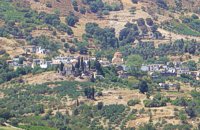 Kenourgiou, Iraklion at 39.4km (W) Priniás (GR: Πρινιάς) is a small village located 35km southwest of Iraklion town and 4km from Agia Varvara, at a height of 610 m above sea level. The village of Prinias lies on the border of three regions: Malevizi, Kenouriou and Monofatsi, and is recorded as forming part of all three regions in the censi.  Malevizi, Iraklion at 39.9km (NW) Agios Myron, with 708 inhabitants, lies 18 km from the city of Iraklion to the south west. Its one of the most important villages of the area with interesting town planning and impressive samples of traditional architecture. Built between two hills it commands a panoramic view and the school's clock, its main characteristic, is visible from almost everywhere in the area of Malevizi. 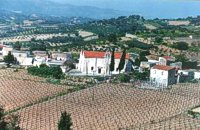 Malevizi, Iraklion at 40km (NW) Pyrgou lies 20 km from Iraklion and 1km from Agios Myron at 400m a.s.l with 354 inhabitants. It is built on a hillside overlooking the area, with panoramic view to the village of Kroussonas and the ravine of "Agia Irini". At the village's perimeter there are well maintained tower-like houses.  Malevizi, Iraklion at 40.1km (NW) Petrokéfalo (GR: Πετροκέφαλο) lies 16km from Iraklion and 3km from Agios Myron at 340m a.s.l with 248 inhabitants. It is built on a rocky hillside. The hill' shape resembles to a human head and it is supposed that the village owes its name to this (petrokefali = stone head) . The settlement was fortified and lately were discovered significant ancient findings. The patron Saint is "Agia Paraskevi" and there is a village feast on the 8th September in her honour.
|
||
|
| ||
C
O
N
T
E
N
T
S
O
N
T
E
N
T
S


