interkriti®
YOUR GATEWAY TO CRETE
|
Crete
: Regional Interest
List Grid Map
Found
89
- Showing :
61 - 80
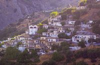 Ierapetra, Lassithi at 24.1km (SE) At a mountainous, precipitous site, in the west mountain slopes of Dikti, at an altitude of 550 m above sea level and at 2 km from the village of Malles, is built the village Christos (GR: Χριστός – Christ). Christos is a beautiful, verdurous village, with many running waters, traditional, unchanged by time, with narrow sloping cobbled alleys. Image Library
 Kenouriou, Iraklion at 24.4km (W) Doúli (GR: Δούλι) is a village in Kenouriou county, located 38 km from Iraklion at an altitude of 440 m above sea level. The earliest reference to it, is to be found in the Duke's Archives of 1372, where it is mentioned as the feudal property of Nic. Venerio. The name figures in all the Venetian censi of the 16th and 17th centuries, as well as in the Turkish (1671) and Egyptian (1834) censi. In 1881, Douli forms part of the municipality of Megali Vrisi with about 170 inhabitants, and again in 1900 with only 21 inhabitants. As of 1920, Douli is a commune in its own right, and today Douli has about 240 residents. The patron saint of the village is Aghios Panteleimonas and the feast of the Saint is celebrated on July 27th.A visit to the old church of Aghios Nikolaos is also a must. For those interested in paleontology, there are fossils to be found at the location 'Pirgos'. 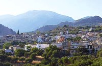 Ierapetra, Lassithi at 25.1km (SE) One of the largest villages of Crete, in the north of the valley of the river Sarantapichos. It is 28 km away from Ierapetra and 40 km away from Aghios Nikolaos, in a verdurous slope within immense olive groves, with an unlimited view to the valley of Myrtos, the Libyan Sea and the mountain peaks that surround it. 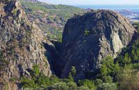 Ierapetra, Lassithi at 25.1km (SE) A monument of natural beauty that attract a lot of local and foreign visitors. The gorge of Sarakina (GR: Σαρακίνα) is one of the most beautiful in Crete. Its steep, vertical walls in some parts reach a height up to 250 m. Its widest opening is no more than 15 metres while in some places it’s so narrow that its sides seem to join each other. Its rich flora and fauna, the dittany, the wild birds that nest there, the running water make the route through the gorge a worthwhile experience. 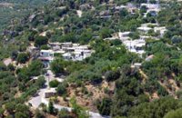 Ierapetra, Lassithi at 25.1km (SE) A small village built at an altitude of 540 m in the south parts of the mountain Dikti at the borders of the province of Ierapetra-Viannos. The imposing mountains above the village, the south horizon among the olive-covered hills and in the lower villages, the cool climate create in you a sensation of bodily and spiritual well-being at this balcony of the Cretan nature. Five settlements, two of them uninhabited today, constituted the Community of Riza, now a Local Department of the Municipality of Ierapetra. 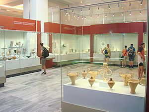 Heraklion city at 25.7km (NW) The most magnificent collection of Minoan art and culture in the world, unique in beauty and completeness is housed in this museum. The exhibiton of the museum is organized in chronological order, ranging from the Neolithic period to the Roman era (4th century A.D.) and geographically, according to the provenance of the finds.
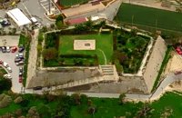 Iraklion at 25.7km (NW) The bastion heart shaped in plan with an acute angle, has two "piazza bassa" and one cavalier. It defines the southeast and the highest part of the fortification. Its name is due to Gabriele Tadini Martinego (1520) who started the construction of a circular tower at the place of the later bastion. It was one of the strongest bastions (the others were that of Pantocratora and that of Vittouri) which also suffered the main attack and most of the bombardment from the Turks. On the top of the bastion itself there was made a cavalier (which looks like a smaller bastion), whose main purpose was the better defense and control of the area around the bastion. The grave of Nikos Kazantzakis, the famous Cretan writer, is situated on the highest point of the Venetian fortification at the Martinego cavalier. The inscription by the wooden cross reads: " I hope for nothing. I fear nothing. I am free ", a phrase taken from "The Odyssey" which Kazantzakis considered as one of his most significant works. The playgrounds of the Academy of the local football team "Ergotelis" are located today on the main bastion and in the ditch around the bastion are the botanical gardens of the city. Image Library
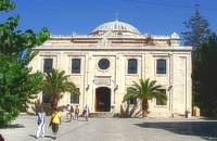 Iraklion Old Town at 26km (NW) With the recovery of Crete from Nikiforos Fokas (961AD), the seat of the bishopric is transferred from Gortyna to Chandakas, which became the capital of the island. The new cathedral, which is the most established and largest in the city, is dedicated to the Apostle Titos. Here, amongst other relics, there are gathered the Holy Skull of the Apostle and the miracle working icon of Messopapaditissas. Image Library
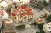 Iraklion Old Town at 26km (NW) The Cathedral of St. Minas:The small church of St. Minas did not meet the religious needs of the constantly growing Christian community, so the demand arose for the erection of a new cathedral. The plot for the new church used to be a garden that belonged to a Turk from whom it was bought. The architect was Athanasios Moussis and in 1862 the foundation stone of one of the most magnificent and impressive Greek churches was laid. The outbreak of the Cretan revolution of 1866 demanded the stopping of the building work which will continue in 1883 in order to be completed in 1895, when the inauguration of the exquisite temple took place. The church is of the cruciform type with a dome based on a high spandrel, while internally there are also elements of a three aisle basilica. It has two bell towers, one in the northeastern corner and the other in the southeastern one. The right aisle is dedicated to Apostle Titos and the left one to St. Ten Martyrs of Crete. The inside of the church has gone through many changes with new additions. With plans of the architect Anastasios Orlandos the woodcut icon screen was replaced by another one made of marble, the same happened with the bishop's seat. The religious painting of the church was assigned to St. Kartakis who followed faithfully the principles and the models of the Byzantine icon painting. The hundredth anniversary from the inauguration of the Cathedral Church of St. Minas (1995) was celebrated with every solemnity that is suited in an equal occasion and more specifically to one of the most glorious and imposing Greek churches. Image Library
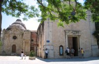 Iraklion at 26.1km (NW) Agia Ekaterini church and Exhibition of Byzantine Art and Ecclesiastical objects. A small sinaitic church of St. Catherine with a Basilica design, houses an exhibition with works of art from the Cretan renaissance. Among the exhibits are some of the most important icons of the Cretan School, ecclesiastical books and manuscripts, vestments, ecclesiastical vessels and relics, wall-paintings, wood-carvings and sculpture. 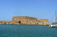 Iraklion Venetian port at 26.2km (NW) A seaside fortress situated at the entrance of the old harbour. It was built by the Venetians, before the construction of the new Venetian fortification, in order to protect the pier and the port. It took its last shape in the years between 1523 - 1540 replacing another construction destroyed by an earthquake. Image Library
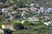 Ierapetra, Lassithi at 26.3km (SE) Deep inside the valley of the river Sarantapihos is built the village Mythoi. It is 22 km away from Ierapetra, it is a small village, in a verdurous landscape,with a beautiful square under the shade of age-old planes. It is said that the village took its name from the plant “Minthi”, or mint, which is abundant there.However, it may have been named thus because of its many legends, traditions, and myths (mythoi), the most prevalent one being the Sarantapihos’ one. A mythical giant, forty ells tall, like another Talos or Akritas Digenis, he protected the residents from raids. There are the place names “Tou Sarantapihoui Patounia” (Sarantapihos’ footprint) and “Tou Sarantapihou to Mnima”(Sarantapihos’ grave). There is evidence of ancient habitation at the site “Leniko” where traces of walls can be seen. Also, in an excavation, the head of a woman of the Roman period has been found. At the sites Kastelou Haraki and Orfanou to Spiliari claypots, oil lamps, e.t.c. have been found. The site called Sarakina above Mythoi was a fortress, a hideout of Saracen pirates. The village’s modern history is rich in contributions to the struggles against the conquerors. It nurtured the chieftains Emmanouil Xenikakis, Ioannis Hatzakis, Emmanouil Christakis andothers. During the German Occupation, residents of Mythoi took part in the guerilla corpses of the United Resistance of Captain Bantouvas. In the battle of Symi, one of the most heroic figures was lost, Apostolos Vagionakis, who stood up to the enemy’s bullets for the ideals of our unsubdued Crete. They paid the price of their participation to the struggles during the German Occupation,as 4 persons were executed, including the old and bedridden Nikolaos Ioannou Christakis. The community of Mythoi is today a Local Department of the Municipality of Ierapetra, in 1900 it had 360 Christian residents, in 1951 it had 423 and in 2001it had 287. In the north of Mythoi, around 6 km away, there is the settlementKarydi with the famous Monastery of Panagia (Our Lady) Karydiani and now abandoned summer residences. The mountainous settlement “Minos”, which is situated in a verdurous small plateau below the Afentis peak of the Lasithi mountains, also belongs to the Community of Mythoi.The village Mythoi is a lively village with a rich social and cultural life. It has a cultural association, a football team and field, and a modern olive press. The village’s square with its old plane trees, the mulberry trees, the old fountain,the traditional coffee-houses with the raki and the local dishes, is a place of reference for the residents of Mythoi. The sights, the wild natural landscapes in the north of the village, the famous gorge of Sarakina, a monument of natural beauty, attract a lot of local and foreign visitors. The gorge of Sarakina is one of the most beautiful in Crete. Its steep, vertical sides cause awe, and reach a height of up to 250 m. Its widest opening is no more than 15 m while in some places it’s so narrow that its sides seem joined. Its rich flora and fauna, dittany,the wild birds that nest there and the route inside the gorge are breath-taking. Its promotion is a foremost goal of the Local Department and the Municipality of Ierapetra, of the residents of the village, who head to the future with optimism and anticipation for the development of their place. Source:The Municipality of Ierapetra. 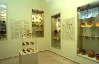 Iraklion town at 26.4km (NW) The history and culture of Crete, from the first centuries of the Christian era to our present time. An exceptional museum featuring a collection of extremely precious objects, a must see for every visitor to Crete. The museum is housed in a two storey neoclassical building, which was constructed in 1903 on the site of an earlier mansion.
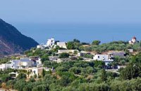 Ierapetra, Lassithi at 26.4km (SE) A stately village built in settlements, 22 km away from Ierapetra, at an altitudeof 225 m, next to the Ierapetra-Vianos provincial road. A green landscape,overgrown with olive trees, with an unlimited view of the Libyan Sea, to thesurrounding areas Koleitos, Kakon Oros, to the beaches Vatos and Kallikovrechtis.An almost abandoned village, with old houses built of stone, with chiseled doorframes and coats of arms bearing the Christian cross and proving its old gloryand history.Giannis Dimitromanolakis, an author from Gdohia, writes:“Gdohia sprouted right opposite the beach of the Libyan Sea. Nothing wouldhave been better for the pirates, who, like diabolical ghosts, emerged into thenight to kill and prey. The village’s history is dipped in blood, as it often sufferedfrom the raids of the pirates from the Barbary Coast. It took the name Gdohiafrom the catastrophes, from the verb “gdyno”, to skin, to set fire, to devastate.”Gdohia’s course in time has evidence of struggles, sacrifices and holocausts toshow. It was not only exposed to the pirates but it was situated on the naturalsouth passage going from the Viannos area to the Ierapetra area. This meantthat the hordes of barbarous conquerors burnt and devastated it, along withthe other Symiana villages, as they are called, in the West Ierapetra.Gdohia’s settlements are built leaving a distance between each other: KatoGdohia or Pitropiana, taking their name from the Epitropakis family livingthere, Pefkiana or Grysboliana, from the Grysbolakis family, Dimitromanolianafrom the Dimitromanolakis family, Daskaliana from the Daskalakis family,Papadiana from the Papadakis family. Great stonecutters, stoneworkers,famous for their art, Gdohia’s residents built the mansions of the whole areaand the famous bridge of Myrtos using stones from the quarries of Kolleitos.The miraculous church of Panagia (Our Lady) Evaggelistria of Gdohia, a workof art and a great ecclesiastical monument is also built by Gdohia’s residents.Gdohia village, once the seat of a Community, today a Local Department ofthe Municipality of Ierapetra, presents an exceptional sight-seeing interest. Itprovides natural landscapes, beautiful beaches, picturesque little churches onthe hills, a spacious square with palm trees, seats and a war memorial forthe fallen fighters of the liberation wars. In the 1881 census, 296 residents areregistered and 73 in 2001. Gdohia’s permanent residents, along with someforeigners’ families who have bought and renovated old houses, struggle forthe village’s development which gradually acquires the necessary infrastructures.A village with rich history and civilization, with vast olive groves, a nicemild climate, both during summer and winter, it hopes to come back to life.The old mansions, half-wrecked and burned in the German Occupation, standas if they were sculptures, a painting with the deep blue Libyan Sea serving asa background, narrate the flourishing, the glory and the history of Gdohia andwait to be inhabited again.
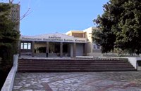 Iraklion at 26.5km (NW) The TEI, located on the beautiful island of Crete, was founded in 1983 in order to provide Higher Technical Education to the students of Greece. Since then it has expanded and developed considerably, and now comprises the Schools of Applied Technology (also in Chania and Rethimno) Health & Welfare Services Management & Economics (also in Agio Nikolao and Ierapetra) and Agricultural Technology assisted by he Departments of General Sciences, Foreign Languages and Physical Education. Students at the TEI follow courses for 4 years including lectures and practical work in laboratories. In addition, they complete a work placement and dissertation before graduating. Education at the TEI offers up to date training in technological subjects and prepares students to develop into skilled, responsible and qualified members of society. With a permanent teaching staff of 200 and approximately 10.000 students the TEI of Heraklion is a thriving academic community with an extensive library, student halls of residence, sport facilities and a health center. P.O. Box 1939 IRAKLIO, Crete, Greece, GR 710 04 Tel: Fax: +30 281 0379328 http://www.teicrete.gr 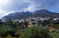 Ierapetra, Lassithi at 26.5km (SE) Mournies (GR: Μουρνιές - meaning: mulberry trees) is a village of the western Ierapetra. It is located north of Myrtos, and 25 kilometers away from Ierapetra at 275m (elevation), built on the southeastern outskirts of the Lasithi mountains, with beautiful views of the Libyan Sea and the plains of Ierapetra. It has a mild climate, without extremes, ideal both for permanent residence and for holidays. The landscape is hilly plenty of olive trees. In the 2001 census it had 83 residents. Mournies is a beautiful, historic, picturesque and traditional village with cafes, a square with a war memorial, an old fountain, and narrow streets branching off the main street of the village. Mournies was named after the Mulberry tree which however is not abundant in the area. 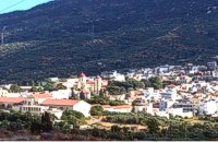 Mirabello, Lassithi at 26.6km (E) Neapolis is located 15 km westwards of Agios Nikolaos on the way to Heraklion from where it is roughly 50 km far. Neapolis is built in the green valley of Mirabello. In the period of the Venetian domination its two settlements were named "New Village". But when the seat of the Prefecture was transferred from Fourni to the “New Village” this last was renamed to Neapolis. Neapolis was maintained as the capital of the prefecture of Lasithi till 1904. After that date Agios Nikolaos became the new capital.  Kenourgiou, Iraklion at 27.2km (W) Agios Thomás (GR: Αγιος Θωμάς) lies at 530 m above sea level. It is 30 km away from Heraklion and has a panoramic view over the whole area to the SE of Aghia Varvara. Agios Thomas is a very old village and the first reference we have of it, is in a document of 1371, where it is quoted as a feudal property of Petrus de Medio, and again in a document dated 1380. Later, it figures in all the Venetian censi of the 16th and 17th centuries. In 1881, and in 1900, it figures as part of the Megali Vrisi municipality, with 344 inhabitants. From 1920, it figures in all the censi as a community with a continuously growing number of inhabitants. Nowadays there are over 800 inhabitants. 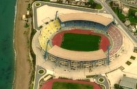 Iraklion at 27.6km (NW) Capacity: 26,240 (seated)- Location: The stadium is located in Heraklion (also: Iraklio) 3 km west of the city centre (at Lido beach)... The building began 15 years ago and the 2004 Olympic Games proved to be the golden opportunity for the Pancretan, as the Athens Organising Committee named it as one of the venues of the football tournament. It was inaugurated on 31 March 2004, when it hosted an international friendly match between the National teams of Greece and Switzerland. The stadium is currently the second largest stadium of the country. The stadium is actually part of a sports complex. A training ground with an 8-lane athletics track, Lido Indoor Hall, and a swimming pool are located right next to the Pancretan Stadium. Image Library
 Malevizi, Iraklion at 28.2km (W) Petrokéfalo (GR: Πετροκέφαλο) lies 16km from Iraklion and 3km from Agios Myron at 340m a.s.l with 248 inhabitants. It is built on a rocky hillside. The hill' shape resembles to a human head and it is supposed that the village owes its name to this (petrokefali = stone head) . The settlement was fortified and lately were discovered significant ancient findings. The patron Saint is "Agia Paraskevi" and there is a village feast on the 8th September in her honour.
|
||
|
| ||
C
O
N
T
E
N
T
S
O
N
T
E
N
T
S


