interkriti®
YOUR GATEWAY TO CRETE
|
Crete
: History & Archaeology
List Grid Map
Found
17
- Showing :
1 - 17
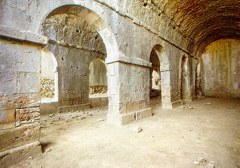
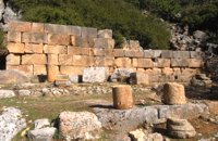 Ancient town in Selino, South Hania at 9.7km (E) Located ~2.3km west of Sougia it was the religious centre of the cities in south-west Crete and the port of Elyros. It flourished during the Hellenistic and Roman periods. In 1957-58 Asklepieion was excavated by N. Platon. The most important monuments of the site are: The Temple of Asklepios, dated to the Hellenistic and Roman periods, Part of a Roman theatre, Rock-cut and built chamber tombs. There two byzantine chapels dedicated to Our Lady and Agios Kirikos The beach in the small cove has coarse pebbles and clear waters. Lissos (GR: Λισσός) nowadays is uninhabited and can be reached from Sougia only by foot (~1& 1/2 hours walk) or by boat (~20 minutes). 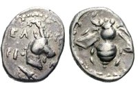 Selino, Hania at 12.1km (NE) Elyros ("Έλυρος" in Greek) is an ancient city, located in southwest Crete, in Kefala Hill, near the village Rodovani and is presently unexcavated. Elyros was flourishing at least as early as the Greek Classical Period, e.g. 500 to 350 BC. In the Classical Period Elyros was the most important ancient city in southwestern Crete, having about 16,000 inhabitants. It was an industrial and commercial city with large weapons production. Syia and Lissos were its harbours. Apollo, Phylakides and Philandros, sons of Apollo and nymph Akakallida, were worshiped there. In the third century BC Elyros was at war with Kydonia, an important center of Cretan power, located in the modern city of Chania. The citizens of Elyros sent to the Delphi Oracle, a bronze votive complex that represents a goat feeding the sons of Apollo when they were infants. It is also one of the thirty cities that signed the decree with Eumenes B’ in 183 BC.Elyros was also important during Roman times. A Roman statue, the Philosopher of Elyros was recovered here and is now in the Archaeological Museum of Chania. During Byzantine times, Elyros was the seat of an Archbishop and the remains of the bishopric church, a sixth century basilica, can still be seen in the centre of the old city. Robert Pashley was the first who identified the location of the city, near village Rodovani. Thenon studied more carefully the ruins of the city and discovered the inscription that says: “it seemed to the city of the Elyrians”. The output of its mint consists of silver drachms from the 3rd c. BC, which depict a wild goat and a bee; in addition to their function as religious symbols, these undoubtedly hint at the stock-raising activities in the region, particularly to this kind of wild goat, which can still be found in great numbers on the island. The bee also has reference to the abundant honey-production of Crete. 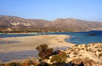 South west Kissamos at 13.7km (W) Elafonissi is a small islet on the southwest of Crete. It is connected to the beach with a shallow reef (max. depth 1 meter) that allows crossing when the sea is calm. There are only a couple of cantinas on the beach and plenty of places for camping. The place can be accessed by car from the village of Vathi or by boat from Paleohora. There are no permanent inhabitants.
Image Library
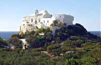 Hryssoskalitissa, Kissamos South West at 15.8km (NW) The monastery of Chryssoskalitissa (golden stair GR: Χρυσοσκαλίτισα) is dedicated to the Assumption of the Holy Mother and the Holy Trinity. It is located at the southwest part of Kissamos, 70km away from Chania. The fortress like monastery is built on a rock and pilgrims visiting have to follow a staircase carved on it with 98 steps. According to the tradition, the last one was made of gold but only faithful people could see it.
Image Library
 archaeological site in Kissamos at 25km (N) Polyrinia (GR: Πολυρρήνια) was one of the most important cities-states of the Western Crete.It was built amphitheatrically on top of the hill (418 m altitude) with a commanding view of both the Cretan and the Libyan sea, located 49 km from Hania and 6 km from Kissamos . The history of Polyrinia starts in the Minoan period and continues to the present day.
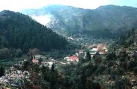 Chania at 33.6km (NE) Thérisso (GR: Θέρισο) is a small village, built on the foot of the White mountains, at 580 m a.s.l, 20km south of the city of Hania. It has 156 inhabitants and it is famous for its physical beauty, its diary-farming and its glorious past. You can reach Therisso from Perivolia passing through the Canyon (good asphalt road), or from Drakona, crossing the 7km dirt road through the forest. From here starts the trekking path which leads to the highest peak of the White mountains, Pahnes (2452m) Due to its location Therisso played a significant role at the history of the island especially during the 19th Century. A mill's stone located at the entrance of the village reminds the death of a young woman (grinded alive), when she denied to surrender to Mustafa Pasha. Here were born the great Cretan revolutionaries (Hainis), Vassilis, Giannis and Stefanos Halis. Vassilis Halis, became a hainis very young, and participated to the most great battles against the Turks in Crete and Peloponnissos. He was lt General when he died at Nafplion (Peloponnissos) in 1846. But Therisso is mostly known for its relation with the Venizelos movement in March 1905. Venizelos, who dissented with prince George' policy and declared the Union of Crete with Greece, had his headquarters at Therisso. The house of Venizelos is today a museum. The visitor to Therisso will admire the natural beauty, learn a lot of the history of the place listening to various stories and looking at the historical monuments, and taste the local specialties at the lovely taverns of the village. 2,5 km north of Therisso, at the left bank of Kladissos river, there is a cave where signs of neolithic and Minoan habitation were discovered. It is believed that it was a worship place. 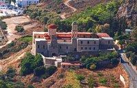 Kolimbari, Kissamos at 36.4km (N) The monastery of Gonia (GR: Μονή Γωνιάς) or Panagia Odigitria, is located 1 km north of Kolimbari (along the Spatha penninsula) and 24 km from the city of Chania in a wonderful place with a magnificent view to the bay of Hania. It was built in the 17th century, in the Venetian fortress style, and it is dedicated to the Assumption of the Virgin. The monastery replaced an older, 13th-century structure, which was located on the territory of an adjacent cemetery. 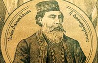 Cretan hero born in Anopolis, Sfakia at 36.9km (E) Daskalogiannis (GR: Δασκαλογιάννης) - born in Anopolis, Sfakia - started planning a revolutionary liberation movement in Crete in 1769 and completed the preparations for the revolution in Sfakia in the spring of 1770. In 1770, the revolution that had already broken out in other parts of Greece broke out in Crete too. Daskalogiannis, revolt was the first step towards freedom from the Turkish occupation in Crete and kept people, hopes from freedom alive. The international airport of Chania is named after this hero.
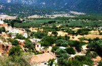 Sfakia, South Hania at 36.9km (E) Anopolis is a small village, built on a small but fertile plateau, 12 km west from Sfakia at 600 m above sea level. There are still traces of the ruins of the ancient city that prospered around the 3rd century BC, who's port was Phoenix (Loutro). Ancient Anopolis was one of the thirty city - states that signed the peace decree with Eumenes B’ in 183 BC. and thus was able to mint its own coins. During both the Venetian and the Turkish occupations, Anopolis was a center for revolutionary activities. It is the birth place of the freedom fighter Ioannis Daskalogiannis who's statue stands at the center of the village.There are three more small settlements, Limnia, Vigle and Pavliana on the same plateau. The mountainous landscape is of outstanding wild beauty. In the village there are rooms for rent and a tavern.The village is worth visiting not only for its natural beauty but also for the opportunity to explore the White Mountains. One of the best hikes is to descent to the shore through the ravine of Aradena, a five hour walk through an imposing ravine that ends up to the wonderful beach of Marmara. 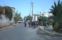 Chania at 40.9km (NE) The village of Mournies is a principal village, located 3.8 km south of Hania at 40m a.s.l. It took the name "Mournies" from the numerous mulberry trees, that use to be here even today. At the beginning of the 17th century, Mournies was famous for its beautiful villas, belonging to local noblemen. One of them, located southeast of the village, was the imposing three storey villa of "Koukounara". It had beautiful flowery gardens, fountains, statues ..., a real paradise, where many famous persons were received hospitality, amongst them the glorious Mme Ortans, the empress Eugene of Napoleon the third, queen Olga of Greece, and the king Constantinos in 1913. The villa today, being restored, houses a department of the Geek Navy. Mournies was the birth place of one of the greatest statesman of the new Hellenic Republic, Eleftherios Venizelos. Venizelos' influence on the history of Greece was paramount, from his participation to the talks with the Ottomans that resulted to granting Crete independence in 1897, to the final union of Crete with Greece in 1913. The house of Venizelos located in Mournies is going to be a museum, and many personal items of the politician are going to be on display there.  Gramvoussa Cape, Kisssamos at 42.9km (N) Due to its strategic location, Gramvoussa was fortified by the Venetians, who built a well-fortified castle on the top of a steepy rock at an altitude of 137 m. Construction on the castle of Gramvoussa started in 1579 and ended in 1582.
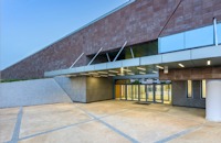 Chalepa, Hania at 45.2km (NE) The Archaeological Museum of Chania is located in the historic suburb of Chalepa, on a plot of land covering 11,526.81 m2, with a total area of approximately 6,000 m2. Its location, averaging 98 m above sea level, offers a magnificent view over much of the city, especially the seafront. The Museum, designed by architect Theofanis Bobotis and partners, is composed of two distinct linear monolithic masses rising from the earth, a symbolic reference to the vestiges of civilisation beneath the surface. The permanent exhibition of the Archaeological Museum of Chania is set out in three galleries on the ground floor, presenting the archaeological riches of the regional unit of Chania from the first traces of human presence in Chania to the 4th century AD, and a gallery on the upper floor where part of the Konstantinos, Marika and Kyriakos Mitsotakis Collection is exhibited. The exhibition is enriched with faithful reconstructions of various spaces, visual media, digital presentations, tactile exhibits (copies of ancient objects) accompanied by Braille captions, and an audio guide. The Temporary Exhibition Gallery and the Museum gift shop are on the ground floor, while the Educational Programme Room, the Amphitheatre and the Café are on the upper floor. 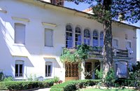 Halepa, Hania at 45.4km (NE) After the scientific and administrative services of the Foundation "Eleftherios Venizelos" were transferred to the former Vloom Mansion, in 2005, the Venizelos residence remained the Foundation's headquarters and it has been converted into a Museum, a commemoration site for Eleftherios Venizelos. The residence bears the imprint of Eleftherios Venizelos and the building has maintained its original form, of the years he lived there. The furniture of the decade 1925-1935 was selected by Venizelos himself and his wife Elena, and was brought from Athens and abroad. Decorative objects and paintings of the period, original photographs and personal items of significant value decorate the interior of the residence. Website:www.venizelos-foundation.gr 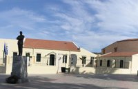 Chania at 45.4km (NE) The aim of the Foundation is to function on a national level as a dynamic european research and educational centre constituting a central point of reference for the coordination of research into the work, era and life of the great statesman and more generally into modern Greek history without ideological constraints and preconceptions and without local limitations. The address of the Foundation is: National Research Foundation "Eleftherios K. Venizelos" House of Eleftherios Venizelos Elena Venizelou Square, Chalepa, 731 33 Chania T.K. 73133 Tel. (0030) 28210-56008, 51555-6, 54011 Fax (0030) 28210-56009 Email: info@venizelos-foundation.gr Office Hours: 08:30 - 16:00 Website:www.venizelos-foundation.gr  Politician born in Mournies, Chania at 45.5km (NE) Eleftherios Venizelos (Elefthérios Kyriákou Venizélos, GR: Ἐλευθέριος Κυριάκου Βενιζέλος - 23 August 1864 – 18 March 1936), born in Mournies village near Chania, was an eminent Greek revolutionary, a prominent and illustrious statesman as well as a charismatic leader in the early 20th century. Elected several times as Prime Minister of Greece and served from 1910 to 1920 and from 1928 to 1932. Venizelos had such profound influence on the internal and external affairs of Greece that he is credited with being "the maker of modern Greece", and he is still widely known as the "Ethnarch".
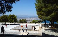 Akrotiri, Chania at 47.1km (NE) At the magical and historical location of Profitis Ilias, in Akrotiri, at the east of Hania lays the tomb of Eleftherios Venizelos, one of the most long-standing prime ministers of Greece and whose political life was focused on doubling the size of Greek territory and on the creation of a contemporary State. Eleftherios Venizelos himself had designated this position to be his resting place before his death. For the visitor, it affords a panoramic view of the rich green plain of Hania, the imposing White Mountains, the Cretan Sea, the town of Hania and the Chalepa quarter which is the location of the house in which the great politician spent most of his life and today is the headquarters of the National Research Foundation 'Eleftherios K. Venizelos'. Image Library
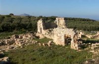 Aptera, Apokoronas, Hania at 49.1km (NE) One of the most important city - states of Crete. The first epigraphic occurence of its name (A-pa-ta-wa) is found in the Linear B tablets found at Knossos. (14th - 13th century B.C.). The history of the city is continued through the centuries untill the 7th century A.D. when a major earthquake destoyed it. Its ideal location, allowed the city to control the naval activity in the bay of Souda, and was determinative for its development in an important commercial center. The era of the city's greatest peak was the early Hellenistic period (late 4th - 3rd century B.C.). At that time Aptera experienced an economical and political floruit, begins to mint its own coins and develops diplomatic relations with important centres of the Hellenistic world.
The most important monuments of the site are: Roman cisterns. Bipartite temple, known as the "bipartite sanctuary", dated to the 5th-4th century B.C. Graves of the Geometric-Roman periods. The fortification wall, preserved to a length of almost 4 kilometres. Part of a Roman bouleuterion. Byzantine buildings. Monastery of Agios Ioannis Theologos. Turkish fortress built in 1866-1869. Source: The Hellenic Ministry of Culture 1
|
|||
|
| |||
C
O
N
T
E
N
T
S
O
N
T
E
N
T
S

