Chrissi (GR: Χρυσή meaning 'Golden', transliterated also Chrisi and Hrissi) or Gaidouronisi (GR: Γαϊδουρονήσι meanining 'donkey island') lies 8 nautical miles (~15kms) south of
Ierapetra. The residents of Ierapetra simply call it
"the island", as there is a special relationship between them, lost in the depths of time.
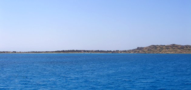
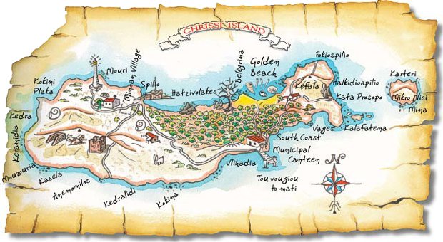
Chrissi is almost flat, with an average height of 10m. From a distance it seems like a thin line of land in the middle of the sea. Its greatest length is 5km, it has an average width of 1km (max 1.5km - min 0.5km), a perimeter of 14.5km and covers almost 5.5 square kilometers. The highest spot is to the east on "Kefala" hill (the head) and is 31m high. On that spot there is the forest lookout, with a view of the whole island.
About 700m east of Chrisi is Mikronisi, a rocky islet which covers 11.7 hectares (ha). The waters around the islands are shallow. Up to 1km to the north and 500m to the south the depth does not exceed 10m, while the 5m depth contour encompasses both the islands.
Chryssi is one of the very few sites in Greece where the rare maquis with Juniperus oxycedrus ssp. macrocarpa is found on sand dunes. Also, the mixed forest of J. oxycedrus ssp. macrocarpa and J. phoenicea is not very common in Greece. The sand beaches laid with small shells constitute one of its extraordinary features. Overall, it is a site with great aesthetic value being designated as special natural beauty site and encompassing a rare combination of ecosystems which form the habitats of several endemic species. The island belongs to the NATURA network (code:GR4320003)
Access
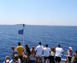
From the middle of May to the end of October, there are daily boat cruises to Chrissi island, departing from Ierapetra and
Makrygialos.
The boats from Ierapetra depart usually at 10:00 and 12:00 am and after one hour's sailing, approach the southern coast of the island, which is normally more sheltered. Passengers disembark at "Vougiou Mati" where there is a small wharf and the reception area. The boats leave Chrissi at arround 17:00 and 18:00 pm.
Within the day trip the visitor has enough time to walk around Chrissi, bathe in its crystal clear green-blue waters and have lunch at the municipal taverna.
History
For the last centuries Chrisi was practically deserted, while much earlier there were small settlements. On the western and eastern part, broken pieces of pottery have been found, which shows activity during the Minoan times. In the northwest there is a chapel of Agios Nikolaos, possibly built in the 13th century. Northeast of the chapel and near the shore there is an even older salt pan and the only house on the island, which is built on ancient ruins that include a small building and a small port. South and southwest of Agios Nikolaos there are some wells and a few carved graves. The largest one dates from the Roman times.
Environment
While walking around the island, visitors will be impressed by the colors of the rocks (reddish brown, greenish gray and black). The larger part of the island is covered by sand. On the flat areas the ground is relatively solid and consists of fine reddish sand, mainly covered by moss and lichens. At the areas where there are sand dunes, the sand is yellow and coarse. The sand is mainly supported by the complex underground roots of the cedars and their leaves, which actually touch the ground.
The
vegetation is quite diverse in view of the island's size. There are mainly cedars, junipers, lentisk, thyme, heath and rockroses and sandy shore vegetation.
The Cedar forest of Chrisi is very rare in its expanse and structure. It covers almost 35 hectares and its density is approximately 28 trees per hectare. Their average height is 3 to 7m tall and their average age is at least 300 years old. Cedars have a root system that spreads across an area which is more than double the height of the tree. Apart from the big roots, a huge amount of tiny roots forms a complex web that keeps the sand in place.
The number of plant species of Chrissi is relatively high compared to its size, comprising 1/20 of the Cretan flora. Many species are rare and endemic, therefore protected by international directives and laws.
In the sea around Chrissi the variety and abundance of the marine species are impressive, as the water is shallow. The sea bed around the island up to a depth of 20m covers about 30km2 (area six times the size of the island).
Most of the island's animal species have a Mediterranean distribution. None of them pose any threat to humans.
The sea turtle Caretta caretta has been observed many times on the island, but without any records of nesting.
Up to now more than 120 species of birds have been reported, the vast majority of which are migrant species that find in Chrissi a place to rest and feed themselves for their long journey.
Some decades ago, when the Mediterranean monk seal (Monachus Monachus) was not threatened by man, it could be seen coming out of the water and basking in the sun, on the island's beaches. Today it rarely appears and mostly the name Fokiospilo (seal cave) on the northwestern coast reminds us of its once common presence.
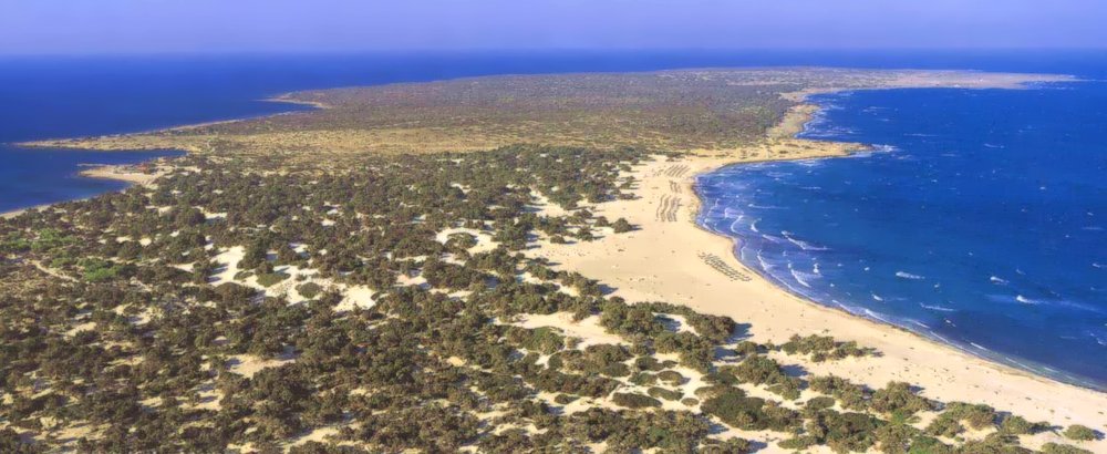
The Beaches
The beaches of Chrissi are maybe the main reason that people visit the island. The shallow waters with the light blue colors and the golden fine sand resembling the Caribbean islands and the huge number of shells are one of the most spectacular attributes of the island.
Walk around
The total length of the island's pathways is 10km. With three hours of relaxed walking the visitor can obtain a good idea of the variety of the landscape. All you need is a pair of sports shoes, and of course hat, sunscreen and water during the summer months.
One that doesn't enjoy walking so much can relax by the blue sea either on the jetty or on the northern beach, which is 5 minutes walk. Even on a relaxed, short stay like that, Chrisi remains very impressive.
Human presence on the island dates back to the Minoan times but only recently the natural environment has been disturbed. The preservation of such a special place, apart from the ethical element, is also imposed by strict national and European law.
For the reasons above, it is not allowed to:
litter
walk outside the designated paths and beaches
collect rocks, fossils, shells or ancient artifacts
collect animals or plants
free camp
light fires
smoke within the bushy or forest areas
Free camping with a sleeping bag or tent , is not prohibited, if it is not harmful to the cedars. Lighting of fires and the permanent establishment are prohibited.


