interkriti®
YOUR GATEWAY TO CRETE
|
Crete
: Regional Interest
List Grid Map
Found
126
- Showing :
101 - 120
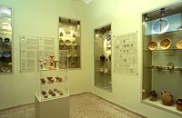 Iraklion town at 40.8km (NW) The history and culture of Crete, from the first centuries of the Christian era to our present time. An exceptional museum featuring a collection of extremely precious objects, a must see for every visitor to Crete. The museum is housed in a two storey neoclassical building, which was constructed in 1903 on the site of an earlier mansion.
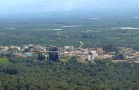 Messara, Iraklion South at 40.8km (W) Agioi Déka (GR: Αγιοι Δέκα) is a town with 820 inhabitants in the plain of Messara, 170m above sea level, 43 km from Heraklion town and very close to the archaeological site of Gortyna. Its people are occupied mostly in agriculture - vines and olive trees. In the area there is is the oldest olive grove in Crete. The town is built on the ruins of the ancient town of Gortyn where the Holy Ten Martyrs have been martyred.  Malevizi, Iraklion at 40.8km (NW) Kato Asites (GR: Κάτω Ασίτες lies 23km from Iraklion and 5km from Agios Myron at 450m a.s.l with 1113 inhabitants. Beautiful town with traditional architecture especially the quarters "Notiko", "Prinos" and "Kastella" close to the monastery of Gorgolaini. Other interesting sights are: The thermae of the king of Prinias, The uninhabited settlement of Nisi with traditional houses, the caves "Lesta spilios" at Marias aloni, "Astirakou spilios", "Sarakina" and "Katsivli spilios" at Lyssogremia and "Melissa", The chapels of "Panagia" aged 800 years, "Agios Antonios" aged 1000 years, "Agios Georgios" and "Agia Paraskevi". The patron Saint is "Agia Paraskevi" celebrated on the 26th July .  Malevizi, Iraklion at 40.9km (NW) Pentamódi (GR: Πενταμόδι)one of the oldest villages in Crete, is located in the valley of Gazanos river, 17km from Iraklion and 4km from Agios Myron at 350m a.s.l with 278 inhabitants. At "Agia Paraskevi" a place with rich vegetation are organized every summer a series of cultural festivals. A fountain of the 15th century with the blazon of the house of "Quirini" is one of the significant monuments of the area. The patron Saint is "Agios Nikolaos" and there is a village feast on the 26th July in his honour. 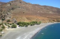 Beach in South Iraklion at 41km (W) Tripití (or Trypití GR: Τρυπητή) is a 400m long beach on the southern Asterousia coastline. It is located 57km from Heraklion (west gate, Giofyros) via Agioi Deka - Vagionia - Vassiliki - Trypiti road. The last 10km, from Vassiliki to Trypiti, is a dirt but in fairly good condition road. The road passes over the gorge of Agios Savvas, with spectacular rocky walls, then through a forest of olive and carob trees and finally via the gorge of Trypiti through a very narrow passage reaches the beach. This is a very interesting route with breathtaking views and fantastic scenery. Image Library
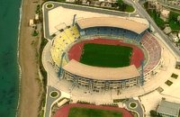 Iraklion at 41.7km (NW) Capacity: 26,240 (seated)- Location: The stadium is located in Heraklion (also: Iraklio) 3 km west of the city centre (at Lido beach)... The building began 15 years ago and the 2004 Olympic Games proved to be the golden opportunity for the Pancretan, as the Athens Organising Committee named it as one of the venues of the football tournament. It was inaugurated on 31 March 2004, when it hosted an international friendly match between the National teams of Greece and Switzerland. The stadium is currently the second largest stadium of the country. The stadium is actually part of a sports complex. A training ground with an 8-lane athletics track, Lido Indoor Hall, and a swimming pool are located right next to the Pancretan Stadium. Image Library
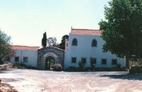 Malevizi, Iraklion at 41.7km (NW) The monastery of Aghios Georgios the Gorgolainis (GR: Αγιος Γεώργιος Γοργολαΐνι) is located on an altitude of 400 m close to the Kato Asites village. It survived through several revolutions and wars during the Ottoman occupation. 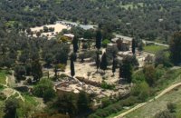 Messara, Iraklion South at 41.9km (W) Located in the valley of Messara, Gortys or Gortyn (GR: Γόρτυς or Γόρτυνα) is a must visit for all visitors to Crete. It was inhabited during Bronze Age times, but its rise to glory came almost a millennium after the downfall of the 'Minoans'. Gortyn was a prosperous city from around the middle of the 5th century BC through to the early 9th century AD, when it was finally destroyed by the Saracens (824AD), never to be rebuilt.
Image Library
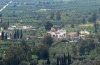 Village in Messara plain at 42.3km (W) Mitropoli (GR: Μητρόπολη) is a small village in the archaeological site of Gortyna in Messara plain. The village is mentioned for the first time in the Ducal archives of Candia in 1368 and later in the census of 1577 by Fr. Barozzi and in 1583 by Castrofylaka. Early mention of the settlement is to document the Ducal Archive of Candia in 1368, also mentioned by Fr. Barozzi in 1577 with the name and the Mitropoli Kastrofilakas in 1583. According to the census of 2001 it has 382 inhabitants. Main occupations of the inhabitants is the cultivation of vines, olives, vegetables, cereals and citrus fruits. At its north borders are located the ruins of the first cathedral of St. Titus, in which it owes its name.(Mitropoli = Cathedral). Image Library
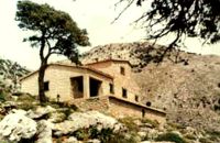 East Ida mountain, Iraklion at 42.4km (W) Prinos refuge at Prinos on Psiloritis mountain (Ida), is at 1100 metres. It can sleep 25 people, it has cooking facilities, two wood burning stoves for heating and a rainwater tank. Access is through the village of Ano Assites in Malevizi around 22km from Iraklion. From there a two kilometres of dirt road leads to a place called Melisses and then a one-and-a-half hour walk along a footpath signed with red marks, to the refuge. Prinos hut was built in 1962 and was renovated around 1992. It is run by the mountaineering club of Heraklion. The view from Prinos to the north and east is great. 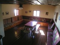 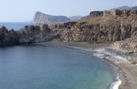 South Iraklion at 43.3km (W) Tráfoulas is a secluded beach, nested in a cove open to the south, at the small promontory of the same name, located between Lendas and Trypiti. You can reach Trafoulas only by boat or on foot via a small canyon. The starting point is around 700m away, to the north, just above the small harbour of Loutras, around 5km east from Lendas, where there is a place for parking. You then follow the hiking path, descending for a while to meet the canyon that leads directly to the beach. The walk takes around 20 minutes and its very nice as there are plenty of oleander and the rocky walls are very spectacular continuing until the sea. Image Library
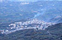 Malevizi, North - West Iraklion at 43.4km (NW) Kroussónas (GR: Κρουσώνας) is an historical town built in a semi-circle on the eastern slopes of the Psilortis (the highest mountain in Crete), between the hills of Koupos and Livadiotis, at 460 meters above sea-level. It is at a distance of 21 kilometres from Heraklion. A magnificent 10kms route, ideal for nature-lovers is that from Kroussonas to the wood of Vromonero at 1300m a.s.l.
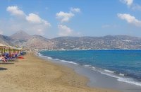 Iraklion at 43.8km (NW) Ammoudara (GR: Αμμουδάρα) is four kilometre long sandy beach that stretches from the west end of Heraklion to Linoperamata near the village of Gazi. The sand is fine and blond and extends several metres to the land and the sea is clear and safe. The predominant winds during the summertime are N, N-W usually "meltemi" that get more fresh at the western end of the beach, where the windsurf school is located. Along the shore there are hotels, some of them very large complexes, taverns, restaurants, bars, cafes etc that offer umbrellas and sun-beds on the beach. There are also lifeguards in some spots. The area in general is touristic and offers a full range of facilities, among them the modern multiplex "Technopolis" with cinema and an open-air theater. Image Library
 Tylissos at 44.5km (NW) The houses of Tylissos were built during the LM I period (16th-15th century B.C.). Additions were made on House A in the LM II (15th-14th century B.C.) and on House C during the LM III period (14th century B.C.). The site was destroyed by fire in the 14th century B.C. and re - inhabited in historic times as is attested by ruins of later houses over the Minoan ones. Tylissos was excavated by Joseph Chatzidakis in 1902-1913. In 1954, in the course of restorations, parts of a paved court were revealed to the west, and a small stoa with five columns to the north of the Square of the Altar. The monuments were restored by the Archaeological Service (under the direction of Nicolaos Platon) in the period between 1954 and 1962. All three houses were again restored in 1990-1994. Source: The Hellenic Ministry of Culture 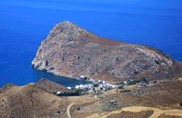 Iraklion South at 46.1km (W) Léndas or Léntas (GR: Λέντας), positioned almost in the centre of Cretes' south coast, clusters around a pretty bay that's dominated by an enormous rock resembling a lion's head that juts into the sea on one side of the resort. The village offers most facilities you might need during your stay; a choice of tavernas, three or four directly on the beach, two or three bars, mini-markets and even an Internet café. There is a sand/shingle beach and the sea is crystal clear and perfect for snorkeling.
Image Library
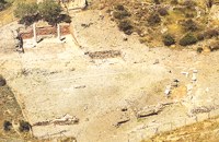 Lentas, South Iraklion at 46.1km (W) The first habitation of the site dates from the Neolithic and Early Minoan period (3rd millenium B.C.). In the late Classical period (beginning of the 4th century B.C.) the Gortynians established the sanctuary of Asklepios at the harbour. During the tremendous earthquake of 46 B.C. the city was destroyed and subsequently rebuilt. In the Early Christian and Byzantine periods, a small settlement developed and the basilica was erected. The most important monuments of the site are: The Temple of Asklepios., the "Treasury"., the Fountain, a large, three-aisled basilica, an Early Minoan settlement (2600-2000 B.C.), the West Stoa, the North Stoa, the Nymphaion and two large, mud-brick cisterns.  Kenouriou, South Iraklion at 46.6km (W) Zaros (Greek: Ζαρός), at an altitude of 340 metres, is a town with a lake and gorge nearby. It has a couple of hotels and it is 44 km from Heraklion at the southern foothills of Mountain Psiloritis. The population of 3,400, produce olive oil, sultanas, vegetables and spring water. There are a couple of fish farms that serve both trout and salmon. In Zaros, there are cafes near Lake Votomos, as well as a tavern that serves fresh trout called I Limni (The Lake). Close by is Rouvas Gorge, which is part of the Psiloritis mountain range and is on the hiking route known as the E4 European Walking Path. Nearby Zaros are traditional water mills which have been working since the 16th century, as well as archaeological sites and monasteries. Zaros is also famous for its water "ZAROS" bottled by a company called Votomos SA. 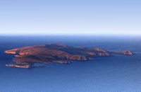 Iraklion north at 47km (N) Dia (GR: Δία & Ντία) is an uninhabited island approximately 7 nautical miles north of Heraklion. It is surrounded by small rocky inlets and its maximum length is 5kms while its maximum width 3kms. Dia is one of NATURA's protected areas due to its status as a biotope for endemic plants and for plants with low dispersal within the Southern Aegean. Image Library
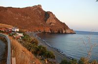 Iraklion South at 47.1km (W) A long beach west of Lendas on the south shores of Iraklion. The name is probably a corruption of Dysikos (GR: Δυσικός) which is the one to the west. There is a small settlement with taverns and accommodation complexes, mostly rooms and apartments for rent. Dyskos used to be popular with nudists and nature lovers in the past and even in present days nudism is tolerated in the western part of the beach. The beach has small pebbles and sand. Those who chose Dyskos for their holidays will have, among other things, the chance to explore the area by small walking tours and enjoy the magnificent sunset.
Image Library
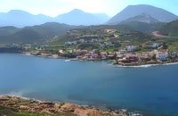 Sitia, East Lassithi at 47.3km (E) A small picturesque village by the sea characterized as a landscape of exquisite, natural beauty. With joyful and peaceful inhabitants who constantly tease each other. It is located in Crete, north of Lasithi prefecture, between Agios Nikolaos and Sitia, at equal distance (30-35km) from the three major cities(Agios Nikolaos, Sitia, Ierapetra). Ideal place for holiday or special weekends. You will enjoy the most colourful sunset and the most beautiful daybreak from any other place. The serenity of the morning open view, with the sun rising from the sea, will be unforgettable. The small island, opposite the village, with the small church of Agios Nikolaos, offers a unique beauty to the landscape. |
||
|
| ||
C
O
N
T
E
N
T
S
O
N
T
E
N
T
S


