interkriti®
YOUR GATEWAY TO CRETE
|
Crete
List Grid Map
Found
245
- Showing :
241 - 245
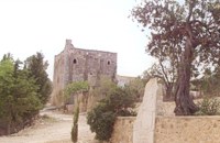
 Messara plain, South - East Iraklion at 47.7km (SW) The monastery of Odigitria is a monastery of great importance and historical value and one of the oldest in Crete. It is located at the west edge of the Asterousia mountains at an altitude of 250 m. The monastery was surrounded by walls, part of them still stands. The temple of the monastery is dedicated to the assumption of Holly-Mother and to the Saint Apostles (Peter & Paul). Inside the temple there are valuable frescoes, icons of famous painters and iconostasis. The monastery is connected with the legendary freedom fighter 'Ksopateras' (1788 - 1828) In the area of the monastery at Agioi Eftihianoi was found an ancient (Early Minoan) cemetery.  Messara, South - West Iraklion at 48.4km (SW) Matala (GR: Μάταλα) was the ancient port of Phaistos and Gortys and a former fishing community which has developed into a modern holiday center. It is located 4 km south-west of the village of Pitsidia and 75 km from Iraklion. It is built on the coast line of the Messara bay inside a small and picturesque inlet. During the 60's the caves of Matala were hosting a hippie commune.
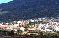
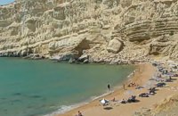
 Mirabello, Lassithi at 48.6km (E) Neapolis is located 15 km westwards of Agios Nikolaos on the way to Heraklion from where it is roughly 50 km far. Neapolis is built in the green valley of Mirabello. In the period of the Venetian domination its two settlements were named "New Village". But when the seat of the Prefecture was transferred from Fourni to the “New Village” this last was renamed to Neapolis. Neapolis was maintained as the capital of the prefecture of Lasithi till 1904. After that date Agios Nikolaos became the new capital.  Matala, South - West Iraklion at 49.1km (SW) The Red beach is located around 700m south from Matala. It is a beautiful secluded beach with fine reddish sand originating from the rocks of the area. The name "Red Beach" is given by the visitors due to its reddish color while its original name is Ammoúdia (GR: Αμμούδια). The sea gets a lovely blue-green color, making the landscape really unique. The only way to access Red Beach is on foot or by boat from Matala. The walk from Matala takes about 20 minutes and it can't be considered as an easy one. Red Beach however can get pretty crowded in the high season. There is a small stone-wall canteen offering snacks and drinks and a few umbrellas and sun-beds. Nudism is tolerated at the two ends of the beach. Image Library
 by Richard Ellis at 50km (SE) It was a familiar performance trying to find the right path out of Selakano. T's map v T's GPS (didn't show the start) v LW's words. Together they made no real sense, because the map was saying that the footpath ran due west out of Selakano while LW’s suggested route was taking me north. In the end good old red paint splashes got me going westwards along a concrete path (starting beside a concrete structure) not far north of the junction between the bunkhouse square and Stella’s taverna. You have to follow your nose here as the paths stop and start a bit, but the GPS did clutch in quite quickly and, as ever, was reliable. Distance:22km Time: 9 hrs. Mov av 3.4 km/hr Height overnight: 824m.(max 2,148m.) |
||
|
| ||
C
O
N
T
E
N
T
S
O
N
T
E
N
T
S


