interkriti®
YOUR GATEWAY TO CRETE
|
Crete
: Beaches
List Grid Map
Found
25
- Showing :
21 - 25
 Messara, South - West Iraklion at 44.8km (SW) Matala (GR: Μάταλα) was the ancient port of Phaistos and Gortys and a former fishing community which has developed into a modern holiday center. It is located 4 km south-west of the village of Pitsidia and 75 km from Iraklion. It is built on the coast line of the Messara bay inside a small and picturesque inlet. During the 60's the caves of Matala were hosting a hippie commune.
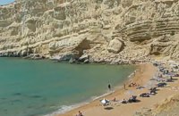
 Matala, South - West Iraklion at 45.3km (SW) The Red beach is located around 700m south from Matala. It is a beautiful secluded beach with fine reddish sand originating from the rocks of the area. The name "Red Beach" is given by the visitors due to its reddish color while its original name is Ammoúdia (GR: Αμμούδια). The sea gets a lovely blue-green color, making the landscape really unique. The only way to access Red Beach is on foot or by boat from Matala. The walk from Matala takes about 20 minutes and it can't be considered as an easy one. Red Beach however can get pretty crowded in the high season. There is a small stone-wall canteen offering snacks and drinks and a few umbrellas and sun-beds. Nudism is tolerated at the two ends of the beach. Image Library
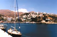
 South Rethymnon at 45.8km (W) A seaside town of the municipality of Agios Vassilios. It is a well organized tourist resort with comfortable hotels, apartments, camping sites, tourist agencies, car-renting offices, restaurants, tavernas and other recreation centres, as well as all the facilities required by tourists and locals alike. There is also a port and port - custom authorities.
Image Library
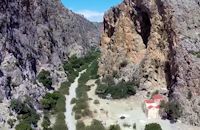
 South - coast Iraklion at 46.9km (SW) Agiofaraggo (GR: Αγιοφάραγγο the gorge of Saints) is a small gorge at the southern shores of Heraklion close to the village and the beach of Kaloi Limenes and 6 kilometers south of the Monastery of Odigitria. Image Library
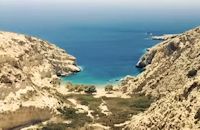
 South - coast Iraklion at 47km (SW) Martsalo (GR: Μάρτσαλο, Mártsalo) is located on the mass of the Asterousia Mountains between Kefali (Cape Lithino) and Agiofarago. It is an impressive gorge about two kilometers long, which belongs to the hermitages of the Holy Monastery of Odigitria. Inside the gorge there is rich vegetation as well as a small palm forest in the middle of its route. The impressive cliffs are home to a large number of caves (similar to eagles' nests) inhabited by many of the area's ascetics. Gorge Martsalo is particularly steep and rough and ends at the Libyan Sea, where there is a small protected cove with a sandy- pebbly beach. Image Library
|
||
|
| ||
C
O
N
T
E
N
T
S
O
N
T
E
N
T
S


