interkriti®
YOUR GATEWAY TO CRETE
|
Crete
: Regional Interest
List Grid Map
Found
90
- Showing :
21 - 40
 Voroi, Messara, Iraklion at 20.2km (E) The exhibited objects in the Museum come from all over Crete. These objects show that the folk culture of Crete is characterized by an amalgam of influences in which Minoan (2000-1000 BC), Archaic (1000-500 BC) and Byzantine models prevail, especially in agriculture, stock breeding, pottery and basketry.
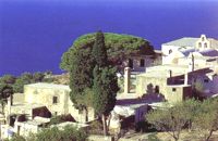 Agios Vassilios, Rethymnon south at 21.1km (NW) It stands 37 km south of Rethimnon, in an imposing landscape which is mentioned at the mid-19th century diary of Th. Spratt (admiral of the British Royal Navy), as "one of the happiest places to withdraw from trials and responsibilities of life".There are lots of legends concerning the foundation of the monastery, which is believed that started during the Venetian occupation of the island. A number of its monks activities made the monastery one of the richest of western Crete and due to its isolated position it played important role in Cretan revolts against the occupying forces. A substantial number of icons and other items is kept in the Museum of the Monastery of Preveli amongst them the miracle - working Eulogistic Cross of Efraim Prevelis.
Image Library
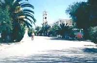 Moires, Messara at 21.5km (E) The monastery of Panagia Kaliviani is located at the 59th km on the road Iraklion-Phaistos. The monastery was built during the second Byzantine period. The small Byzantine chapel was painted with frescoes but most of them are today destroyed. The chapel was deserted until, during the Turkish occupation in 1873, an old small icon of the Annunciation of the Holy Mother was miraculously found there.and the monastery became a place of worship. 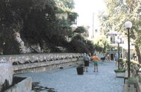 Spili, Rethymno at 24.1km (N) Spili (GR:Σπήλι) is 30 km away from Rethymnon, along the road that goes from Rethymnon to Armenoi and then Spili. The town has about 800 inhabitants and it lies at a height of 430 m above sea level, at the foothills of Mount Vorizi, which belongs to the Kedros chain. The landmark of the town is the square at Kefalovrissi with the 25 fountains each one in the shape of a lion's head. The square is named after Thanassis Skordalos (1920-1998), a popular lyra player and composer born in Spili. Spili is a modern town, with all the facilities and services required by the locals and by the large number of visitors. Image Library
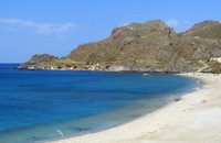 Agios Vassilios, South Rethymnon at 25km (NW) One of the nicest sandy beaches of Crete Damnoni is around 6km to the east of Plakias. There are some facilities like umbrellas, sun beds and sea sports and a couple of taverns for drinks and food. Accommodation is also available. Within walking distance to the east there are two smaller beaches nested in small coves. A little farther is the beach of Shinaria which is very popular with the divers.
Image Library
 Messara plain, South - East Iraklion at 25.1km (E) The administrative center of the Messara Valley. Moires (GR: Μοίρες) is the biggest town in the Messara Valley with a population of approximately 5000 people. It has a police station, magistrate's court,post office, public PTT office, health center, and offices of most Greek major banks.
 Messara, Iraklion South at 25.4km (E) Gallia is one of the oldest villages of the area. It is mentioned as a location in the Venetian records as early as 1577, and as a village with 120 residents since 1583. The renaissance tower in the village (still imposing although rundown) and the water fountains in the Kapeloniana area are proof of the passing of the Venetians. Part of the village, called Monohoro, is mentioned as early as 800 A.D.  Mires, Messara Valley at 26.6km (E) It is located north of Mires close to a small gorge, with springs and covered with trees. There are many churches in the village the most important one being the church of Agios Nikolaos, a domed church dated to the 13th century. The walls of the temple are hand painted with biblical scenes and pictures of saints
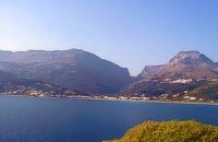 Agios Vassilios, Rethymno (South) at 27.6km (NW) A sea side village, 40 km south from Rethimno, with 237 permanent residents, built at the cove of the bay of the same name on a wonderful sandy beach, 1300 m long, between the capes Stavros and Kako Mouri, that is ideal for swimming and sea sports. The natural beauty of the place helped Plakias to become a renowned tourist resort now providing all the facilities that a visitor could wish. It belongs to the municipality of Finikas.
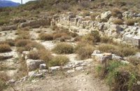 Amari, Rethymnon at 27.7km (N) Sivritos (GR: Σίβρυτος) was an important and autonomous city of the ancient Crete. The city was built in the location that today is the village of Thronos. It was located on a hill dominating the valley of Amari. The name Sivritos is derived from the words si, that in the ancient eastern languages meant water, and the word vriti, that is of prehistoric origin and meant sweet. Therefore, Sivritos in the Minoan period meant sweet water. The derivation is also verified by the fact that near the hill where the city was located there are numerous sweet water springs.  Voriza, South - West Iraklion at 27.8km (NE) Close historical bonds link this monastery to that of Vrontisiou. The Varsamonerou Monastery lies in the surrounding fields of the village Voriza, 54.5 kms from Heraklion. The monastery is abandoned and, though its cells have been destroyed, its church has some of the most remarkable wall paintings in Crete.
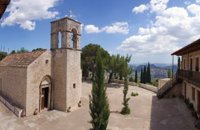 Zaros at 29.3km (NE) This is one of Crete's most famous monasteries. It played an important role during the years of the Cretan Renaissance, both in the letters and the arts, and, during the last centuries of Venetian rule, it was known for its many scholars, artists and venerable monks.
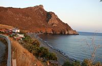 Iraklion South at 29.7km (E) A long beach west of Lendas on the south shores of Iraklion. The name is probably a corruption of Dysikos (GR: Δυσικός) which is the one to the west. There is a small settlement with taverns and accommodation complexes, mostly rooms and apartments for rent. Dyskos used to be popular with nudists and nature lovers in the past and even in present days nudism is tolerated in the western part of the beach. The beach has small pebbles and sand. Those who chose Dyskos for their holidays will have, among other things, the chance to explore the area by small walking tours and enjoy the magnificent sunset.
Image Library
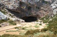 Psiloritis Mountain at 30.1km (NE) At 1538m above sea level, 20 km. south of the traditional town of Anogia , on the plateau of Nida, of Mountain Psiloritis, lies this sacred cave, where according to mythology, Rhea, Zeus' mother, hid the new born Zeus in this cave in order to protect him from his father Kronos (Saturn), who was in the habit of swallowing his children because he feared they might deprive him of his power. Hidden in that cave Zeus grew up being fed with the milk of the goat Amalthia, while the 'Kourites" covered the child's crying through banging their copper shields. Image Library
 Kenouriou, South Iraklion at 30.5km (NE) Zaros (Greek: Ζαρός), at an altitude of 340 metres, is a town with a lake and gorge nearby. It has a couple of hotels and it is 44 km from Heraklion at the southern foothills of Mountain Psiloritis. The population of 3,400, produce olive oil, sultanas, vegetables and spring water. There are a couple of fish farms that serve both trout and salmon. In Zaros, there are cafes near Lake Votomos, as well as a tavern that serves fresh trout called I Limni (The Lake). Close by is Rouvas Gorge, which is part of the Psiloritis mountain range and is on the hiking route known as the E4 European Walking Path. Nearby Zaros are traditional water mills which have been working since the 16th century, as well as archaeological sites and monasteries. Zaros is also famous for its water "ZAROS" bottled by a company called Votomos SA. 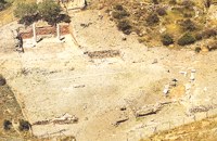 Lentas, South Iraklion at 30.5km (E) The first habitation of the site dates from the Neolithic and Early Minoan period (3rd millenium B.C.). In the late Classical period (beginning of the 4th century B.C.) the Gortynians established the sanctuary of Asklepios at the harbour. During the tremendous earthquake of 46 B.C. the city was destroyed and subsequently rebuilt. In the Early Christian and Byzantine periods, a small settlement developed and the basilica was erected. The most important monuments of the site are: The Temple of Asklepios., the "Treasury"., the Fountain, a large, three-aisled basilica, an Early Minoan settlement (2600-2000 B.C.), the West Stoa, the North Stoa, the Nymphaion and two large, mud-brick cisterns. 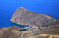 Iraklion South at 30.6km (E) Léndas or Léntas (GR: Λέντας), positioned almost in the centre of Cretes' south coast, clusters around a pretty bay that's dominated by an enormous rock resembling a lion's head that juts into the sea on one side of the resort. The village offers most facilities you might need during your stay; a choice of tavernas, three or four directly on the beach, two or three bars, mini-markets and even an Internet café. There is a sand/shingle beach and the sea is crystal clear and perfect for snorkeling.
Image Library
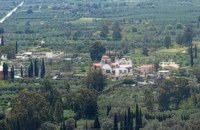 Village in Messara plain at 31.4km (E) Mitropoli (GR: Μητρόπολη) is a small village in the archaeological site of Gortyna in Messara plain. The village is mentioned for the first time in the Ducal archives of Candia in 1368 and later in the census of 1577 by Fr. Barozzi and in 1583 by Castrofylaka. Early mention of the settlement is to document the Ducal Archive of Candia in 1368, also mentioned by Fr. Barozzi in 1577 with the name and the Mitropoli Kastrofilakas in 1583. According to the census of 2001 it has 382 inhabitants. Main occupations of the inhabitants is the cultivation of vines, olives, vegetables, cereals and citrus fruits. At its north borders are located the ruins of the first cathedral of St. Titus, in which it owes its name.(Mitropoli = Cathedral). Image Library
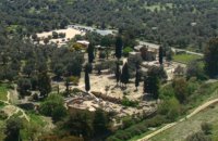 Messara, Iraklion South at 31.9km (E) Located in the valley of Messara, Gortys or Gortyn (GR: Γόρτυς or Γόρτυνα) is a must visit for all visitors to Crete. It was inhabited during Bronze Age times, but its rise to glory came almost a millennium after the downfall of the 'Minoans'. Gortyn was a prosperous city from around the middle of the 5th century BC through to the early 9th century AD, when it was finally destroyed by the Saracens (824AD), never to be rebuilt.
Image Library
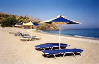 Rodakino, South Rethymno at 32.7km (NW) At the end of the canyon that traverses the area of Rodakino lies the beach of Korakas at the bay of the same name. It is a nice, wide and 400m long beach, with clear waters and small grayish sand and pebbles. There are a few accommodation options in family run apartment complexes and a few taverns on the beach front. Umbrellas and sun beds are also available at the eastern part. The headland to the east separate Korakas Beach from another lovely beach named "Klimata". At the east side of that headland there is a small fishing harbour and along its coast there are sharp rocks in the shape of a crow's beak (Kórakas GR: Κόρακας, means crow) thus giving the name to the bay. Image Library
|
||
|
| ||
C
O
N
T
E
N
T
S
O
N
T
E
N
T
S


