interkriti®
YOUR GATEWAY TO CRETE
|
Crete
: Towns & Villages
List Grid Map
Found
53
- Showing :
41 - 53
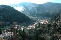
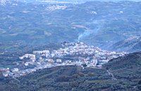
 Chania at 44.5km (W) Thérisso (GR: Θέρισο) is a small village, built on the foot of the White mountains, at 580 m a.s.l, 20km south of the city of Hania. It has 156 inhabitants and it is famous for its physical beauty, its diary-farming and its glorious past. You can reach Therisso from Perivolia passing through the Canyon (good asphalt road), or from Drakona, crossing the 7km dirt road through the forest. From here starts the trekking path which leads to the highest peak of the White mountains, Pahnes (2452m) Due to its location Therisso played a significant role at the history of the island especially during the 19th Century. A mill's stone located at the entrance of the village reminds the death of a young woman (grinded alive), when she denied to surrender to Mustafa Pasha. Here were born the great Cretan revolutionaries (Hainis), Vassilis, Giannis and Stefanos Halis. Vassilis Halis, became a hainis very young, and participated to the most great battles against the Turks in Crete and Peloponnissos. He was lt General when he died at Nafplion (Peloponnissos) in 1846. But Therisso is mostly known for its relation with the Venizelos movement in March 1905. Venizelos, who dissented with prince George' policy and declared the Union of Crete with Greece, had his headquarters at Therisso. The house of Venizelos is today a museum. The visitor to Therisso will admire the natural beauty, learn a lot of the history of the place listening to various stories and looking at the historical monuments, and taste the local specialties at the lovely taverns of the village. 2,5 km north of Therisso, at the left bank of Kladissos river, there is a cave where signs of neolithic and Minoan habitation were discovered. It is believed that it was a worship place.  Malevizi, Iraklion at 45.4km (E) Dóxa (GR: Δόξα) is a pretty village built on a height of 400 metres above sea-level and 20 kilometres to the west of Heraklion on the road to the mountainous Milopotamos. The historical cave of Dóxa (GR: Δόξα) is located in a short distance from the village of Marathos on the road to Heraklion. It is at a height of 490 metres above sea-level, near a well-known taverna also called DOXA. The cave has a total length of 50 metres and impressive stalactites and stalagmites.  Messara, Iraklion South at 45.7km (SE) Vori is a beautiful, traditional village of the county of Pirgiotissas in the Messara Valley. It is located 60 km south of Iraklion and in the western part of the Messara Valley. The village stretches in a slope, by the side of a small river. The archaeological site of Phaistos is 2 km to the south and the coast of Messara 4 km to the west.
 Messara, Iraklion South at 47.1km (SE) Kamilari is a quiet, traditional village, with a panoramic view to the endless olive groves of the Messara valley on the one side, and to the Libyan sea on the other side. It has been inhabited since the Minoan period. One of the seven wise men of the ancient world, Epimenidis, a great wise man and a soothsayer, lived in a small community outside Kamilari, called Metohi.
 Kenouriou, South Iraklion at 47.3km (SE) Zaros (Greek: Ζαρός), at an altitude of 340 metres, is a town with a lake and gorge nearby. It has a couple of hotels and it is 44 km from Heraklion at the southern foothills of Mountain Psiloritis. The population of 3,400, produce olive oil, sultanas, vegetables and spring water. There are a couple of fish farms that serve both trout and salmon. In Zaros, there are cafes near Lake Votomos, as well as a tavern that serves fresh trout called I Limni (The Lake). Close by is Rouvas Gorge, which is part of the Psiloritis mountain range and is on the hiking route known as the E4 European Walking Path. Nearby Zaros are traditional water mills which have been working since the 16th century, as well as archaeological sites and monasteries. Zaros is also famous for its water "ZAROS" bottled by a company called Votomos SA.  Messara, Iraklion South at 48.3km (SE) The village of Pitsidia is located 65 km southwest of Iraklion at an altitude of 80 m a.s.l, just before the magnificent bay of Messara. The village with aproximately 700 inhabitants is the oldest village of the area and is refered (by S. Spanakis) that it was the place where the soldiers of Nikiforos Fokas, commander of the Byzantine army, settled. The army, famous for its bravery, came from Pisidia of the south Asia Minor, and this is probably the origin of the name Pitsidia.
Image Library
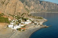
 Messara, Iraklion South at 48.5km (SE) Gallia is one of the oldest villages of the area. It is mentioned as a location in the Venetian records as early as 1577, and as a village with 120 residents since 1583. The renaissance tower in the village (still imposing although rundown) and the water fountains in the Kapeloniana area are proof of the passing of the Venetians. Part of the village, called Monohoro, is mentioned as early as 800 A.D.  Sfakia, South Hania at 48.7km (W) Agia Rouméli (GR: Αγία Ρουμέλη)is a small fishing village, approximately two kms from the ending of Samaria Gorge. It is accessible only by boat from Paleohora, and from Hora Sfakion. It serves mainly as a stopover for visitors coming down the Samaria Gorge, and waiting for the boat to take them to Sfakia or Paleohora. However those who decide to stay for a couple of days or more will find apart from the unique scenery, a great beach with crystal clear water, plenty of interesting walks and a good choice of accommodations, taverns, cafés and stores. The place is also rich in history as it was inhabited since the antiquity. It is the site of the ancient city of Tárra (GR: Τάρρα), a famous cult place, that flourished from the Classical to the Roman times. Image Library
 Malevizi, North - West Iraklion at 48.7km (E) Kroussónas (GR: Κρουσώνας) is an historical town built in a semi-circle on the eastern slopes of the Psilortis (the highest mountain in Crete), between the hills of Koupos and Livadiotis, at 460 meters above sea-level. It is at a distance of 21 kilometres from Heraklion. A magnificent 10kms route, ideal for nature-lovers is that from Kroussonas to the wood of Vromonero at 1300m a.s.l.
 Messara, South - West Iraklion at 48.8km (SE) Matala (GR: Μάταλα) was the ancient port of Phaistos and Gortys and a former fishing community which has developed into a modern holiday center. It is located 4 km south-west of the village of Pitsidia and 75 km from Iraklion. It is built on the coast line of the Messara bay inside a small and picturesque inlet. During the 60's the caves of Matala were hosting a hippie commune.
 Messara, Iraklion South at 49.5km (SE) Its 1000 years history comes to life for the visitor, who has the chance to admire its monuments, and old houses, perfectly preserved through the centuries. In the village square , you can sit and enjoy your coffee in the traditional coffee shop, while children can play in the playground next to the school. You can also visit the church of Agios Ioannis in the same square. There are quite few rooms for rent in the village and tavernas serving traditional Cretan dishes.
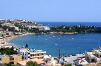
 Malevizi, North - West Iraklion at 49.6km (E) Agia Pelagia lies 20km west of Iraklion. The bay of Agia Pelagia is ideal for combining sea sports with relaxation. The visitor will find well trained instructors that offer lessons for sea sports such as water-ski, wind surf, canoe. Agia Pelagia offers unique high standard hotel facilities as well as many small hotels and pensions.
 Mires, Messara Valley at 50km (SE) It is located north of Mires close to a small gorge, with springs and covered with trees. There are many churches in the village the most important one being the church of Agios Nikolaos, a domed church dated to the 13th century. The walls of the temple are hand painted with biblical scenes and pictures of saints
|
||
|
| ||
C
O
N
T
E
N
T
S
O
N
T
E
N
T
S


