interkriti®
YOUR GATEWAY TO CRETE
|
Crete
: Sightseeing
List Grid Map
Found
66
- Showing :
61 - 66
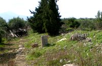
 Gortyn archaeological site at 42.3km (SW) The Hippodrome was located in the south part of the city of Gortyn, and was surrounded by columns. The central section was 374 metres long and 60 metres wide. Our information on the site is insufficient for the reason that there was never a systematic survey, or even a small excavation. What we see today of this magnificent monument are only some parts of columns and capitals.
Image Library
 Zaros at 42.4km (SW) This is one of Crete's most famous monasteries. It played an important role during the years of the Cretan Renaissance, both in the letters and the arts, and, during the last centuries of Venetian rule, it was known for its many scholars, artists and venerable monks.
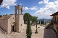
 Voriza, South - West Iraklion at 44km (SW) Close historical bonds link this monastery to that of Vrontisiou. The Varsamonerou Monastery lies in the surrounding fields of the village Voriza, 54.5 kms from Heraklion. The monastery is abandoned and, though its cells have been destroyed, its church has some of the most remarkable wall paintings in Crete.
 Mires, Messara Valley at 45.8km (SW) It is located north of Mires close to a small gorge, with springs and covered with trees. There are many churches in the village the most important one being the church of Agios Nikolaos, a domed church dated to the 13th century. The walls of the temple are hand painted with biblical scenes and pictures of saints
 Messara, Iraklion South at 46.8km (SW) Gallia is one of the oldest villages of the area. It is mentioned as a location in the Venetian records as early as 1577, and as a village with 120 residents since 1583. The renaissance tower in the village (still imposing although rundown) and the water fountains in the Kapeloniana area are proof of the passing of the Venetians. Part of the village, called Monohoro, is mentioned as early as 800 A.D.  Pahia Ammos, Ierapetra at 48.8km (SE) Gournia lies on a small hill, a few hundred metres from the sea in the Gulf of Mirabello, close to the north end of the Ierapetra isthmus ( 2 Km from Pachia Ammos village & 19 Km from Ag.Nikolaos). Gournia - the ancient name of which is not known - is the most characteristic of the excavated medium-size settlements, dated to the period of the peak of the Minoan culture (Late Minoan I period: 1550-1450 B.C.). It is called "Pompeii of Minoan Crete" because of the good state of preservation. It occupies a low hill, close to the sea, at the Isthmus of Ierapetra. |
||
|
| ||
C
O
N
T
E
N
T
S
O
N
T
E
N
T
S


