interkriti®
YOUR GATEWAY TO CRETE
|
Crete
: Regional Interest
List Grid Map
Found
92
- Showing :
81 - 92
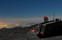 Idi mountain at 45.4km (E) Located at the top (1750m) of Skinakas mountain of Idi (Ida) mounatin range, 60km from Heraklion. There are two telescopes and modern equipment and facilities both for research and educational activities in astronomy. It is a department of the University of Crete. Skinakas observatory offers a number of open days each year. This gives the opportunity to visitors to be introduced to the operation of the observatory, to get informed about the latest achievements in Astrophysics and to observe through the telescope. Open days for the year 2012: August 26 September 23 During the open days the Observatory facilities can be visited from 17:00 to 23:00. Due to low temperatures at the Skinakas altitude, warm clothes are highly recommended. The visitors will have the opportunity to be guided through the Observatory's infrastructure and follow a related presentation. The road to Skinakas Observatory is very narrow. Accident may occur and the space is limited on the top. For the reasons above, buses are not allowed (advised) to visit the Observatory during open days. Website : http://skinakas.physics.uoc.gr/ 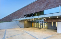 Chalepa, Hania at 45.7km (NW) The Archaeological Museum of Chania is located in the historic suburb of Chalepa, on a plot of land covering 11,526.81 m2, with a total area of approximately 6,000 m2. Its location, averaging 98 m above sea level, offers a magnificent view over much of the city, especially the seafront. The Museum, designed by architect Theofanis Bobotis and partners, is composed of two distinct linear monolithic masses rising from the earth, a symbolic reference to the vestiges of civilisation beneath the surface. The permanent exhibition of the Archaeological Museum of Chania is set out in three galleries on the ground floor, presenting the archaeological riches of the regional unit of Chania from the first traces of human presence in Chania to the 4th century AD, and a gallery on the upper floor where part of the Konstantinos, Marika and Kyriakos Mitsotakis Collection is exhibited. The exhibition is enriched with faithful reconstructions of various spaces, visual media, digital presentations, tactile exhibits (copies of ancient objects) accompanied by Braille captions, and an audio guide. The Temporary Exhibition Gallery and the Museum gift shop are on the ground floor, while the Educational Programme Room, the Amphitheatre and the Café are on the upper floor.  Messara, Iraklion South at 46km (E) Gallia is one of the oldest villages of the area. It is mentioned as a location in the Venetian records as early as 1577, and as a village with 120 residents since 1583. The renaissance tower in the village (still imposing although rundown) and the water fountains in the Kapeloniana area are proof of the passing of the Venetians. Part of the village, called Monohoro, is mentioned as early as 800 A.D. 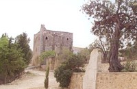 Messara plain, South - East Iraklion at 46.2km (SE) The monastery of Odigitria is a monastery of great importance and historical value and one of the oldest in Crete. It is located at the west edge of the Asterousia mountains at an altitude of 250 m. The monastery was surrounded by walls, part of them still stands. The temple of the monastery is dedicated to the assumption of Holly-Mother and to the Saint Apostles (Peter & Paul). Inside the temple there are valuable frescoes, icons of famous painters and iconostasis. The monastery is connected with the legendary freedom fighter 'Ksopateras' (1788 - 1828) In the area of the monastery at Agioi Eftihianoi was found an ancient (Early Minoan) cemetery. 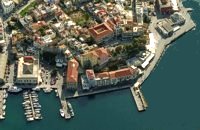 North West Crete at 46.8km (NW) Hania (or Chania GR: Χανιά) is the capital of the Prefecture of the same name and the second biggest town in Crete, with a population of 60.000 inhabitants. It lies (Coordinates 35°31' N 24°1' E ) along the North coast of the island, about 55 km west of Rethymnon and 140 km west of Iraklion (Heraklion). Hania's old town (although it was heavily bombed by Germans in World War II) is considered as Crete's most beautiful urban district, especially the Venetian harbour with its 16th century lighthouse and the Mosque of the Janissaries ("Giali Tzamissi", built 17th century). Many of the old buildings have been restored as hotels, restaurants, shops and bars, making the old town a lively and colourful place, especially during the tourist period.
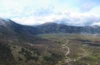 White Mountains, Hania at 47km (W) The famous - mainly due to the gorge of Samaria- plateau of Omalos (GR: Ομαλός) is surrounded by the high crowns of the Lefka Ori (White Mountains) at 1,040 to 1,250 meters and is just 38 km from the town of Chania. It extends to the counties of Sfakia, Selino and Kydonia in the prefecture of Hania. Its shape is nearly rectangular with a perimeter of about 25kms and a diameter of approximately 4 kms. It can be reached by car from the north (Neratzoporo) and from the south (Agios Theodoros).
 Kenouriou, South Iraklion at 47.2km (E) Zaros (Greek: Ζαρός), at an altitude of 340 metres, is a town with a lake and gorge nearby. It has a couple of hotels and it is 44 km from Heraklion at the southern foothills of Mountain Psiloritis. The population of 3,400, produce olive oil, sultanas, vegetables and spring water. There are a couple of fish farms that serve both trout and salmon. In Zaros, there are cafes near Lake Votomos, as well as a tavern that serves fresh trout called I Limni (The Lake). Close by is Rouvas Gorge, which is part of the Psiloritis mountain range and is on the hiking route known as the E4 European Walking Path. Nearby Zaros are traditional water mills which have been working since the 16th century, as well as archaeological sites and monasteries. Zaros is also famous for its water "ZAROS" bottled by a company called Votomos SA. 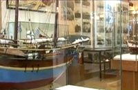 Hania, Venetian port at 47.2km (NW) A two storey house, located at the old port of Hania, with a total area of 840 m2. The exhibition includes about 2,500 exhibits, such as models of ships, different kinds of naval instruments and devices, paintings, heirlooms, gleanings from the sea bottom, shells, photographs etc., which are divided in 13 units, covering chronologically all the periods. 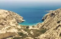 South - coast Iraklion at 47.3km (SE) Martsalo (GR: Μάρτσαλο, Mártsalo) is located on the mass of the Asterousia Mountains between Kefali (Cape Lithino) and Agiofarago. It is an impressive gorge about two kilometers long, which belongs to the hermitages of the Holy Monastery of Odigitria. Inside the gorge there is rich vegetation as well as a small palm forest in the middle of its route. The impressive cliffs are home to a large number of caves (similar to eagles' nests) inhabited by many of the area's ascetics. Gorge Martsalo is particularly steep and rough and ends at the Libyan Sea, where there is a small protected cove with a sandy- pebbly beach. Image Library
 Messara plain, South - East Iraklion at 47.5km (SE) The administrative center of the Messara Valley. Moires (GR: Μοίρες) is the biggest town in the Messara Valley with a population of approximately 5000 people. It has a police station, magistrate's court,post office, public PTT office, health center, and offices of most Greek major banks.
 Mires, Messara Valley at 47.6km (E) It is located north of Mires close to a small gorge, with springs and covered with trees. There are many churches in the village the most important one being the church of Agios Nikolaos, a domed church dated to the 13th century. The walls of the temple are hand painted with biblical scenes and pictures of saints
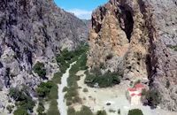 South - coast Iraklion at 48.2km (SE) Agiofaraggo (GR: Αγιοφάραγγο the gorge of Saints) is a small gorge at the southern shores of Heraklion close to the village and the beach of Kaloi Limenes and 6 kilometers south of the Monastery of Odigitria. Image Library
|
||
|
| ||
C
O
N
T
E
N
T
S
O
N
T
E
N
T
S


