interkriti®
YOUR GATEWAY TO CRETE
|
Crete
: Regional Interest
List Grid Map
Found
144
- Showing :
81 - 100
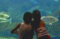 Gournes at 29.9km (NE) The CretAquarium - Thalassocosmos (GR: Θαλασσόκοσμος) was officially opened in December 2005. It provides its visitors with a special experience, a trip to the underwater world of the Mediterranean Sea and its creatures. It is a unique park whose focus is on science, education, culture and recreation and whose goal is to promote, share and spread knowledge concerning the marine environment. Image Library
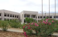 Gournes, Iraklion at 29.9km (NE) A modern competitive organisation, IMBBC (part of the Hellenic Centre for Marine Research - www.hcmr.gr) is widely recognized as one of the leading institutes in the Mediterranean. Its installations are located at Gournes, near Heraklion, Crete, where its laboratories, administration, library and conference facilities cover 1.500 m2. It has a wide range of state-of-the-art facilities needed to carry out its basic and applied research. 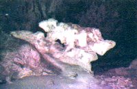 Skotino,Gouves, Iraklion at 30km (E) This is one of the three largest caves in the prefecture of Heraklion. It lies at half an hour distance to the north-west from the village of Skotino and is at a height of 225 m. above sea-level. The entrance to the cave is impressive: a large arch, 27 m wide and 10 m high. To the right one can see the ruins of an ancient chapel on which the modern chapel dedicated to Aghia Paraskevi was built. There is a feast held in front of the chapel on July 26th .
 Messara Bay, Iraklion at 30km (SW) One of the most beautiful sandy beaches of Crete, extends from a clump of rocks riveted in the shallow waters in the south to the Kalamaki settlement in the North. In Minoan times there used to be the ancient port of Phaistos. The antiquities lie just a few meters away from the sea.
Image Library
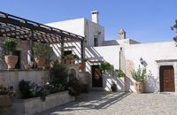 Voritsi, Gouves at 30.1km (E) Kyra Eleoússa (GR: Κυρά Ελεούσα) Monastery is located close to the village Voroú or Voritsi. Due to its historical value the monastery and the outside area which covers 1000m has acquired protected status. Kyra Eleoussa is built according to feudal architectural style, and despite some interventions over the years it maintains many original architectural features. It is first referred in a document dating from 1606. At first it belonged to the monastery of Agia Ekaterini of Sinai but later it became part of Agarathos monastery. 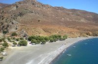 Beach in South Iraklion at 30.2km (S) Tripití (or Trypití GR: Τρυπητή) is a 400m long beach on the southern Asterousia coastline. It is located 57km from Heraklion (west gate, Giofyros) via Agioi Deka - Vagionia - Vassiliki - Trypiti road. The last 10km, from Vassiliki to Trypiti, is a dirt but in fairly good condition road. The road passes over the gorge of Agios Savvas, with spectacular rocky walls, then through a forest of olive and carob trees and finally via the gorge of Trypiti through a very narrow passage reaches the beach. This is a very interesting route with breathtaking views and fantastic scenery. Image Library
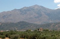 Pediada, Iraklion at 30.2km (E) 330 m above sea level, just out of Kasteli (1.5 km) to the east, lies the village of Archangelos (GR: Αρχάγγελος) with 433 residents. It was founded in 961 by the military forces of Nikiphoros Phocas and was originally named ‘Varvaro’, and was still known by that name in 1583, where the Chandax Register puts it down as a village of the Pediada district with 37 inhabitants. Its name was changed only recently, in 1961, to Archangelos, and the main village church in the square is dedicated to the Archangel Michael. There is another smaller and older church, that of the Panaghia, with Byzantine wall paintings. Remains of ancient mills can still be seen. In a location known as Trochalos, archaeological finds have brought to light a series of Minoan tools dating back to the first and second Late Minoan periods. As in every Cretan village, raki and ‘mezedes’ are always available at the kapheneions. The feast of Michail Archangelos on November 8th is celebrated with much feasting in the village. 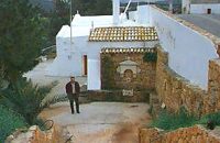 Gouves, Iraklion at 30.6km (E) At a height of 140m. above sea-level, this village has 142 inhabitants and is 22.5 kms away from Iraklion. According to the villagers, the name comes from the church of Aghios Nikolaos Skotino at the entrance of a cave. It was built at the end of the Venetian period. Today an extra wing has been added, dedicated to Aghios Charalambos. This church of Aghios Nikolaos Skotino presumably functioned as a "Hedge School" (or "Hidden School") under Turkish rule when education had been banned. When the locals said: "We are going to Skotino (which also means "darkness")", they meant they were going to school. Turkish administration refers to this place as Skotino Perasma in 1671. Very close to the village (1.5 km) the cave of Aghia Paraskevi draws crowds of tourists and is well worth a visit. 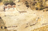 Lentas, South Iraklion at 31km (S) The first habitation of the site dates from the Neolithic and Early Minoan period (3rd millenium B.C.). In the late Classical period (beginning of the 4th century B.C.) the Gortynians established the sanctuary of Asklepios at the harbour. During the tremendous earthquake of 46 B.C. the city was destroyed and subsequently rebuilt. In the Early Christian and Byzantine periods, a small settlement developed and the basilica was erected. The most important monuments of the site are: The Temple of Asklepios., the "Treasury"., the Fountain, a large, three-aisled basilica, an Early Minoan settlement (2600-2000 B.C.), the West Stoa, the North Stoa, the Nymphaion and two large, mud-brick cisterns. 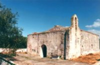 Pediada, Iraklion at 31km (E) At an altitude of 380m, with 63 inhabitants, Liliano (GR: Λιλιανό) is first mentioned in the Turkish census of 1671. The Basilica with its three naves, dedicated to Saint John, was built in the 12th -13th centuries and is one of the oldest and the most interesting in Crete. The stones used in its construction came from earlier buildings. The three naves, with the middle nave higher than the other two, are supported by columns in Ionic style. The narthex in front is lower with wider arches, whereas the door and windows have pointed arches. 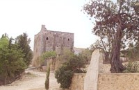 Messara plain, South - East Iraklion at 31.1km (SW) The monastery of Odigitria is a monastery of great importance and historical value and one of the oldest in Crete. It is located at the west edge of the Asterousia mountains at an altitude of 250 m. The monastery was surrounded by walls, part of them still stands. The temple of the monastery is dedicated to the assumption of Holly-Mother and to the Saint Apostles (Peter & Paul). Inside the temple there are valuable frescoes, icons of famous painters and iconostasis. The monastery is connected with the legendary freedom fighter 'Ksopateras' (1788 - 1828) In the area of the monastery at Agioi Eftihianoi was found an ancient (Early Minoan) cemetery. 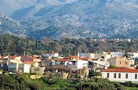 Mylopotamos, Rethymno at 31.1km (NW) Margarites (GR: Μαργαρίτες) with 300 inhabitants, is located 27 kilometers from Rethymnon at 300 m above sea level near the amcient town of Eleftherna. Margarites, is a village with Venetian roots, mentioned by sixteenth-century travellers. In the nineteenth century, Margarites was a flourishing town, whose centuries-old ceramic tradition began at least as early as the Ottoman period. Margarites is undoubtedly the most important pottery centre in western Crete. 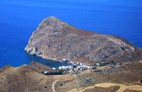 Iraklion South at 31.1km (S) Léndas or Léntas (GR: Λέντας), positioned almost in the centre of Cretes' south coast, clusters around a pretty bay that's dominated by an enormous rock resembling a lion's head that juts into the sea on one side of the resort. The village offers most facilities you might need during your stay; a choice of tavernas, three or four directly on the beach, two or three bars, mini-markets and even an Internet café. There is a sand/shingle beach and the sea is crystal clear and perfect for snorkeling.
Image Library
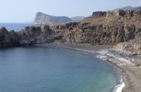 South Iraklion at 31.2km (S) Tráfoulas is a secluded beach, nested in a cove open to the south, at the small promontory of the same name, located between Lendas and Trypiti. You can reach Trafoulas only by boat or on foot via a small canyon. The starting point is around 700m away, to the north, just above the small harbour of Loutras, around 5km east from Lendas, where there is a place for parking. You then follow the hiking path, descending for a while to meet the canyon that leads directly to the beach. The walk takes around 20 minutes and its very nice as there are plenty of oleander and the rocky walls are very spectacular continuing until the sea. Image Library
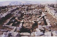 Pediada, Iraklion at 31.2km (E) Smari has a very long history and was inhabited, according to reliable sources, from the proto-Minoan period onwards. The archeological relics in the Akropolis of the hill called Profitis Elias, excavated under the direction of the Archeologist D. Hatzi Vallianou, indicate a continuous human presence from the Middle-Minoan period to about 630 B.C. 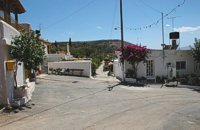 Pediada, Iraklion at 31.4km (E) Village of the area of Kastelli with 115 residents, Agia Paraskevi is situated 5 km northeast of Kastelli at an altitude of 400m. It is first mentioned in the Turkish census of 1671 as Agia Paraskevi tou Xourdou with 17 haratsia (head tax). It is very possible that Santa Venerata, a village mentioned in 1463 by Cardinal Bissarion, is the name by which Agia Paraskevi was known at that period. 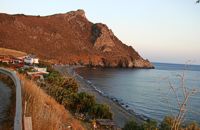 Iraklion South at 31.5km (S) A long beach west of Lendas on the south shores of Iraklion. The name is probably a corruption of Dysikos (GR: Δυσικός) which is the one to the west. There is a small settlement with taverns and accommodation complexes, mostly rooms and apartments for rent. Dyskos used to be popular with nudists and nature lovers in the past and even in present days nudism is tolerated in the western part of the beach. The beach has small pebbles and sand. Those who chose Dyskos for their holidays will have, among other things, the chance to explore the area by small walking tours and enjoy the magnificent sunset.
Image Library
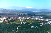 Pediada, Iraklion at 31.6km (E) Kastelli (GR: Καστέλλι) is a small town in the countryside of the province of Pediada. It has over 2000 inhabitants and provides all the modern facilities and public services its residents and/or visitors may need. Many events are organized through the year by the municipality, the school and the cultural centre. In August a special festival, known as the Feast of Xenitemenou (ex-patriot feast) includes concerts, folklore, exhibitions and theatre plays.
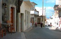 Gouves, Iraklion at 31.6km (E) Pano Gouves (GR: Πάνω Γούβες) is a village of the district of Pediada in the prefecture of Iraklion at a height of 100 metres above sea-level. It lies twenty kms away from Iraklion, to the right at 17.3 kms on the National Road to Aghios Nikolaos. The village is built on the western flanks of the Ederi hill (322 m.). The name comes from "edera" which means ivy and symbolises affection. The name Gouves, on the other hand, comes from Gouva and means a hollow in the earth. It also means, in Crete, a hole in which during the middle ages, people stored their wheat. The earliest reference we have of the village is that of "Guves" in 1387 documents of the Duke’s archives in Chandax. Later on, in 1577, Fr. Barozzi mentions "Guvos" in the district of Pediados, and then "Guves" in the 1583 Register, with 252 inhabitants. Finally, in 1630, Vassilikata refers to "Vuves’. This is the birthplace of the poet Ioannis Konstantinidis. There are several outstanding churches in the village, among them: Zoodochos Pigis, Aghios Giorgos, Aghios Ioannis and Panayia (dedicated to the birth of Our Lady). 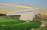 Mylopotamos, Rethymno at 31.7km (NW) The " Museum of ancient Eleutherna - Homer in Crete" , was created to accommodate the results of the excavations carried out for thirty years in the ancient city of Eleutherna (Eleftherna GR: Ελεύθερνα). It is a modern building approximately 1,800 sq.m. which together with the surrounding area occupies 3 acres and remotely resembles ark that emerges from the earth, gazing Ida (Psiloritis). |
||
|
| ||
C
O
N
T
E
N
T
S
O
N
T
E
N
T
S


