interkriti®
YOUR GATEWAY TO CRETE
|
Crete
: Regional Interest
List Grid Map
Found
125
- Showing :
101 - 120
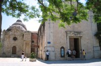 Iraklion at 43.4km (E) Agia Ekaterini church and Exhibition of Byzantine Art and Ecclesiastical objects. A small sinaitic church of St. Catherine with a Basilica design, houses an exhibition with works of art from the Cretan renaissance. Among the exhibits are some of the most important icons of the Cretan School, ecclesiastical books and manuscripts, vestments, ecclesiastical vessels and relics, wall-paintings, wood-carvings and sculpture. 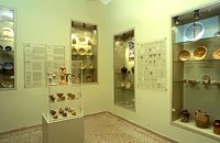 Iraklion town at 43.5km (E) The history and culture of Crete, from the first centuries of the Christian era to our present time. An exceptional museum featuring a collection of extremely precious objects, a must see for every visitor to Crete. The museum is housed in a two storey neoclassical building, which was constructed in 1903 on the site of an earlier mansion.
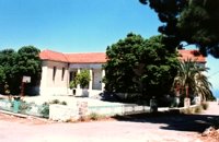 Apokoronas, Hania at 43.5km (NW) The community of Kefalas (GR:Κεφαλάς) is situated in Apokoronas, Hania, approximately 4 km to the east of Vamos. During the Venetian occupation higher and lower Kefalas were classed as two separate villages, however, today they have become one. It is a large village built in an outstanding position facing the sea with architecture dominated by the influence of the early and late years of the Turkish occupation. This influence is well preserved despite the existence of other architectural styles. The church of Timios Stavros (16th century) is the oldest building of the village while the more recent churches of Panagia, Agios Antonios, and Michael the archangel, works of the reputed Kefalas craftsmen, are examples of folk architecture of the 19th century. A further example of the work of the same craftsmen is the Public School of Kefalas, which in accordance with the decision of the county council of Hania will house the Environmental Educational Centre of the prefecture, a foundation that will play a definitive role in the development of the municipality of Vamos. Other interesting communities are Paleloni and Drapanos in the direction of Kokino Horio. The road from Paleloni leads to Embrosgialo, a relatively easily accessible place, along the steep coastline, which extends to Georgioupoli. 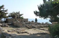 Archanes at 43.6km (E) The Minoan villa at Vathypetro was most likely the residence of a local ruler. Its architecture is comparable to that of a "Little Palace": it has a central and west court, a small tripartite shrine, a three-columned portico, storerooms and workshops. It seems that the construction of the building was never completed. Interesting elements of its architecture are the installations of a wine-press in the south wing and an oil-press in the courtyard. 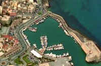 North - Central Crete at 43.7km (E) Iraklion (Heraklion or Herakleion GR: Ηράκλειον) is the largest urban centre in Crete, the capital of the region and the economic centre of the island. The first European civilisation, the Minoan civilisation, flourished on this land 5000 years ago. Currently the population of Iraklion is approximately 150.000 people. It is a very dynamic and cosmopolitan town, particularly during the summer period when thousands of visitors can be seen shopping in the market or visiting the museums and other places of interest. Today Heraklion is the top choice for tourist destinations in the Mediterranean. The city is also the commercial and scientific centre of the island. During the last 20 years the city has made remarkable progress in the academic and technological fields...
Image Library
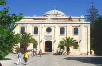 Iraklion Old Town at 43.8km (E) With the recovery of Crete from Nikiforos Fokas (961AD), the seat of the bishopric is transferred from Gortyna to Chandakas, which became the capital of the island. The new cathedral, which is the most established and largest in the city, is dedicated to the Apostle Titos. Here, amongst other relics, there are gathered the Holy Skull of the Apostle and the miracle working icon of Messopapaditissas. Image Library
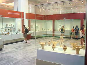 Heraklion city at 44km (E) The most magnificent collection of Minoan art and culture in the world, unique in beauty and completeness is housed in this museum. The exhibiton of the museum is organized in chronological order, ranging from the Neolithic period to the Roman era (4th century A.D.) and geographically, according to the provenance of the finds.
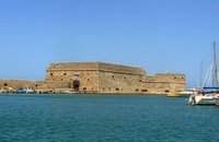 Iraklion Venetian port at 44.1km (E) A seaside fortress situated at the entrance of the old harbour. It was built by the Venetians, before the construction of the new Venetian fortification, in order to protect the pier and the port. It took its last shape in the years between 1523 - 1540 replacing another construction destroyed by an earthquake. Image Library
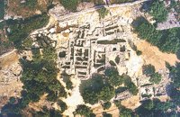 Archanes at 44.3km (E) Excavations at Phourni have brought to light 26 buildings, most of which had funerary use. The cemetery was used from 2400 B.C. until 1200 B.C. and each complex had more than one architectural phase. Most of the funerary buildings were used for many decades and contain successive burials. Excavations were begun in 1964 by Efi and John Sakellarakis and have been continued until today (1995) with short interruptions. Most of the buildings are preserved in good condition. 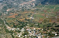 Sfakia, White Mountains at 44.7km (W) It is located at an altitude of 750 m, 50 km SE from the city of Hania and 20 km from the village of Vryses. Its population is approximately 500 people. The small villages that constitute the community of Askifou are Kares, Ammoudari, Goni and Petres. The most touristic organised of them is Ammoudari with restaurants, gas station, and some rooms for rent.
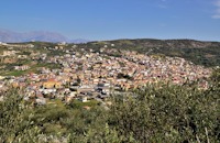 Archanes, Iraklion at 44.8km (E) A small traditional town (~4000 people) 15 km south of Iraklion on the foot of the sacred mountain Yiouhtas. Renowned for its excellent wine (from the varieties: vilana, kotsifali and madilari) and the archaeolocical sites and caves. In 1912, Xanthoudides noted the importance of Archanes, but Sir Arthur Evans was the first to characterize the site as palatial, declaring that Archanes was likely a Summer Palace for the Knossos kings. Spyridon Marinatos and N. Platon excavated minor areas in the region, but nothing supported Evans' theory. In 1964, J. Sakellarakis dug trial trenches at the Tourkoyeitonia site and uncovered the first evidence of a palace site. Since 1966, Archanes has been excavated by the Greek Archaeaological Society under the supervision of John Sakellarakis and Efi Sapouna-Sakellarakis. The small town of Epano Archanes, one of the most famous places of the Cretan land, with its colorful courtyards, teaches culture, taste, tradition, colors, aromas and life itself. The silvery grays of the olive groves, the red, pink, salmon and tiled walls, the blue and green shutters, the colorful bougainvillea boldly climbing the walls of the houses, the manicured flower beds, but also the elaborate, colorful signs in coffee shops and grocery stores. All this makes Archanes the most colorful village of Crete, but also of Greece. The town is full of atmospheric neighborhoods with well-maintained houses, painted in cheerful colors. At each step the visitor learns more and more about it. That's why the locals have taken care of it: the Folklore Museum, the Archaeological Museum, the sculpture workshop, the Museum of Cretan History and Tradition just outside. Image Library
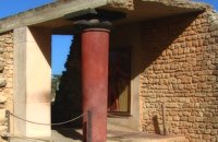 Palace and Archaeological site at 45.2km (E) The famous Palace of king Minos and the centre of the Minoan civilisation 5km south of Iraklion. The Great Palace covered an area of 20.000 sq. meters and had 1.400 rooms. Every section of the Palace had a specific use. In the west side of the Palace were the chambers of the ceremonies, of the administration and of the public storehouse...
Image Library
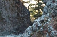 Sfakia, South Hania at 45.5km (W) The ravine begins from the last houses of the village of Imbros and 8 km after it ends at the village of Komitades. Its crossing is smooth and entails no danger...
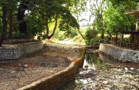 Apokoronas, Hania at 45.5km (W) The traditional little village of Vrisses lies approx. 35 km from Chania town. The old village square with its tall plane trees, the tavernas and kafenions is the perfect place to relax and enjoy the lush green landscape by the river Vrissanos and taste the renowned and particularly delicious local yogurt.
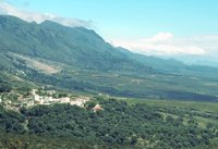 Sfakia, Hania, Crete at 45.7km (W) At the exit of the ravine of Imbros, near the south coast of Sfakia. It is located at an altitude of 200 m, 68 km from the city of Hania and 4,5 km from Hora Sfakion. The area is covered with olive trees and the view to the Libyan sea and the island of Gavdos in the horizon...
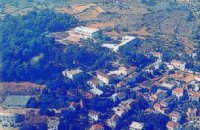 Apokoronas, Hania at 46.9km (NW) Vámos (GR: Βάμος) is the capital of Apokoronas district is an exceptionally interesting village that the Ministry for the Environment, Physical Planning and Public Works has classed as traditional. It is more like a small town, very well preserved, with folk and neoclassical architectural elements. The initiative of a group of inhabitants to create an association for the preservation of the village as well as alternative tourism strategies is already paying off while constituting a model for further local progress. The famous art and cultural festivals are good opportunities for everyone to experience the hospitality and entertainment Vamos can offer.
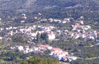 Apokoronas, Hania at 46.9km (NW) Gavalohóri (GR: Γαβαλοχώρι) is an old big traditional village, with fine examples of traditional rural architecture and stone buildings that are well preserved. The village has been declared a traditional settlement and is awarded a protected status. Many interesting buildings still stand, such as the 18th century olive press, the church of Panagia (Virgin Mary) and that of Agios Sergios, the old school and the complex of the wells from the period of the Venetian occupation.
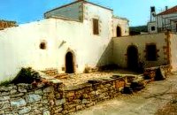 Gavalohori, Vamos, Apokoronas at 47km (NW) The exhibition of the objects takes place according to the contemporary museum conception, with explanatory texts, photographs, plans, models, and is enriched with new exhibits every year. The Museum is divided into seven rooms, according to the following units: The Arched House, Silk, Pottery, Lace-making, Masonry and Stone carving, Church and Woodcarving.
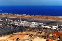 Iraklion ( Nea Alikarnassos) at 47.1km (E) Heraklion International Airport, "Nikos Kazantzakis" (Greek: Κρατικός Αερολιμένας Ηρακλείου, "Νίκος Καζαντζάκης") or Nikos Kazantzakis International Airport (IATA: HER, ICAO: LGIR) is the primary airport on the island of Crete, Greece. It is located about 5km from the main city of Heraklion. Heraklion International Airport is is one of the biggest in Greece and receives approximately 15% of the total tourist traffic of Greece. There are many airlines currently operating flights from Athens and Thessaloniki to Iraklion (Olympic Airways, Aegean Airlines and others), while during the high season there are flights from/to Rhodes, Mykonos, Santorini and other Greek islands. There are also international airlines that connects Iraklion to other European cities. During the summer season there are numerous chartered flights to Iraklion from all over Europe (mainly Germany, the United Kingdom, Russia, and Holland). During the summer months there is a huge increase in air traffic that peaks in August (approximately 130 flights per day). Major car-rental companies have desks at the airport. Taxi and public bus are available for transfer from/to Iraklion. 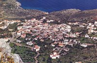 Apokoronas, Hania at 47.3km (NW) Kókino Horio (GR: Κόκκινο Χωρίο), which is located at a higher altitude, has maintained its traditional architectural style even more so than the other villages with its narrow roads, beautiful gates and tiled roofs. A group of cisterns, built in a sloping field, gather the rainwater, an interesting example of local architecture, dealing with the permanent problem of lack of water. Above Kokino Horio one can see the strangely shaped hill Drapanokefala or Calapodha (so named during the venetian occupation). The coastline northwest of the village is an extremely interesting place for a stroll due to the ground formation and the caves, such as the cave of Petsi (or Karavotopos). Another cave called Katalimata, located at the centre of the village, is also an interesting site. At cape Drapano, approximately 10 metres under water, is the impressive Elephant cave, an area 60mx60m full of stalactites and stalagmites of various shapes and colours. Video - The Elephants' Cave |
||
|
| ||
C
O
N
T
E
N
T
S
O
N
T
E
N
T
S


