interkriti®
YOUR GATEWAY TO CRETE
|
Crete
List Grid Map
Found
222
- Showing :
161 - 180
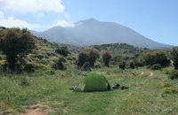 by Richard Ellis at 36km (SW) 11th, 12th and 13th June- We had made camp in the yard beside the Aghios Ioannis chapel at Rouvas but, the following morning, it was quite clear that I wasn’t going to go any further on foot until the shin splint had settled down a bit. Minor surgery on the blisters exposed the full extent of those problems and I hung them out to dry in the sun while Triantafyllos went off looking for paths to put on his maps. I think I was lucky not to get infected blisters but Betadine is a great resource which I used extensively.
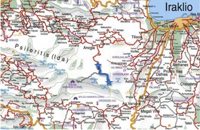 by Richard Ellis at 36km (SW) 14th June- The walk up from Rouvas is quite straightforward; once you have walked back down the stream from the Rouvas picnic area and turned right (north) up the dry river bed for two hundred yards, you scramble up a short, easy rock section (well sign posted) before the path continues up through open oak woodland (the Rouvas Forest) heading first for the Duo Prinoi chapel, which has a water tap, and then later up and over a ridge, beyond which a small dry water course leads up a steep sided valley to the flat lands of the Nidha plateau. Distance:12 km Time: 4.75 hrs. Mov av 3.7 km/hr Height overnight: 1,360m. 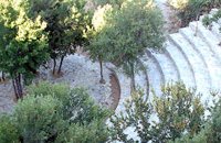 Anogia at 36.9km (W) The artistic events, which take place every year in the first week of July at the same place called Fourni and in the Cretan village of Anogia. The poet, songwriter and singer from Anogia, who they call "Loudovikos from Anogia" wants to make the history of the young martyr, who supersedes his fear in love known to the public. And because 1.900 years have passed since the martyrdom of Yakinthos, he decided to honor the Saint of Love and sing together with him of the poetry of love.(www.yakinthia.com)
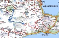 by Richard Ellis at 37.2km (SE) It was a familiar performance trying to find the right path out of Selakano. T's map v T's GPS (didn't show the start) v LW's words. Together they made no real sense, because the map was saying that the footpath ran due west out of Selakano while LW’s suggested route was taking me north. In the end good old red paint splashes got me going westwards along a concrete path (starting beside a concrete structure) not far north of the junction between the bunkhouse square and Stella’s taverna. You have to follow your nose here as the paths stop and start a bit, but the GPS did clutch in quite quickly and, as ever, was reliable. Distance:22km Time: 9 hrs. Mov av 3.4 km/hr Height overnight: 824m.(max 2,148m.) 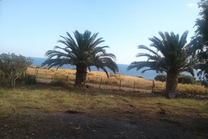 Krassas, Tsoutsouros at 38.4km (S) Palm House is a beautiful stone-built house on the south coast of Ceete. It is built on a tree-lined plot with panoramic sea views ,ideal for comfortable accommodation for 4 people. Its distance from the sea is only 300 meters.
Petra & Fos pizzeria - cafe bar Tsoutsouros at 38.4km (S) Delicious pizza in the wood heated oven, wonderful surroundings, ice cold beer, just by the libyan sea.
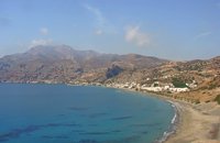 Monofatsi, South Iraklion at 38.4km (S) Tsoutsouros (GR: Τσούτσουρος) is a small village on the southern coast of Iraklion prefecture, with lovely beaches and a small harbour. The ancient city of Inatos, used to stand were Tsoutsouros is now. Inatos served as a port to Priansos a renowned city - state of the Hellenistic time, located near the village of Kasteliana. Tsoutsouros is a popular tourist resort especially with Greek families. There are many taverns and cafes most of them around the small harbour, and a good choice of apartments and hotels along the beach. Image Library
 Krasas, Tsoutsouros at 38.7km (S) Seaside Houses located an hour drive (60kms) from Heraklion's airport at Tsoutsouros village. The houses are on the top of a headland separating two bays with magnificent beaches - the one almost private! - constituting a majestic scenery of virgin Crete with both sea and mountain view. Unique place for those who seek privacy, peace and romantic mood. The houses are fully equipped and have large shaded verandas. Prices from € 160/ night (2people)  Kenouriou, South Iraklion at 38.8km (SW) Zaros (Greek: Ζαρός), at an altitude of 340 metres, is a town with a lake and gorge nearby. It has a couple of hotels and it is 44 km from Heraklion at the southern foothills of Mountain Psiloritis. The population of 3,400, produce olive oil, sultanas, vegetables and spring water. There are a couple of fish farms that serve both trout and salmon. In Zaros, there are cafes near Lake Votomos, as well as a tavern that serves fresh trout called I Limni (The Lake). Close by is Rouvas Gorge, which is part of the Psiloritis mountain range and is on the hiking route known as the E4 European Walking Path. Nearby Zaros are traditional water mills which have been working since the 16th century, as well as archaeological sites and monasteries. Zaros is also famous for its water "ZAROS" bottled by a company called Votomos SA. 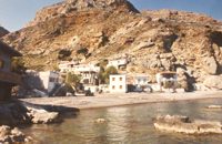 Monofatsi, South Iraklion at 39.3km (S) Maridaki (GR: Μαριδάκι) is a small coastal hamlet in the bay of Tsoutsouros on the southern coast of Iraklion prefecture. It is built at the end of the gorge of Ahendrias.
Image Library
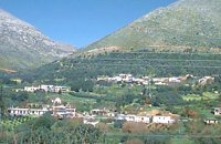 Mylopotamos, Rethymno at 39.7km (W) Apladianá (GR: Απλαδιανά) is a small village built at the foot of the two Kouloukona heights. The settlement stretches out along the old national road, where it developed after the opening of the new national road. It comprises cafes, tavernas, and accommodation facilities included in the Countryside Tourism programs. It is worth your while, however, to visit the old village, climbing there on foot or by car. Picturesque, narrow streets, wonderful old houses with interesting architectural elements, old cisterns and churches will reward your efforts. The old village built on a height of 260 m above sea-level has 175 inhabitants and the settlement along the old national road, known as "Kampos ton Apladianon", has 78 inhabitants. It is 40 kilometres away from Rethymnon and is located at the foot of the highest peak of the Kouloukona mountain in the Tallaios range. Historical background Already as far back as 1368 we find a mention of the Aplada family, the founders of the present village and in the topographical maps of the Civil Engineering Services of Rethymnon it figures as Pladiana. The settlement is not mentioned in the 16th and 17th cent. documents. In the 1881 census, Apladiana is attributed to the commune of Garazo, with 57 inhabitants and in 1900 it is referred to as the Apladiana Commune which, together with the Cheliana settlement, had 153 inhabitants. 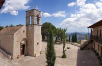 Zaros at 39.8km (SW) This is one of Crete's most famous monasteries. It played an important role during the years of the Cretan Renaissance, both in the letters and the arts, and, during the last centuries of Venetian rule, it was known for its many scholars, artists and venerable monks.
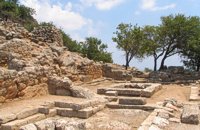 Mirabello, Lasstithi at 39.9km (SE) Lato (Gr: Λατώ) was an ancient city of Crete, the ruins of which are located approximately 3 km from the small town of Kritsa. The Dorian city-state was built in a defensible position overlooking Mirabello Bay between two peaks, both of which became acropolises to the city. Although the city probably predates the arrival of the Dorians, the ruins date mainly from the Dorian period (fifth and fourth centuries BC). The city was destroyed ca. 200 BCE, but its port (Lato Etera or Lato pros Kamara), located near Agios Nikolaos was in use during Roman rule. There is some suggestion that the city was named after the goddess Leto (of which Lato is the usual Doric form) and may be mentioned in Linear B tablets as RA-TO. Lato also minted coins in antiquity,[3] bearing the likeness of the goddess Eileithyia who appears to have been the one particularly worshipped at Lato. Nearchus, admiral of Alexander the Great, was born at Lato. 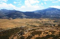 Psiloritis Mountain at 40km (W) The plateau is located in the center of the Ida mountain range at an altitude of 1400 m. It can be accessed from various sides but the only asphalt road is from the town of Anogeia. It has a roughly triangular shape and is almost flat. Visitors can enjoy the wild landscape, take a walk to the entrance of Idaion cave or to the freedom fighter sculpture, made with boulders from the mountain. An other interesting attraction is the various Mitata scattered all over the area. Those are circular domed buildings made with stones and used by shepherds for accommodation and storage of cheese. There is also a tavern with traditional food. The area of Nida, in earlier times, before the systematic farming and logging damage the flora of Psiloritis, was covered by forests in which mythological and traditional tales put different events. Here Dimitra fell in love with the mortal Iasion. http://www.anogialand.gr 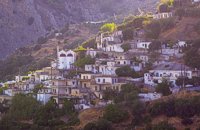 Ierapetra, Lassithi at 40.2km (SE) At a mountainous, precipitous site, in the west mountain slopes of Dikti, at an altitude of 550 m above sea level and at 2 km from the village of Malles, is built the village Christos (GR: Χριστός – Christ). Christos is a beautiful, verdurous village, with many running waters, traditional, unchanged by time, with narrow sloping cobbled alleys. Image Library
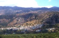 Mirabello, Lasstithi at 40.3km (SE) Kritsa is one of the most picturesque towns in Crete, built amphitheatrically on a rock hill. It is located 11 km from Agios Nikolaos and has 2000 inhabitants. The people keep the old Cretan customs and the traditions and the town is considered one of the most important centers of the Cretan folk and weaving art.
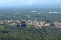 Messara, Iraklion South at 40.4km (SW) Agioi Déka (GR: Αγιοι Δέκα) is a town with 820 inhabitants in the plain of Messara, 170m above sea level, 43 km from Heraklion town and very close to the archaeological site of Gortyna. Its people are occupied mostly in agriculture - vines and olive trees. In the area there is is the oldest olive grove in Crete. The town is built on the ruins of the ancient town of Gortyn where the Holy Ten Martyrs have been martyred. 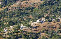 Ierapetra, Lassithi at 40.4km (SE) It is a small village with few residents, loacated 4 km to the west of the village Christos at an altitude of 600 m. The residents of Metaxohori (GR: Μεταξοχώρι, or Parsás - GR: Παρσάς) have immigrated to the plains of Ierapetra, in Stomio, Ammoudares and Xerokampos and work in the glasshouses. The village has been renamed in 1955 from Parsas to Metaxohori to honor the Ecumenical Patriarch Meletios Metaxakis who was born here. 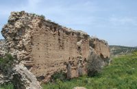 Gortyn archaeological site at 40.7km (SW) The main acropolis of Gortyna was located on Agios Ioannis hill, to the northwest of the Agora. Acropolis can be accessed from its west side driving through Ambelouzos village to the direction of Gergeri. At a spot around 1.6 kms from Gortyna parking there is a footpath (not clearly signposted and maintained) that leads to the top of the hill. Once at the top you'll be rewarded by the magnificent view to the whole area and the archaeological site itself. The site was first inhabited in the Neolithic era and again at the end of Minoan times (1200 BC). Since then it was continuously inhabited until the Middle Byzantine period. From the first settlement only parts of walls, floors and hearths were preserved. In the 10th century BC a Geometric settlement was established fortified by a polygonal wall with towers at the corners. At the end of the 7th c. A.D., a small tripartite temple, dedicated to Athena Poliouchos was founded at the south side of the hill. From this temple some very important architectural sculptures were excavated. During the Early Byzantine period (5 - 6th century AD), a basilica was erected over the ruins of the geometric/archaic temple and, in the time of the emperor Heraclios (7th century A.D.) the last fortification with a castle in the center was built which still survives but in a very poor condition. Image Library
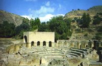 Gortyn archaeological site at 40.8km (SW) The Roman Odeum at Gortyn is considered one of the best and the most important of its type on Crete. Is has been founded at the North part of the Ancient Agora of the City. This semicircular building consists of three main parts: a. The Cavea, connected with a domed corridor through three wide staircases; b. the Orchestra, which has an internal diameter 8,5 m. and was paved with white and blue marble slabs; c. The Scene, which had two entrances and the paraskenion, with mosaic pavement in geometric pattern. Statues of Muses stood in the niches. Initially the building was a circular Ekklesiasterion founded in the 5th c. BC. In the portico of this public building the Great Inscription with the Law Code of Gortyn dated to the early 5th c., stood. It was destroyed twice: in the 1st century BC, and again in 46 AD. After this last destruction it was reconstructed as an Odeum. The great Inscription is considered to be the largest Greek inscription, the Queen of all Inscriptions. Its first fragments were found by the French travelers and were bought by the Louvre Museum. The most part of the Inscription was found accidentally by local farmers in 1884 and was further explored F. Halbherr. It is a Law Code inscribed in the boustrophedon system of writing. It dates in the 1st half of the 5th c. BC and is the oldest Greek and European Law Code. It consists of twelve Deltoi and was built in the Ekklesiasterion of the 5th c BC. In this Code older laws, regarding the personal and family rights of the citizens of Gortyn, were codified. Image Library
|
||
|
| ||
C
O
N
T
E
N
T
S
O
N
T
E
N
T
S

