interkriti®
YOUR GATEWAY TO CRETE
HOME
CRETE FACTS
NAVIGATE
EXPLORE

Agia Galini
Triopetra
Kissamos
Chryssi Isl.
Agia Marina
Balos
Gavdos isl.
Georgioupolis
SAMARIA
IDA Mtn
Palaiochora
Agia Roumeli
Sfakaki
Bali
Kalamaki
Matala
Lassithi
Plateau Lendas
Tsoutsouros
Vianos
Myrtos
Sfakia
Plakias
Ierapetra
Makrygialos
ZAKROS
Vai
Sitia
Agios Nikolaos
Elounda
MALIA
Hersonissos
Gouves
Chania
Rethymnon
Heraklion
GORTYN
FESTOS
KNOSSOS
|
|
Crete
List Grid Map
Found
179
- Showing :
41 - 60
 Mires, Messara Valley at 19.7km (S) It is located north of Mires close to a small gorge, with springs and covered with trees. There are many churches in the village the most important one being the church of Agios Nikolaos, a domed church dated to the 13th century. The walls of the temple are hand painted with biblical scenes and pictures of saints
 Amari, Rethymnon at 19.9km (W) Sivritos (GR: Σίβρυτος) was an important and autonomous city of the ancient Crete. The city was built in the location that today is the village of Thronos. It was located on a hill dominating the valley of Amari. The name Sivritos is derived from the words si, that in the ancient eastern languages meant water, and the word vriti, that is of prehistoric origin and meant sweet. Therefore, Sivritos in the Minoan period meant sweet water. The derivation is also verified by the fact that near the hill where the city was located there are numerous sweet water springs.  Malevizi, North - West Iraklion at 20.1km (NE) Ahláda (GR: Αχλάδα) is a small village located 24 kms west of Iraklion at an altitude of 300 meters a.s.l. It is close to the tourist resorts of Agia Pelagia and Ligaria, and it has approximately 500 inhabitants, most of them farmers and stock breeders. The name of the village meaning wild pear tree is given probably due to the huge wild pear tree that used to be at the village.  Voutes, Iraklion at 20.1km (E) The Foundation for Research and Technology – Hellas (FORTH) is one of the largest research centers of Greece with well - organised facilities and a highly qualified staff. It functions under the supervision of the General Secretariat for Research and Technology of the Hellenic Ministry of Development and consists of seven Research Institutes, which are located in various regions of Greece: Heraklion, Rethymno, Patras and Ioannina. The Foundation’s headquarters, as well as the Central Administration offices are located in Heraklion, Crete.  Voroi, Messara, Iraklion at 20.4km (S) The exhibited objects in the Museum come from all over Crete. These objects show that the folk culture of Crete is characterized by an amalgam of influences in which Minoan (2000-1000 BC), Archaic (1000-500 BC) and Byzantine models prevail, especially in agriculture, stock breeding, pottery and basketry.
 Messara, Iraklion South at 20.7km (S) Vori is a beautiful, traditional village of the county of Pirgiotissas in the Messara Valley. It is located 60 km south of Iraklion and in the western part of the Messara Valley. The village stretches in a slope, by the side of a small river. The archaeological site of Phaistos is 2 km to the south and the coast of Messara 4 km to the west.
 Voutes Iraklion & Rethymno at 21km (E) The University of Crete, is multi-disciplinary, research- oriented Institution, situated in the cities of Rethymnon and Heraklion. It is a University with a well-known reputation both nationally and internationally, with state-of-the art curricula and graduate programmes, considerable research activity and initiatives that reflect its dynamic character. It was established in 1973 and operated during the academic year 1977-1978. Today, approximately 10628 students attend the University. The University's staff consists of 580 Teaching and Research Staff members. Its' operation is supported by more than 400 administrative staff.  Stavrakia, Iraklion at 21km (E) The University Hospital of Heraklion (Pa.G.N.I.) is the largest hospital facility in Crete and one of the largest public hospitals in the country. The Pa.G.N.I. provides secondary and tertiary health care in a wide range of clinical specialties, diagnostic and laboratory tests. It is located 8km away from the city of Heraklion in the area of Stavrakia, next to the School of Medicine of the University of Crete Telephone: +30 2813 402111 & 2810 392111 Website: www.pagnh.gr/  Messara, Iraklion South at 21.3km (SW) The town of Timpaki (GR: Τυμπάκι) is located in the west edge of the plain of Messara, 65.3km away from the city of Iraklion. It is a rich and busy town with significant economic activity especially due to the early vegetables production in the wider area. There are banks, a post office, medical centers, stores, schools, hotels, restaurants, ect to cover both the needs of the locals and visitors.
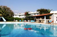 Ammoudara Beach, Iraklion at 21.3km (NE) Gorgona is a family run hotel that offer all the modern amenities. It has its own swimming pool, and is surrounded by its own gardens with lush tropical vegetation, that spread on 5000 sq. meters. There is also a lounge with TV, bar, restaurant, reception, pool bar and a large private parking area. The 39 rooms have their own balconies, private bath, central heating, air conditioning, TV, radio, refrigerator, telephone and safe box. Sandy beach is only 200m away. Open all year round
 by Richard Ellis at 21.4km (E) 10th June- I packed up the tent early after a noisy night of competing dogs and was on the road by 0615. After 3 or 4 kilometres on a mix of dirt roads and tarmac roads, I managed to find the concrete road which is the official E4 (marked with paint on a concrete watertank) up from Pirgos and a couple of hours later I was in Venerato having a frappe in the café by the turn to Kerasia.. Distance:35.8km Time: 13.75 hrs. Mov av 3.9 km/hr Height overnight: 945m. Max. height: 1600m  Messara bay, Iraklion South at 21.5km (SW) Kokkinos Pirgos (GR: Κόκκινος Πύργος) is a small coastal community, 2km away from Timbaki with a nice, long sandy beach, one of the longest in Crete, and a clear transparent sea. The part of the beach to the north west of the harbour is called Makrimaliana (or Kakoskalo) and the south east part of it is called Katalyki . The harbour in front of the village of Kokkinos Pirgos, offers docking facilities for sailing and fishing boats. There are hotels, restaurants, bars, etc. across the harbour and along the beach. You can always find good fresh fish in the taverns of the village. Kokkinos Pirgos (meaning red tower) , took its name from a castle that use to be there during the Middle Ages, which was built by red clay earth.
Image Library
 Kenouriou, Iraklion at 21.6km (SE) Doúli (GR: Δούλι) is a village in Kenouriou county, located 38 km from Iraklion at an altitude of 440 m above sea level. The earliest reference to it, is to be found in the Duke's Archives of 1372, where it is mentioned as the feudal property of Nic. Venerio. The name figures in all the Venetian censi of the 16th and 17th centuries, as well as in the Turkish (1671) and Egyptian (1834) censi. In 1881, Douli forms part of the municipality of Megali Vrisi with about 170 inhabitants, and again in 1900 with only 21 inhabitants. As of 1920, Douli is a commune in its own right, and today Douli has about 240 residents. The patron saint of the village is Aghios Panteleimonas and the feast of the Saint is celebrated on July 27th.A visit to the old church of Aghios Nikolaos is also a must. For those interested in paleontology, there are fossils to be found at the location 'Pirgos'.  Iraklion at 21.7km (NE) Ammoudara (GR: Αμμουδάρα) is four kilometre long sandy beach that stretches from the west end of Heraklion to Linoperamata near the village of Gazi. The sand is fine and blond and extends several metres to the land and the sea is clear and safe. The predominant winds during the summertime are N, N-W usually "meltemi" that get more fresh at the western end of the beach, where the windsurf school is located. Along the shore there are hotels, some of them very large complexes, taverns, restaurants, bars, cafes etc that offer umbrellas and sun-beds on the beach. There are also lifeguards in some spots. The area in general is touristic and offers a full range of facilities, among them the modern multiplex "Technopolis" with cinema and an open-air theater. Image Library
 Gortyn archaeological site at 21.7km (S) The main acropolis of Gortyna was located on Agios Ioannis hill, to the northwest of the Agora. Acropolis can be accessed from its west side driving through Ambelouzos village to the direction of Gergeri. At a spot around 1.6 kms from Gortyna parking there is a footpath (not clearly signposted and maintained) that leads to the top of the hill. Once at the top you'll be rewarded by the magnificent view to the whole area and the archaeological site itself. The site was first inhabited in the Neolithic era and again at the end of Minoan times (1200 BC). Since then it was continuously inhabited until the Middle Byzantine period. From the first settlement only parts of walls, floors and hearths were preserved. In the 10th century BC a Geometric settlement was established fortified by a polygonal wall with towers at the corners. At the end of the 7th c. A.D., a small tripartite temple, dedicated to Athena Poliouchos was founded at the south side of the hill. From this temple some very important architectural sculptures were excavated. During the Early Byzantine period (5 - 6th century AD), a basilica was erected over the ruins of the geometric/archaic temple and, in the time of the emperor Heraclios (7th century A.D.) the last fortification with a castle in the center was built which still survives but in a very poor condition. Image Library
 Gortyn archaeological site at 21.8km (S) The oldest theater of Gortyna was on the south slope of the Profitis Ilias hill (Acropolis), opposite to the Odeum. Its cavea was partly cut into the rock and partly built. Its scene was built at the west side of the large court of the Agora, which covered the river Lethaios with a flat bridge. This scene, which H. Belli saw in the 16th c AD, was 120 m long and was already destroyed in 19th c. AD. On the proscenium there was an inscription of Julia Augusta and it was decorated with statues and relies, among which there was the statue of Europe on the Bull, with broken legs and head.This statue, as described by Admiral Spratt, is now kept in the British Museum and is dated to the 2nd c BC.  Messara plain, South - East Iraklion at 21.9km (S) The administrative center of the Messara Valley. Moires (GR: Μοίρες) is the biggest town in the Messara Valley with a population of approximately 5000 people. It has a police station, magistrate's court,post office, public PTT office, health center, and offices of most Greek major banks.
 Archaeological Site in Messara, S-W Iraklion at 21.9km (S) The "Royal Villa" at Ayia Triada which is situated very close to Phaistos, was built in about 1550 BC. i.e. just before the new palace at Phaistos, and was destroyed by fire in l450 BC, like all other important Minoan centres. It succeeded the first palace at Phaistos as the economic and administrative centre of the regions depriving the new palace there of this role, and appears to have had connections with Knossos. The two wings, with an open-air space between them, consisted of groups of interconnecting rooms (polythyra), storerooms and stairways. On the site of the ruins, a Mycenaean megaron, the so-called "Agora" and an open - air shrine were subsequently built. In the villa's disaster layer from the fire in 1450 BC, excavation revealed a valuable group of exceptional works of art, precious materials, records in Minoan script and seals. The famous black serpentine vessels, the "Harvesters' Vase", the "Boxers' Vase" and the "Chieftain ‘ s Cup", the wall paintings depicting the natural landscape, the sarcophagus, the bronze and clay figurines of worshipers and the copper ingots from the Treasury are among the most noteworthy findings.  Moires, Messara at 21.9km (S) The monastery of Panagia Kaliviani is located at the 59th km on the road Iraklion-Phaistos. The monastery was built during the second Byzantine period. The small Byzantine chapel was painted with frescoes but most of them are today destroyed. The chapel was deserted until, during the Turkish occupation in 1873, an old small icon of the Annunciation of the Holy Mother was miraculously found there.and the monastery became a place of worship.  Gortyn archaeological site at 21.9km (S) The Roman Odeum at Gortyn is considered one of the best and the most important of its type on Crete. Is has been founded at the North part of the Ancient Agora of the City. This semicircular building consists of three main parts: a. The Cavea, connected with a domed corridor through three wide staircases; b. the Orchestra, which has an internal diameter 8,5 m. and was paved with white and blue marble slabs; c. The Scene, which had two entrances and the paraskenion, with mosaic pavement in geometric pattern. Statues of Muses stood in the niches. Initially the building was a circular Ekklesiasterion founded in the 5th c. BC. In the portico of this public building the Great Inscription with the Law Code of Gortyn dated to the early 5th c., stood. It was destroyed twice: in the 1st century BC, and again in 46 AD. After this last destruction it was reconstructed as an Odeum. The great Inscription is considered to be the largest Greek inscription, the Queen of all Inscriptions. Its first fragments were found by the French travelers and were bought by the Louvre Museum. The most part of the Inscription was found accidentally by local farmers in 1884 and was further explored F. Halbherr. It is a Law Code inscribed in the boustrophedon system of writing. It dates in the 1st half of the 5th c. BC and is the oldest Greek and European Law Code. It consists of twelve Deltoi and was built in the Ekklesiasterion of the 5th c BC. In this Code older laws, regarding the personal and family rights of the citizens of Gortyn, were codified. Image Library
|
||
|
| ||


C
O
N
T
E
N
T
S
O
N
T
E
N
T
S