interkriti®
YOUR GATEWAY TO CRETE
|
Crete
List Grid Map
Found
163
- Showing :
61 - 80
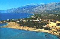 Sfakia, South Hania at 29km (SW) On the south coast of Crete, on a magnificent white sandy beach, stands one of the most beautiful Venetian fortresses, Fragokastello, built in 1371. It is located approximately 170 km from Iraklion, 70 km from Rethimnon, and 70 Km from Hania. Today, Fragokastello is a small, but developing, community, with nice beaches covered in sand dunes, and limited, but increasing, tourist facilities.The Villages Patsianos and Kalikratis, the castle, the history of the place and the fenomenon of Drossoulites...
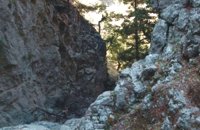 Sfakia, South Hania at 29.3km (SW) The ravine begins from the last houses of the village of Imbros and 8 km after it ends at the village of Komitades. Its crossing is smooth and entails no danger...
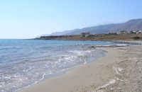 Frangokastello at 29.4km (SW) Vatalos is the long beach to the west of the main beach of Frangokastello. It is a stretch of fine sand interrupted by pebbles and rocks that create small coves. There are no umbrellas and sun beds available for rent and the only shadow can be found under the little tamarisks. It is by far less crowded than the main beach. It is frequented mostly by the guests of the hotels that stand above the beach as it is peaceful, and, quite safe for the kids.
Image Library
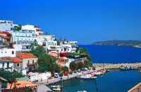 Rethymnon North coast at 29.5km (E) Bali is a small fishing village, about 40 km west of Iraklion and 37km east of Rethymno easily accessed from the international road. It has a small picturesque harbour and lots of small coves with wonderful clear beaches. Recent years Bali has been developed to a popular tourist resort but it is still preserves its traditional character. Ideal place for family holidays, with small hotels and lovely taverns serving fresh fish and local specialties. 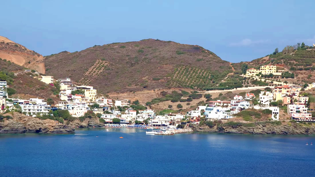 The Venetians called the place "Atali", from its ancient name which was "Astali", while its current name was given by the Ottomans. There is also the Atali Monastery nearby, which retains the medieval name of the place and is dedicated to Saint John. The monastery is built on a small elevated peninsula overlooking the bay and the Cretan sea. Image Library
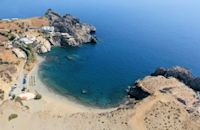 South Rethymnon at 30.5km (S) The beach of Agios Pavlos is about 60 km from Rethymno and can be easily reached through an asphalt road. In fact, Agios Pavlos is a small settlement on a beautiful, picturesque cove. Around and close to the beach there are some small hotels and taverns and right on the beach a beautiful cafe / bar. West of the small settlement at a place known as Alatsogremni (Cliffs of salt) are the famous dunes of Agios Pavlos. Although dunes are not rare in the south coast of Crete, those are very impressive. High dunes that end in crystal clear, turquoise waters. A landscape of unique natural beauty that is worth seeing. The scenery is even more imposing late in the afternoon, when the sun is setting and the sand gets a golden hue. It looks like an image coming from another world. Between the small beach at Agios Pavlos and the Dunes we find the area of Apoplystra with the unique rock formations. From the beach of Agios Pavlos climb a wooden staircase and you are in front of a unique spectacle. Rocks sculpted by salt water, in various shapes and wonderful colors. 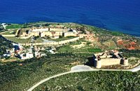 Aptera, Apokoronas, Hania at 30.7km (W) Those are two Turkish castles that are built in the 19th century using material from the nearby archaeological site of Aptera. The lower castle is that of Itzedin (also known as Kalami fort) named in honour of the son of the Sultan of the time, by the commander of Crete, Reouf Pasha was used in the past as a prison.
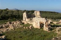 Aptera, Apokoronas, Hania at 31.1km (W) One of the most important city - states of Crete. The first epigraphic occurence of its name (A-pa-ta-wa) is found in the Linear B tablets found at Knossos. (14th - 13th century B.C.). The history of the city is continued through the centuries untill the 7th century A.D. when a major earthquake destoyed it. Its ideal location, allowed the city to control the naval activity in the bay of Souda, and was determinative for its development in an important commercial center. The era of the city's greatest peak was the early Hellenistic period (late 4th - 3rd century B.C.). At that time Aptera experienced an economical and political floruit, begins to mint its own coins and develops diplomatic relations with important centres of the Hellenistic world.
The most important monuments of the site are: Roman cisterns. Bipartite temple, known as the "bipartite sanctuary", dated to the 5th-4th century B.C. Graves of the Geometric-Roman periods. The fortification wall, preserved to a length of almost 4 kilometres. Part of a Roman bouleuterion. Byzantine buildings. Monastery of Agios Ioannis Theologos. Turkish fortress built in 1866-1869. Source: The Hellenic Ministry of Culture 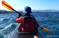 article by Stelios Asmargianakis at 31.4km (W) An article where Stelios Asmargianakis describes his experience of sea kayak, through a two-day trip to the north of Chania as it took place in mid February 2012. The whole journey is about 40 km, and is characterized by the absence of beaches for easy approaching and relaxing as well as exposure to the elements of the Cretan Sea.
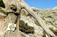 by Richard Ellis at 31.8km (SE) This is my log of the E4 long distance walk along the spine of Crete from East to West - it is intended to be a useful resource for others who are contemplating a similar walk along the E4 in Crete; it is not intended in any way to be a complete route guide.
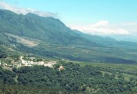 Sfakia, Hania, Crete at 31.9km (SW) At the exit of the ravine of Imbros, near the south coast of Sfakia. It is located at an altitude of 200 m, 68 km from the city of Hania and 4,5 km from Hora Sfakion. The area is covered with olive trees and the view to the Libyan sea and the island of Gavdos in the horizon...
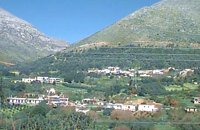 Mylopotamos, Rethymno at 32.2km (E) Apladianá (GR: Απλαδιανά) is a small village built at the foot of the two Kouloukona heights. The settlement stretches out along the old national road, where it developed after the opening of the new national road. It comprises cafes, tavernas, and accommodation facilities included in the Countryside Tourism programs. It is worth your while, however, to visit the old village, climbing there on foot or by car. Picturesque, narrow streets, wonderful old houses with interesting architectural elements, old cisterns and churches will reward your efforts. The old village built on a height of 260 m above sea-level has 175 inhabitants and the settlement along the old national road, known as "Kampos ton Apladianon", has 78 inhabitants. It is 40 kilometres away from Rethymnon and is located at the foot of the highest peak of the Kouloukona mountain in the Tallaios range. Historical background Already as far back as 1368 we find a mention of the Aplada family, the founders of the present village and in the topographical maps of the Civil Engineering Services of Rethymnon it figures as Pladiana. The settlement is not mentioned in the 16th and 17th cent. documents. In the 1881 census, Apladiana is attributed to the commune of Garazo, with 57 inhabitants and in 1900 it is referred to as the Apladiana Commune which, together with the Cheliana settlement, had 153 inhabitants.  Amari, Rethymnon at 33.8km (SE) The village of Apodoulou is located 55 km from Rethimno at an altitude of 450m. Remains of an extensive centre of the Old Palace period (1950-1700 B.C.) have been uncovered.at the site called Gournes, near the village of Apodoulou, at the west foot of Psiloreitis. The site dominates the Amari valley and controls the main route to the Messara plain. Excavations have brought to light three building complexes while tholos tombs of the Postpalatial period (1380-1200 B.C.) have also been located in the adjacent area. The first excavations on the site were carried out by S. Marinatos in the 1930's. During World War II it was excavated by the German Archaeological Institute, under the direction of E. Kirsten. Since 1985, systematic excavations have been carried out by the Greek Ministry of Culture in collaboration with the University of Naples. The most important monuments on the site are: Building A. It lies on the east side of the hill, to the south of the massive retaining wall. It had two storeys, as is indicated by the two preserved steps of a staircase. Decades of pithoi and other vases found on the ground floor suggest that it was used for storage. The house was destroyed by fire which followed an earthquake. Building B, located to the north of the retaining wall. It is a complex of rooms which originally communicated with Building A. Building C. It lies to the east of house A and belongs to a later phase of the settlement. Tholos tomb at Sopatakia. Tholos tomb with dromos, lying to the east of the road that leads from Apodoulou to Nithavris. The dromos is 7 m. long and the chamber has a diameter of 3.10 m. Three larnakes were found inside the burial chamber. Dated to 1380-1200 B.C. Source: The Hellenic Ministry of Culture 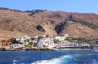 Sfakia at 34.6km (SW) Sfakia are centred around the White Mountains mountain range, Madares, as they are called in Crete with 110 peaks and the most and biggest gorges. Sfakia remain the most wild and unspoiled landscape in all Crete. Hora Sfakion, the seaside capital of the county, is a coastal village located on the Southwestern coast of Crete, 70 km from the city of Hania and 150 km from Iraklion. In its picturesque, enclosed harbor, the small boats from Agia Roumeli dock in the summer, bringing the hikers from the Samaria Gorge. Visitors can enjoy the quiet and calm of the village , on the seaside cafes and tavernas...
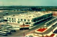 Akrotiri, Chania at 35.2km (NW) Chania International Airport, "Ioannis Daskalogiannis" (IATA: CHQ, ICAO: LGSA) is an international airport located 14km east from Hania, near Souda on the Akrotiri penisula. It is named after Ioannis Daskalogiannis, a Cretan revolutionary against Ottoman rule in the 18th century and is a joint civil - military airport (Souda Air Base). Access:By public bus and Taxi (~16 euros) Airport facilities: Police Station, Parking, Snack bar, ATM, Dutyfree, gift - souvenir shops, local nutrition products. Telephones:Information desk +30 28210 83800 - 83805 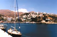 South Rethymnon at 35.9km (SE) A seaside town of the municipality of Agios Vassilios. It is a well organized tourist resort with comfortable hotels, apartments, camping sites, tourist agencies, car-renting offices, restaurants, tavernas and other recreation centres, as well as all the facilities required by tourists and locals alike. There is also a port and port - custom authorities.
Image Library
 Hania at 36.8km (NW) A guide to the area of Akrotiri. Tourist facilities, regional information and image gallery. Akrotiri with its scenic landscape provides a relaxing, refined country break away from the pressures of urban life. Its numerous monasteries, from the oldest in Crete, played a significant role in the history of the area. Gorges of outstanding beauty offer a unique hiking experience, breathtaking views and the joy of exploration...
Image Library
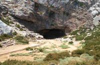 Psiloritis Mountain at 37.4km (SE) At 1538m above sea level, 20 km. south of the traditional town of Anogia , on the plateau of Nida, of Mountain Psiloritis, lies this sacred cave, where according to mythology, Rhea, Zeus' mother, hid the new born Zeus in this cave in order to protect him from his father Kronos (Saturn), who was in the habit of swallowing his children because he feared they might deprive him of his power. Hidden in that cave Zeus grew up being fed with the milk of the goat Amalthia, while the 'Kourites" covered the child's crying through banging their copper shields. Image Library
 Cretan hero born in Anopolis, Sfakia at 37.9km (SW) Daskalogiannis (GR: Δασκαλογιάννης) - born in Anopolis, Sfakia - started planning a revolutionary liberation movement in Crete in 1769 and completed the preparations for the revolution in Sfakia in the spring of 1770. In 1770, the revolution that had already broken out in other parts of Greece broke out in Crete too. Daskalogiannis, revolt was the first step towards freedom from the Turkish occupation in Crete and kept people, hopes from freedom alive. The international airport of Chania is named after this hero.
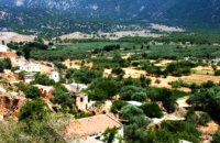 Sfakia, South Hania at 37.9km (SW) Anopolis is a small village, built on a small but fertile plateau, 12 km west from Sfakia at 600 m above sea level. There are still traces of the ruins of the ancient city that prospered around the 3rd century BC, who's port was Phoenix (Loutro). Ancient Anopolis was one of the thirty city - states that signed the peace decree with Eumenes B’ in 183 BC. and thus was able to mint its own coins. During both the Venetian and the Turkish occupations, Anopolis was a center for revolutionary activities. It is the birth place of the freedom fighter Ioannis Daskalogiannis who's statue stands at the center of the village.There are three more small settlements, Limnia, Vigle and Pavliana on the same plateau. The mountainous landscape is of outstanding wild beauty. In the village there are rooms for rent and a tavern.The village is worth visiting not only for its natural beauty but also for the opportunity to explore the White Mountains. One of the best hikes is to descent to the shore through the ravine of Aradena, a five hour walk through an imposing ravine that ends up to the wonderful beach of Marmara. 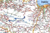 by Richard Ellis at 37.9km (SE) 15th June- The path up to the summit of Psiloritis is well-known and well-marked and does not need any further description from me. Fortunately for me, my pack was lighter by about 4 kg as I had handed over my camping equipment and extra food supplies to T who was going to catch the ferry back from Chania two days later and who could drop my gear at the flat en route. Distance:20.1 km Time: 8 hrs. Mov av 3.2 km/hr Height overnight: 427m. Max. height:2,454 m |
|||
|
| |||
C
O
N
T
E
N
T
S
O
N
T
E
N
T
S

