interkriti®
YOUR GATEWAY TO CRETE
|
Crete
: Regional Interest
List Grid Map
Found
94
- Showing :
61 - 80
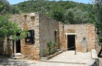 Fodele, Iraklion, Crete at 43.4km (E) The museum is located at a place called "Archontiko", around 1000m west from Fodele village and is housed in the house where according to tradition the great painter Doménikos Theotokópoulos (El Greco), was born. The exhibits are mainly photo - reproductions of his paintings and other documents related to the painter's life and work. The house was severely damaged by the passage of time. The restoration began in 1982 with a grant from the Ministry of Culture and the considerable help of the then Minister Melina Mercouri, in collaboration with the community of Fodele. It was reconstructed according to its original design. 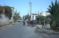 Chania at 43.5km (W) The village of Mournies is a principal village, located 3.8 km south of Hania at 40m a.s.l. It took the name "Mournies" from the numerous mulberry trees, that use to be here even today. At the beginning of the 17th century, Mournies was famous for its beautiful villas, belonging to local noblemen. One of them, located southeast of the village, was the imposing three storey villa of "Koukounara". It had beautiful flowery gardens, fountains, statues ..., a real paradise, where many famous persons were received hospitality, amongst them the glorious Mme Ortans, the empress Eugene of Napoleon the third, queen Olga of Greece, and the king Constantinos in 1913. The villa today, being restored, houses a department of the Geek Navy. Mournies was the birth place of one of the greatest statesman of the new Hellenic Republic, Eleftherios Venizelos. Venizelos' influence on the history of Greece was paramount, from his participation to the talks with the Ottomans that resulted to granting Crete independence in 1897, to the final union of Crete with Greece in 1913. The house of Venizelos located in Mournies is going to be a museum, and many personal items of the politician are going to be on display there.  Voriza, South - West Iraklion at 43.7km (SE) Close historical bonds link this monastery to that of Vrontisiou. The Varsamonerou Monastery lies in the surrounding fields of the village Voriza, 54.5 kms from Heraklion. The monastery is abandoned and, though its cells have been destroyed, its church has some of the most remarkable wall paintings in Crete.
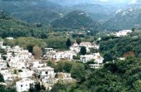 Malevizi, North - West Iraklion at 43.9km (E) A traditional village - birth place of Domenikos Theotokopoulos (EL GRECO) - with many pottery and weaving workshops. Close to the village is a small beach with taverns and a large hotel resort. Fodele is known also for its quality orange production.
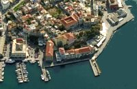 North West Crete at 44.2km (W) Hania (or Chania GR: Χανιά) is the capital of the Prefecture of the same name and the second biggest town in Crete, with a population of 60.000 inhabitants. It lies (Coordinates 35°31' N 24°1' E ) along the North coast of the island, about 55 km west of Rethymnon and 140 km west of Iraklion (Heraklion). Hania's old town (although it was heavily bombed by Germans in World War II) is considered as Crete's most beautiful urban district, especially the Venetian harbour with its 16th century lighthouse and the Mosque of the Janissaries ("Giali Tzamissi", built 17th century). Many of the old buildings have been restored as hotels, restaurants, shops and bars, making the old town a lively and colourful place, especially during the tourist period.
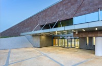 Hania at 44.2km (W) The museum is housed in the katholikon of the Venetian monastery of St. Francis. During the period of the Turkish occupation it was the Muslim mosque of Yussuf Pasha, while in modern times it was used as a cinema or a storehouse for military equipment. Since 1963 it has been functioning as the Archaeological Museum of the city. Apart from the permanent exhibition, the museum houses temporary exhibitions in the frame of certain local events 25 Chalidon Str., tel. +30821 90334 It contains impressive finds from the excavations of the ancient city of Kydonia, from Idramia, Aptera, Polyrinia, Kissamos, Elyros, Irtakina, Syia, Lissos, Chania, Axos, and Lappa. 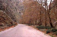 Kydonia,Chania at 44.3km (W) Within a few distance from the village of Perivolia, starts the gorgeous canyon of Therisso (Theriano faragi or Eleftherios Venizelos Gorge), which leads to the village of Therisso at 580m a.s.l. Six kilometers long, the gorge stretches like a snake, with high, almost vertical walls, and rich flora and fauna.It was a difficult to trespass gate, for the invaders, and that is the reason why Therisso was the center of the Cretan rebels during the 19th Century. The authorities has recently renamed the gorge, giving to it the name of the great Cretan statesman, Eleftherios Venizelos, who's name is strongly related with the area. 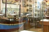 Hania, Venetian port at 44.5km (W) A two storey house, located at the old port of Hania, with a total area of 840 m2. The exhibition includes about 2,500 exhibits, such as models of ships, different kinds of naval instruments and devices, paintings, heirlooms, gleanings from the sea bottom, shells, photographs etc., which are divided in 13 units, covering chronologically all the periods. 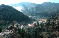 Chania at 44.5km (W) Thérisso (GR: Θέρισο) is a small village, built on the foot of the White mountains, at 580 m a.s.l, 20km south of the city of Hania. It has 156 inhabitants and it is famous for its physical beauty, its diary-farming and its glorious past. You can reach Therisso from Perivolia passing through the Canyon (good asphalt road), or from Drakona, crossing the 7km dirt road through the forest. From here starts the trekking path which leads to the highest peak of the White mountains, Pahnes (2452m) Due to its location Therisso played a significant role at the history of the island especially during the 19th Century. A mill's stone located at the entrance of the village reminds the death of a young woman (grinded alive), when she denied to surrender to Mustafa Pasha. Here were born the great Cretan revolutionaries (Hainis), Vassilis, Giannis and Stefanos Halis. Vassilis Halis, became a hainis very young, and participated to the most great battles against the Turks in Crete and Peloponnissos. He was lt General when he died at Nafplion (Peloponnissos) in 1846. But Therisso is mostly known for its relation with the Venizelos movement in March 1905. Venizelos, who dissented with prince George' policy and declared the Union of Crete with Greece, had his headquarters at Therisso. The house of Venizelos is today a museum. The visitor to Therisso will admire the natural beauty, learn a lot of the history of the place listening to various stories and looking at the historical monuments, and taste the local specialties at the lovely taverns of the village. 2,5 km north of Therisso, at the left bank of Kladissos river, there is a cave where signs of neolithic and Minoan habitation were discovered. It is believed that it was a worship place. 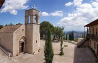 Zaros at 44.7km (SE) This is one of Crete's most famous monasteries. It played an important role during the years of the Cretan Renaissance, both in the letters and the arts, and, during the last centuries of Venetian rule, it was known for its many scholars, artists and venerable monks.
 Archaeological Site in Messara, S-W Iraklion at 45.1km (SE) The "Royal Villa" at Ayia Triada which is situated very close to Phaistos, was built in about 1550 BC. i.e. just before the new palace at Phaistos, and was destroyed by fire in l450 BC, like all other important Minoan centres. It succeeded the first palace at Phaistos as the economic and administrative centre of the regions depriving the new palace there of this role, and appears to have had connections with Knossos. The two wings, with an open-air space between them, consisted of groups of interconnecting rooms (polythyra), storerooms and stairways. On the site of the ruins, a Mycenaean megaron, the so-called "Agora" and an open - air shrine were subsequently built. In the villa's disaster layer from the fire in 1450 BC, excavation revealed a valuable group of exceptional works of art, precious materials, records in Minoan script and seals. The famous black serpentine vessels, the "Harvesters' Vase", the "Boxers' Vase" and the "Chieftain ‘ s Cup", the wall paintings depicting the natural landscape, the sarcophagus, the bronze and clay figurines of worshipers and the copper ingots from the Treasury are among the most noteworthy findings.  Malevizi, Iraklion at 45.4km (E) Dóxa (GR: Δόξα) is a pretty village built on a height of 400 metres above sea-level and 20 kilometres to the west of Heraklion on the road to the mountainous Milopotamos. The historical cave of Dóxa (GR: Δόξα) is located in a short distance from the village of Marathos on the road to Heraklion. It is at a height of 490 metres above sea-level, near a well-known taverna also called DOXA. The cave has a total length of 50 metres and impressive stalactites and stalagmites.  Voroi, Messara, Iraklion at 45.5km (SE) The exhibited objects in the Museum come from all over Crete. These objects show that the folk culture of Crete is characterized by an amalgam of influences in which Minoan (2000-1000 BC), Archaic (1000-500 BC) and Byzantine models prevail, especially in agriculture, stock breeding, pottery and basketry.
 Messara, Iraklion South at 45.7km (SE) Vori is a beautiful, traditional village of the county of Pirgiotissas in the Messara Valley. It is located 60 km south of Iraklion and in the western part of the Messara Valley. The village stretches in a slope, by the side of a small river. The archaeological site of Phaistos is 2 km to the south and the coast of Messara 4 km to the west.
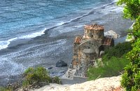 Sfakia, South Hania at 45.7km (W) Ágios Pávlos (GR: Άγιος Παύλος)is a beach on the shores of Sfakiá between Agia Rouméli and Loutró. The pine trees from the high cliffs above almost reach the sea and form a unique landscape. The beach is sandy with pebbles with no facilities except for a small tavern. It can be reached only on foot ( about 1 hour walk from Agia Roumeli) or by boat. The picturesque small church of Agios Pavlos (Saint Paul) a byzantine basilica of the 10th century A.D. with frescoes, lies just a few meters from the sea. It is built with stones from the beach itself on the spot where Saint Paul reportedly baptised people on his way to Rome.
Image Library
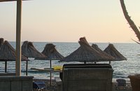 Messara bay, Iraklion South at 45.9km (SE) A small coastal village with a long sandy beach is becoming very popular with tourists due both its natural beauty and its proximity to Phaistos, Gortys and other important sites. There are quite few hotels, apartments etc and taverns, cafes by the beach.
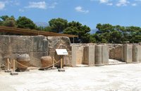 Palace and Archaeological Site at 47km (SE) The archaeological site, the palace, the findings - The Festos Disc. According to mythology, Phaistos (or Festos) was the seat of king Radamanthis, brother of king Minos. It was also the city that gave birth to the great wise man and soothsayer Epimenidis, one of the seven wise men of the ancient world.Excavations by archaeologists have unearthed ruins of the Neolithic times (3.000 B.C.).
Image Library
 Malevizi, North - West Iraklion at 47.1km (E) Ahláda (GR: Αχλάδα) is a small village located 24 kms west of Iraklion at an altitude of 300 meters a.s.l. It is close to the tourist resorts of Agia Pelagia and Ligaria, and it has approximately 500 inhabitants, most of them farmers and stock breeders. The name of the village meaning wild pear tree is given probably due to the huge wild pear tree that used to be at the village.  Messara, Iraklion South at 47.1km (SE) Kamilari is a quiet, traditional village, with a panoramic view to the endless olive groves of the Messara valley on the one side, and to the Libyan sea on the other side. It has been inhabited since the Minoan period. One of the seven wise men of the ancient world, Epimenidis, a great wise man and a soothsayer, lived in a small community outside Kamilari, called Metohi.
 Kenouriou, South Iraklion at 47.3km (SE) Zaros (Greek: Ζαρός), at an altitude of 340 metres, is a town with a lake and gorge nearby. It has a couple of hotels and it is 44 km from Heraklion at the southern foothills of Mountain Psiloritis. The population of 3,400, produce olive oil, sultanas, vegetables and spring water. There are a couple of fish farms that serve both trout and salmon. In Zaros, there are cafes near Lake Votomos, as well as a tavern that serves fresh trout called I Limni (The Lake). Close by is Rouvas Gorge, which is part of the Psiloritis mountain range and is on the hiking route known as the E4 European Walking Path. Nearby Zaros are traditional water mills which have been working since the 16th century, as well as archaeological sites and monasteries. Zaros is also famous for its water "ZAROS" bottled by a company called Votomos SA. |
||
|
| ||
C
O
N
T
E
N
T
S
O
N
T
E
N
T
S


