interkriti®
YOUR GATEWAY TO CRETE
|
Crete
List Grid Map
Found
90
- Showing :
81 - 90
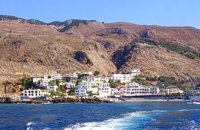 Sfakia at 42.4km (SE) Sfakia are centred around the White Mountains mountain range, Madares, as they are called in Crete with 110 peaks and the most and biggest gorges. Sfakia remain the most wild and unspoiled landscape in all Crete. Hora Sfakion, the seaside capital of the county, is a coastal village located on the Southwestern coast of Crete, 70 km from the city of Hania and 150 km from Iraklion. In its picturesque, enclosed harbor, the small boats from Agia Roumeli dock in the summer, bringing the hikers from the Samaria Gorge. Visitors can enjoy the quiet and calm of the village , on the seaside cafes and tavernas...
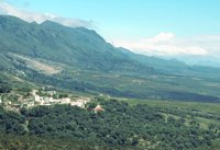 Sfakia, Hania, Crete at 43.5km (SE) At the exit of the ravine of Imbros, near the south coast of Sfakia. It is located at an altitude of 200 m, 68 km from the city of Hania and 4,5 km from Hora Sfakion. The area is covered with olive trees and the view to the Libyan sea and the island of Gavdos in the horizon...
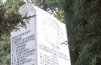 Sfakia, South Hania at 45.7km (SE) Kalikratis is a small mountainous village at the foot of the White Mountains (Lefka Ori) at an altitude of 750m above sea level. It is a traditional village with many well preserved stone houses. A German army of two thousand soldiers, invaded the village during the October of 1943 , burned it down and executed twenty men and nine women who did not manage to leave on time. A little to the south of the village starts the gorge of the same name which is part of the European hiking footpath (E4) and after some 4km walking ends at the village of Patsianos.  Rethymnon North at 46.6km (SE) Episkopi is a small town of the prefecture and county of Rethymno. It is located at the old national road of Rethymno - Hania, 17 km away from the city of Rethymno. The town is built at 120 m a.s.l. overlooking the northern coast of Crete, and the green and fertile valley of Mousselas river.
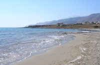 Frangokastello at 48km (SE) Vatalos is the long beach to the west of the main beach of Frangokastello. It is a stretch of fine sand interrupted by pebbles and rocks that create small coves. There are no umbrellas and sun beds available for rent and the only shadow can be found under the little tamarisks. It is by far less crowded than the main beach. It is frequented mostly by the guests of the hotels that stand above the beach as it is peaceful, and, quite safe for the kids.
Image Library
 Rethymnon at 48.5km (SE) It is built at 500m a.s.l. and 37km away from the city of Rethymno, with 400 inhabitants most of them farmers and stock breeders. It took its name due to its position, "MYRIOKEFALA" means myriads of heads (here :Hills). It is the birth place of George Maravelakis, a great fighter of the 1866 revolution against the turks. The monastery of Miriokefala, an interesting sight, devoted to the Holly Mother, was established by Ai Kir Giannis (a Cretan Saint) in the 11th century. There are many icons of Byzantine art, among them this of Holly Mother.
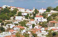 Rethymnon North at 49km (SE) A beautiful small town in the county of Rethymno with great views, natural water springs and lush vegetation. It's located at 260m a.s.l. between the rivers "Mousselas" and "Petres", 22km from the national road and 5km from Episkopi. Argiroupolis is the site of the ancient city of Lapa.
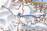 by Richard Ellis at 49km (SE) 28th August - Because we had researched this bit in May, it wasn't so daunting to leave the tarmac-bound E4 and to launch off uphill to make the old crossing (not yet on any map) between here and Askyfou. The first gully climb up to 3,300 ft was quite straight forward as we had done it before. Distance: 22.4 km Time: 8 hrs. 35mins. Mov av 3.7 km/hr Height overnight: 714m. 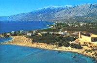 Sfakia, South Hania at 49.5km (SE) On the south coast of Crete, on a magnificent white sandy beach, stands one of the most beautiful Venetian fortresses, Fragokastello, built in 1371. It is located approximately 170 km from Iraklion, 70 km from Rethimnon, and 70 Km from Hania. Today, Fragokastello is a small, but developing, community, with nice beaches covered in sand dunes, and limited, but increasing, tourist facilities.The Villages Patsianos and Kalikratis, the castle, the history of the place and the fenomenon of Drossoulites...
 Rethymnon at 50km (SE) Zouridi is a village of the county of Rethymno, located 19,5 km away from the city, built at 260m a.s.l. with 90 inhabitants. Here excavations unearthed findings from the post palace period, and the Roman period as well as many venetian houses. Nowadays the village is characterized as a preservable settlement, and buildings such as the old high school are going to be restored.
|
||
|
| ||
C
O
N
T
E
N
T
S
O
N
T
E
N
T
S


