interkriti®
YOUR GATEWAY TO CRETE
|
Crete
List Grid Map
Found
171
- Showing :
81 - 100
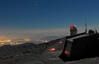 Idi mountain at 37.7km (SE) Located at the top (1750m) of Skinakas mountain of Idi (Ida) mounatin range, 60km from Heraklion. There are two telescopes and modern equipment and facilities both for research and educational activities in astronomy. It is a department of the University of Crete. Skinakas observatory offers a number of open days each year. This gives the opportunity to visitors to be introduced to the operation of the observatory, to get informed about the latest achievements in Astrophysics and to observe through the telescope. Open days for the year 2012: August 26 September 23 During the open days the Observatory facilities can be visited from 17:00 to 23:00. Due to low temperatures at the Skinakas altitude, warm clothes are highly recommended. The visitors will have the opportunity to be guided through the Observatory's infrastructure and follow a related presentation. The road to Skinakas Observatory is very narrow. Accident may occur and the space is limited on the top. For the reasons above, buses are not allowed (advised) to visit the Observatory during open days. Website : http://skinakas.physics.uoc.gr/  Painter born in Fodele, Iraklion at 38.2km (E) Great painter famous as "EL GRECO"(Fodele Iraklion Crete 1541 - Toledo Spain 1614) El Greco's art is the product of both his time and his genius. The artistic currents and the places he visited, are reflected in his work. It is more difficult to outline precisely the influence of the Cretan School in his work. Birth name: Doménikos Theotokópoulos (GR: Δομήνικος Θεοτοκόπουλος) Born :1541 Crete, then Republic of Venice Died :April 7, 1614 Toledo, Spain Field :Painting, sculpture and architecture Movement :Mannerism, Antinaturalism Famous works :El Espolio (1577–1579), The Assumption of the Virgin (1577–1579), The Burial of the Count of Orgaz (1586–1588), View of Toledo (1596–1600), Opening of the Fifth Seal (1608–1614). 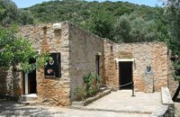 Fodele, Iraklion, Crete at 38.2km (E) The museum is located at a place called "Archontiko", around 1000m west from Fodele village and is housed in the house where according to tradition the great painter Doménikos Theotokópoulos (El Greco), was born. The exhibits are mainly photo - reproductions of his paintings and other documents related to the painter's life and work. The house was severely damaged by the passage of time. The restoration began in 1982 with a grant from the Ministry of Culture and the considerable help of the then Minister Melina Mercouri, in collaboration with the community of Fodele. It was reconstructed according to its original design. 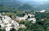 Malevizi, North - West Iraklion at 38.7km (E) A traditional village - birth place of Domenikos Theotokopoulos (EL GRECO) - with many pottery and weaving workshops. Close to the village is a small beach with taverns and a large hotel resort. Fodele is known also for its quality orange production.
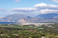 Messara, Iraklion South at 39.6km (SE) The town of Timpaki (GR: Τυμπάκι) is located in the west edge of the plain of Messara, 65.3km away from the city of Iraklion. It is a rich and busy town with significant economic activity especially due to the early vegetables production in the wider area. There are banks, a post office, medical centers, stores, schools, hotels, restaurants, ect to cover both the needs of the locals and visitors.
 Voriza, South - West Iraklion at 39.6km (SE) Close historical bonds link this monastery to that of Vrontisiou. The Varsamonerou Monastery lies in the surrounding fields of the village Voriza, 54.5 kms from Heraklion. The monastery is abandoned and, though its cells have been destroyed, its church has some of the most remarkable wall paintings in Crete.
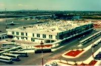 Akrotiri, Chania at 40.1km (NW) Chania International Airport, "Ioannis Daskalogiannis" (IATA: CHQ, ICAO: LGSA) is an international airport located 14km east from Hania, near Souda on the Akrotiri penisula. It is named after Ioannis Daskalogiannis, a Cretan revolutionary against Ottoman rule in the 18th century and is a joint civil - military airport (Souda Air Base). Access:By public bus and Taxi (~16 euros) Airport facilities: Police Station, Parking, Snack bar, ATM, Dutyfree, gift - souvenir shops, local nutrition products. Telephones:Information desk +30 28210 83800 - 83805 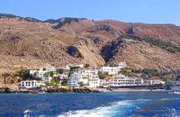 Sfakia at 40.2km (SW) Sfakia are centred around the White Mountains mountain range, Madares, as they are called in Crete with 110 peaks and the most and biggest gorges. Sfakia remain the most wild and unspoiled landscape in all Crete. Hora Sfakion, the seaside capital of the county, is a coastal village located on the Southwestern coast of Crete, 70 km from the city of Hania and 150 km from Iraklion. In its picturesque, enclosed harbor, the small boats from Agia Roumeli dock in the summer, bringing the hikers from the Samaria Gorge. Visitors can enjoy the quiet and calm of the village , on the seaside cafes and tavernas...
 Malevizi, Iraklion at 40.2km (E) Dóxa (GR: Δόξα) is a pretty village built on a height of 400 metres above sea-level and 20 kilometres to the west of Heraklion on the road to the mountainous Milopotamos. The historical cave of Dóxa (GR: Δόξα) is located in a short distance from the village of Marathos on the road to Heraklion. It is at a height of 490 metres above sea-level, near a well-known taverna also called DOXA. The cave has a total length of 50 metres and impressive stalactites and stalagmites. 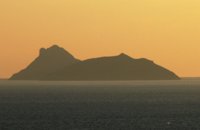 Messara Bay, Iraklion at 40.5km (S) Two small dry and uninhabited islets off the bay of Messara, ~7.5 naut. miles to the west of Matala. Due to their close proximity to one another the two islands appear as one from a distance. They are also called "elephantaki" as from north they look like a baby elephant that is lying down. In mythology it is believed that the goddess Lito gave birth to the god Apollon and the goddess Artemis on these islands. In antiquity they were called Dionissioi after the god Dionissos. During the summertime there are small cruising boats that bring tourists here from Agia Galini and Kokkinos Pyrgos. There is only a small beach with fine pebble and rich seabed at the south side of the easternmost islet. 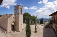 Zaros at 40.6km (SE) This is one of Crete's most famous monasteries. It played an important role during the years of the Cretan Renaissance, both in the letters and the arts, and, during the last centuries of Venetian rule, it was known for its many scholars, artists and venerable monks.
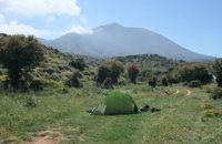 by Richard Ellis at 41.6km (SE) 11th, 12th and 13th June- We had made camp in the yard beside the Aghios Ioannis chapel at Rouvas but, the following morning, it was quite clear that I wasn’t going to go any further on foot until the shin splint had settled down a bit. Minor surgery on the blisters exposed the full extent of those problems and I hung them out to dry in the sun while Triantafyllos went off looking for paths to put on his maps. I think I was lucky not to get infected blisters but Betadine is a great resource which I used extensively.
 Hania at 41.7km (NW) A guide to the area of Akrotiri. Tourist facilities, regional information and image gallery. Akrotiri with its scenic landscape provides a relaxing, refined country break away from the pressures of urban life. Its numerous monasteries, from the oldest in Crete, played a significant role in the history of the area. Gorges of outstanding beauty offer a unique hiking experience, breathtaking views and the joy of exploration...
Image Library
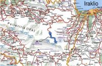 by Richard Ellis at 41.7km (SE) 14th June- The walk up from Rouvas is quite straightforward; once you have walked back down the stream from the Rouvas picnic area and turned right (north) up the dry river bed for two hundred yards, you scramble up a short, easy rock section (well sign posted) before the path continues up through open oak woodland (the Rouvas Forest) heading first for the Duo Prinoi chapel, which has a water tap, and then later up and over a ridge, beyond which a small dry water course leads up a steep sided valley to the flat lands of the Nidha plateau. Distance:12 km Time: 4.75 hrs. Mov av 3.7 km/hr Height overnight: 1,360m. 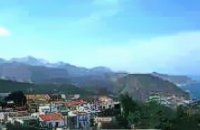 Malevizi, North - West Iraklion at 41.9km (E) Ahláda (GR: Αχλάδα) is a small village located 24 kms west of Iraklion at an altitude of 300 meters a.s.l. It is close to the tourist resorts of Agia Pelagia and Ligaria, and it has approximately 500 inhabitants, most of them farmers and stock breeders. The name of the village meaning wild pear tree is given probably due to the huge wild pear tree that used to be at the village.  Archaeological Site in Messara, S-W Iraklion at 42km (SE) The "Royal Villa" at Ayia Triada which is situated very close to Phaistos, was built in about 1550 BC. i.e. just before the new palace at Phaistos, and was destroyed by fire in l450 BC, like all other important Minoan centres. It succeeded the first palace at Phaistos as the economic and administrative centre of the regions depriving the new palace there of this role, and appears to have had connections with Knossos. The two wings, with an open-air space between them, consisted of groups of interconnecting rooms (polythyra), storerooms and stairways. On the site of the ruins, a Mycenaean megaron, the so-called "Agora" and an open - air shrine were subsequently built. In the villa's disaster layer from the fire in 1450 BC, excavation revealed a valuable group of exceptional works of art, precious materials, records in Minoan script and seals. The famous black serpentine vessels, the "Harvesters' Vase", the "Boxers' Vase" and the "Chieftain ‘ s Cup", the wall paintings depicting the natural landscape, the sarcophagus, the bronze and clay figurines of worshipers and the copper ingots from the Treasury are among the most noteworthy findings.  Voroi, Messara, Iraklion at 42.2km (SE) The exhibited objects in the Museum come from all over Crete. These objects show that the folk culture of Crete is characterized by an amalgam of influences in which Minoan (2000-1000 BC), Archaic (1000-500 BC) and Byzantine models prevail, especially in agriculture, stock breeding, pottery and basketry.
 Messara, Iraklion South at 42.4km (SE) Vori is a beautiful, traditional village of the county of Pirgiotissas in the Messara Valley. It is located 60 km south of Iraklion and in the western part of the Messara Valley. The village stretches in a slope, by the side of a small river. The archaeological site of Phaistos is 2 km to the south and the coast of Messara 4 km to the west.
 Kenouriou, South Iraklion at 43.1km (SE) Zaros (Greek: Ζαρός), at an altitude of 340 metres, is a town with a lake and gorge nearby. It has a couple of hotels and it is 44 km from Heraklion at the southern foothills of Mountain Psiloritis. The population of 3,400, produce olive oil, sultanas, vegetables and spring water. There are a couple of fish farms that serve both trout and salmon. In Zaros, there are cafes near Lake Votomos, as well as a tavern that serves fresh trout called I Limni (The Lake). Close by is Rouvas Gorge, which is part of the Psiloritis mountain range and is on the hiking route known as the E4 European Walking Path. Nearby Zaros are traditional water mills which have been working since the 16th century, as well as archaeological sites and monasteries. Zaros is also famous for its water "ZAROS" bottled by a company called Votomos SA. 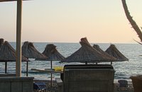 Messara bay, Iraklion South at 43.2km (SE) A small coastal village with a long sandy beach is becoming very popular with tourists due both its natural beauty and its proximity to Phaistos, Gortys and other important sites. There are quite few hotels, apartments etc and taverns, cafes by the beach.
|
||
|
| ||
C
O
N
T
E
N
T
S
O
N
T
E
N
T
S


