interkriti®
YOUR GATEWAY TO CRETE
|
Crete
List Grid Map
Found
250
- Showing :
101 - 120
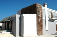 Myrtia. Iraklion at 16.3km (E) The Nikos Kazantzakis Museum is dedicated to the great Greek writer, poet and philosopher Nikos Kazantzakis. It was founded in 1983 and it is located at the village Myrtia in Iraklion, next to his father's house. The museum contains some of his personal belongings (pipes, glasses, pens, etc.) and a rich collection of his manuscripts and letters, first Greek editions of his books, documents from theatrical productions of his works, copies of TV series and movies based on his novels, portraits of Nikos Kazantzakis, copies of press releases and articles on his life and work. 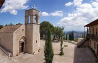 Zaros at 16.7km (SW) This is one of Crete's most famous monasteries. It played an important role during the years of the Cretan Renaissance, both in the letters and the arts, and, during the last centuries of Venetian rule, it was known for its many scholars, artists and venerable monks.
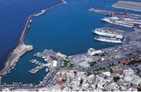 Iraklion at 16.7km (NE) The Port of Heraklion is the main and most modern gateway for the transport of passengers and commodities on the island of Crete. There are three main companies that connect Iraklion to mainland Greece, Minoan Lines, Superfast Ferries and ANEK. During the winter months there are daily trips from Athens to Iraklion. The trip takes approximately 6 - 9 hours by ferry boat. The ships depart Athens in the evening (10.30 p.m.) and arrive in Iraklion at 5:00 - 6:00 a.m. There is also a weekly trip to Thessaloniki. During the summer season all companies operate also an extra daily trip that departs in the morning from Athens and arrives at Iraklion port in the afternoon. Finally various other companies operate ships connecting Iraklion with other island in the Aegean (Rodos, Santorini etc.). Daily cruises are also offered to the island of Santorini. Image Library
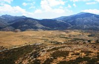 Psiloritis Mountain at 17.2km (W) The plateau is located in the center of the Ida mountain range at an altitude of 1400 m. It can be accessed from various sides but the only asphalt road is from the town of Anogeia. It has a roughly triangular shape and is almost flat. Visitors can enjoy the wild landscape, take a walk to the entrance of Idaion cave or to the freedom fighter sculpture, made with boulders from the mountain. An other interesting attraction is the various Mitata scattered all over the area. Those are circular domed buildings made with stones and used by shepherds for accommodation and storage of cheese. There is also a tavern with traditional food. The area of Nida, in earlier times, before the systematic farming and logging damage the flora of Psiloritis, was covered by forests in which mythological and traditional tales put different events. Here Dimitra fell in love with the mortal Iasion. http://www.anogialand.gr 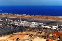 Iraklion ( Nea Alikarnassos) at 17.4km (NE) Heraklion International Airport, "Nikos Kazantzakis" (Greek: Κρατικός Αερολιμένας Ηρακλείου, "Νίκος Καζαντζάκης") or Nikos Kazantzakis International Airport (IATA: HER, ICAO: LGIR) is the primary airport on the island of Crete, Greece. It is located about 5km from the main city of Heraklion. Heraklion International Airport is is one of the biggest in Greece and receives approximately 15% of the total tourist traffic of Greece. There are many airlines currently operating flights from Athens and Thessaloniki to Iraklion (Olympic Airways, Aegean Airlines and others), while during the high season there are flights from/to Rhodes, Mykonos, Santorini and other Greek islands. There are also international airlines that connects Iraklion to other European cities. During the summer season there are numerous chartered flights to Iraklion from all over Europe (mainly Germany, the United Kingdom, Russia, and Holland). During the summer months there is a huge increase in air traffic that peaks in August (approximately 130 flights per day). Major car-rental companies have desks at the airport. Taxi and public bus are available for transfer from/to Iraklion. 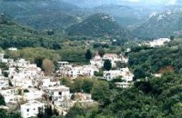 Malevizi, North - West Iraklion at 17.8km (N) A traditional village - birth place of Domenikos Theotokopoulos (EL GRECO) - with many pottery and weaving workshops. Close to the village is a small beach with taverns and a large hotel resort. Fodele is known also for its quality orange production.
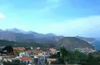 Malevizi, North - West Iraklion at 18.2km (N) Ahláda (GR: Αχλάδα) is a small village located 24 kms west of Iraklion at an altitude of 300 meters a.s.l. It is close to the tourist resorts of Agia Pelagia and Ligaria, and it has approximately 500 inhabitants, most of them farmers and stock breeders. The name of the village meaning wild pear tree is given probably due to the huge wild pear tree that used to be at the village.  Voriza, South - West Iraklion at 18.2km (SW) Close historical bonds link this monastery to that of Vrontisiou. The Varsamonerou Monastery lies in the surrounding fields of the village Voriza, 54.5 kms from Heraklion. The monastery is abandoned and, though its cells have been destroyed, its church has some of the most remarkable wall paintings in Crete.
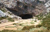 Psiloritis Mountain at 18.3km (W) At 1538m above sea level, 20 km. south of the traditional town of Anogia , on the plateau of Nida, of Mountain Psiloritis, lies this sacred cave, where according to mythology, Rhea, Zeus' mother, hid the new born Zeus in this cave in order to protect him from his father Kronos (Saturn), who was in the habit of swallowing his children because he feared they might deprive him of his power. Hidden in that cave Zeus grew up being fed with the milk of the goat Amalthia, while the 'Kourites" covered the child's crying through banging their copper shields. Image Library
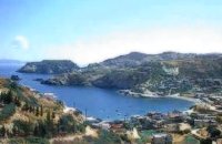 Agia Pelagia, Maleviziou, Iraklion N-W at 18.3km (N) Lygaria (also Ligaria GR: Λυγαριά) is a small seaside resort 2 kms to the east of Agia Pelagia. It is built in a small cove with a lovely sandy beach protected from the summer winds (Meltemi). Lygaria started as a residential area comprising of summer houses built mainly by residents of Heraklion but soon it has developed to a tourist resort. It has a couple of small taverns, hotels and cafes by the beach and it is very popular with tourists and locals alike. There is regular public bus transport from Heraklion. The distance from Heraklion is 19 kilometers via the national road.
Image Library
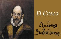 Painter born in Fodele, Iraklion at 18.3km (NW) Great painter famous as "EL GRECO"(Fodele Iraklion Crete 1541 - Toledo Spain 1614) El Greco's art is the product of both his time and his genius. The artistic currents and the places he visited, are reflected in his work. It is more difficult to outline precisely the influence of the Cretan School in his work. Birth name: Doménikos Theotokópoulos (GR: Δομήνικος Θεοτοκόπουλος) Born :1541 Crete, then Republic of Venice Died :April 7, 1614 Toledo, Spain Field :Painting, sculpture and architecture Movement :Mannerism, Antinaturalism Famous works :El Espolio (1577–1579), The Assumption of the Virgin (1577–1579), The Burial of the Count of Orgaz (1586–1588), View of Toledo (1596–1600), Opening of the Fifth Seal (1608–1614). 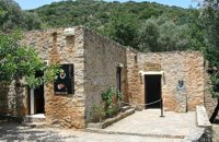 Fodele, Iraklion, Crete at 18.3km (NW) The museum is located at a place called "Archontiko", around 1000m west from Fodele village and is housed in the house where according to tradition the great painter Doménikos Theotokópoulos (El Greco), was born. The exhibits are mainly photo - reproductions of his paintings and other documents related to the painter's life and work. The house was severely damaged by the passage of time. The restoration began in 1982 with a grant from the Ministry of Culture and the considerable help of the then Minister Melina Mercouri, in collaboration with the community of Fodele. It was reconstructed according to its original design. 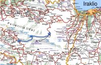 by Richard Ellis at 18.3km (W) 15th June- The path up to the summit of Psiloritis is well-known and well-marked and does not need any further description from me. Fortunately for me, my pack was lighter by about 4 kg as I had handed over my camping equipment and extra food supplies to T who was going to catch the ferry back from Chania two days later and who could drop my gear at the flat en route. Distance:20.1 km Time: 8 hrs. Mov av 3.2 km/hr Height overnight: 427m. Max. height:2,454 m  Iraklion at 18.8km (NE) This 2 km long sandy beach was for years and still is the favorite beach of the people of Heraklion town. It is named after the river "Karteros" which outflows at the west end of it near the airport. The water is clean, the seabed is sandy with smoothly shelving and swimming is safe. The access is free in most parts except for some areas that are reserved for military personnel and the municipal beach "Akti" where visitors should pay an entrance fee in order to use the facilities. At the east end there are some very good taverns offering fresh fish among their specialties and are very popular with locals and tourists alike.
Image Library
 Malevizi, North - West Iraklion at 19.2km (N) Agia Pelagia lies 20km west of Iraklion. The bay of Agia Pelagia is ideal for combining sea sports with relaxation. The visitor will find well trained instructors that offer lessons for sea sports such as water-ski, wind surf, canoe. Agia Pelagia offers unique high standard hotel facilities as well as many small hotels and pensions.
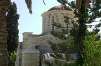 Iraklion at 19.9km (E) The monastery of Agaráthou (GR: Μονή Αγκαράθου), dedicated to the Virgin, stands at an altitude of 538m, on "Soros Panteli", a rocky hill between the villages of Sgourokefali and Sabas, 23 km from Heraklion. During the period of Venetian rule it was a centre of learning, producing many famous churchmen including the Patriarchs Cyril Lucaris, Meletius Pegas and Sylvester the Cretan. The church was rebuilt in 1894 and flourished once more after the end of the Turkish occupation. Young, educated monks with university degrees have recently settled in the monastery, restoring it to its former glory.  Gortyn archaeological site at 20.2km (S) The main acropolis of Gortyna was located on Agios Ioannis hill, to the northwest of the Agora. Acropolis can be accessed from its west side driving through Ambelouzos village to the direction of Gergeri. At a spot around 1.6 kms from Gortyna parking there is a footpath (not clearly signposted and maintained) that leads to the top of the hill. Once at the top you'll be rewarded by the magnificent view to the whole area and the archaeological site itself. The site was first inhabited in the Neolithic era and again at the end of Minoan times (1200 BC). Since then it was continuously inhabited until the Middle Byzantine period. From the first settlement only parts of walls, floors and hearths were preserved. In the 10th century BC a Geometric settlement was established fortified by a polygonal wall with towers at the corners. At the end of the 7th c. A.D., a small tripartite temple, dedicated to Athena Poliouchos was founded at the south side of the hill. From this temple some very important architectural sculptures were excavated. During the Early Byzantine period (5 - 6th century AD), a basilica was erected over the ruins of the geometric/archaic temple and, in the time of the emperor Heraclios (7th century A.D.) the last fortification with a castle in the center was built which still survives but in a very poor condition. Image Library
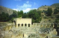 Gortyn archaeological site at 20.3km (S) The Roman Odeum at Gortyn is considered one of the best and the most important of its type on Crete. Is has been founded at the North part of the Ancient Agora of the City. This semicircular building consists of three main parts: a. The Cavea, connected with a domed corridor through three wide staircases; b. the Orchestra, which has an internal diameter 8,5 m. and was paved with white and blue marble slabs; c. The Scene, which had two entrances and the paraskenion, with mosaic pavement in geometric pattern. Statues of Muses stood in the niches. Initially the building was a circular Ekklesiasterion founded in the 5th c. BC. In the portico of this public building the Great Inscription with the Law Code of Gortyn dated to the early 5th c., stood. It was destroyed twice: in the 1st century BC, and again in 46 AD. After this last destruction it was reconstructed as an Odeum. The great Inscription is considered to be the largest Greek inscription, the Queen of all Inscriptions. Its first fragments were found by the French travelers and were bought by the Louvre Museum. The most part of the Inscription was found accidentally by local farmers in 1884 and was further explored F. Halbherr. It is a Law Code inscribed in the boustrophedon system of writing. It dates in the 1st half of the 5th c. BC and is the oldest Greek and European Law Code. It consists of twelve Deltoi and was built in the Ekklesiasterion of the 5th c BC. In this Code older laws, regarding the personal and family rights of the citizens of Gortyn, were codified. Image Library
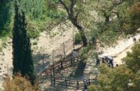 Gortyn archaeological site at 20.3km (S) According to the myth, Zeus, disguised as a bull, coupled with Europe, whom he had brought from Phoenicia, under a deep- shaded plane tree on the banks of the Lethaios River. The offspring of this union were three sons, Minos, Sarpidon and Radamanthis. Later, the oldest Agora of the city of Gortyn, the Ekklesisterion (Congress hall), and the Roman Odeum were founded on this site. The plane tree was blessed and has remained ever green since that time. As his place of birth, the city was founded by King Minos himelf. According to the myth, it was on the fields of Gortyn that the bull given as a gift to Minos by Poseidon coupled with the Queen Pasiphae and out of this union Minotaur was born. Image Library
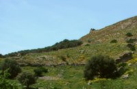 Gortyn archaeological site at 20.3km (S) The oldest theater of Gortyna was on the south slope of the Profitis Ilias hill (Acropolis), opposite to the Odeum. Its cavea was partly cut into the rock and partly built. Its scene was built at the west side of the large court of the Agora, which covered the river Lethaios with a flat bridge. This scene, which H. Belli saw in the 16th c AD, was 120 m long and was already destroyed in 19th c. AD. On the proscenium there was an inscription of Julia Augusta and it was decorated with statues and relies, among which there was the statue of Europe on the Bull, with broken legs and head.This statue, as described by Admiral Spratt, is now kept in the British Museum and is dated to the 2nd c BC. |
||
|
| ||
C
O
N
T
E
N
T
S
O
N
T
E
N
T
S


