interkriti®
YOUR GATEWAY TO CRETE
HOME
CRETE FACTS
NAVIGATE
EXPLORE

Agia Galini
Triopetra
Kissamos
Chryssi Isl.
Agia Marina
Balos
Gavdos isl.
Georgioupolis
SAMARIA
IDA Mtn
Palaiochora
Agia Roumeli
Sfakaki
Bali
Kalamaki
Matala
Lassithi
Plateau Lendas
Tsoutsouros
Vianos
Myrtos
Sfakia
Plakias
Ierapetra
Makrygialos
ZAKROS
Vai
Sitia
Agios Nikolaos
Elounda
MALIA
Hersonissos
Gouves
Chania
Rethymnon
Heraklion
GORTYN
FESTOS
KNOSSOS
|
|
Crete
List Grid Map
Found
64
- Showing :
41 - 60
 Rethymnon North at 19.5km (W) A beautiful small town in the county of Rethymno with great views, natural water springs and lush vegetation. It's located at 260m a.s.l. between the rivers "Mousselas" and "Petres", 22km from the national road and 5km from Episkopi. Argiroupolis is the site of the ancient city of Lapa.
 Amari, Rethymnon at 19.6km (E) The village of Apodoulou is located 55 km from Rethimno at an altitude of 450m. Remains of an extensive centre of the Old Palace period (1950-1700 B.C.) have been uncovered.at the site called Gournes, near the village of Apodoulou, at the west foot of Psiloreitis. The site dominates the Amari valley and controls the main route to the Messara plain. Excavations have brought to light three building complexes while tholos tombs of the Postpalatial period (1380-1200 B.C.) have also been located in the adjacent area. The first excavations on the site were carried out by S. Marinatos in the 1930's. During World War II it was excavated by the German Archaeological Institute, under the direction of E. Kirsten. Since 1985, systematic excavations have been carried out by the Greek Ministry of Culture in collaboration with the University of Naples. The most important monuments on the site are: Building A. It lies on the east side of the hill, to the south of the massive retaining wall. It had two storeys, as is indicated by the two preserved steps of a staircase. Decades of pithoi and other vases found on the ground floor suggest that it was used for storage. The house was destroyed by fire which followed an earthquake. Building B, located to the north of the retaining wall. It is a complex of rooms which originally communicated with Building A. Building C. It lies to the east of house A and belongs to a later phase of the settlement. Tholos tomb at Sopatakia. Tholos tomb with dromos, lying to the east of the road that leads from Apodoulou to Nithavris. The dromos is 7 m. long and the chamber has a diameter of 3.10 m. Three larnakes were found inside the burial chamber. Dated to 1380-1200 B.C. Source: The Hellenic Ministry of Culture  Rodakino, South Rethymno at 20.1km (W) At the end of the canyon that traverses the area of Rodakino lies the beach of Korakas at the bay of the same name. It is a nice, wide and 400m long beach, with clear waters and small grayish sand and pebbles. There are a few accommodation options in family run apartment complexes and a few taverns on the beach front. Umbrellas and sun beds are also available at the eastern part. The headland to the east separate Korakas Beach from another lovely beach named "Klimata". At the east side of that headland there is a small fishing harbour and along its coast there are sharp rocks in the shape of a crow's beak (Kórakas GR: Κόρακας, means crow) thus giving the name to the bay. Image Library
 Rethymno south at 20.2km (W) Two small villages, Epano & Kato (Upper & Lower) Rodakino halfway from Plakias to Frangokastelo, overlooking the bay of Korakas. Rodakino is 42 kms from Rethimnon, 27 kms from Hora Sfakion and 13 kms from Fragokastello. Rodakino is surrounded by small beaches some of them accessible only by foot, were visitors can isolate themselves from any trace of civilization. There are some small hotels and rooms to rent available and a couple of tavernas. The road to Rodakino is asphalt paved and there is a bus service to Rodakino from Rethimnon twice a day. In the village the visitor can find a taxi station, and a gasoline station. A doctor is available for medical emergencies on the village of Plakias approximately 15 kms from Rodakino. Rodakino played its own part during the eons, in the fighting of the Cretans against all the invaders. The village was totally destroyed during the Venetian occupation, with only one resident escaping to Peloponnese in Greece . Years after the destruction he returned to the site of the village, and he rebuilt it. In Kourkoylo one of the quarters of the village the first rising of the flag of the revolution against the Turks was raised on May 24th 1821. During the second World War the kidnapped German general Craipe was sent away from the bay of Korakas to the Middle East. Image Library
 Rethymnon at 21.3km (W) It is built at 500m a.s.l. and 37km away from the city of Rethymno, with 400 inhabitants most of them farmers and stock breeders. It took its name due to its position, "MYRIOKEFALA" means myriads of heads (here :Hills). It is the birth place of George Maravelakis, a great fighter of the 1866 revolution against the turks. The monastery of Miriokefala, an interesting sight, devoted to the Holly Mother, was established by Ai Kir Giannis (a Cretan Saint) in the 11th century. There are many icons of Byzantine art, among them this of Holly Mother.
 by Richard Ellis at 21.5km (E) This is my log of the E4 long distance walk along the spine of Crete from East to West - it is intended to be a useful resource for others who are contemplating a similar walk along the E4 in Crete; it is not intended in any way to be a complete route guide.
 Rethymnon North at 21.8km (NW) Episkopi is a small town of the prefecture and county of Rethymno. It is located at the old national road of Rethymno - Hania, 17 km away from the city of Rethymno. The town is built at 120 m a.s.l. overlooking the northern coast of Crete, and the green and fertile valley of Mousselas river.
 Messara bay, Iraklion South at 23.7km (SE) Kokkinos Pirgos (GR: Κόκκινος Πύργος) is a small coastal community, 2km away from Timbaki with a nice, long sandy beach, one of the longest in Crete, and a clear transparent sea. The part of the beach to the north west of the harbour is called Makrimaliana (or Kakoskalo) and the south east part of it is called Katalyki . The harbour in front of the village of Kokkinos Pirgos, offers docking facilities for sailing and fishing boats. There are hotels, restaurants, bars, etc. across the harbour and along the beach. You can always find good fresh fish in the taverns of the village. Kokkinos Pirgos (meaning red tower) , took its name from a castle that use to be there during the Middle Ages, which was built by red clay earth.
Image Library
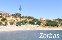 Lakkoi Skalotis, Frangokastelo at 24.1km (W) "Zorbas Rent Rooms and Taverna" run by the family of George GliniadakisThere are five double rooms with private bathroom - hot water 24hrs/day, air conditioning, refrigerator and large verandas with nice view to the sea. The beach is only 80 meters away.The tavern serves breakfast and meals from the morning till late in the night. The traditional Cretan specialities are all made with extra virgin organic olive oil and other products from the owner's farm.
 Messara Bay, Iraklion at 24.1km (S) Two small dry and uninhabited islets off the bay of Messara, ~7.5 naut. miles to the west of Matala. Due to their close proximity to one another the two islands appear as one from a distance. They are also called "elephantaki" as from north they look like a baby elephant that is lying down. In mythology it is believed that the goddess Lito gave birth to the god Apollon and the goddess Artemis on these islands. In antiquity they were called Dionissioi after the god Dionissos. During the summertime there are small cruising boats that bring tourists here from Agia Galini and Kokkinos Pyrgos. There is only a small beach with fine pebble and rich seabed at the south side of the easternmost islet.  Sfakia, South Hania at 25.3km (W) Kalikratis is a small mountainous village at the foot of the White Mountains (Lefka Ori) at an altitude of 750m above sea level. It is a traditional village with many well preserved stone houses. A German army of two thousand soldiers, invaded the village during the October of 1943 , burned it down and executed twenty men and nine women who did not manage to leave on time. A little to the south of the village starts the gorge of the same name which is part of the European hiking footpath (E4) and after some 4km walking ends at the village of Patsianos.  Rethymnon North coast at 26.1km (NE) Panormo is a small coastal village with ~400 inhabitants, located 25km east of Rethymnon in a small distance from the national road. The village has developed to a tourist resort providing quite a few tourist facilities such as hotels, apartments, lovely taverns and bars. There is also a small fishing harbour that serves mostly the locals. It is an nice place for swimming as its beaches - with umbrellas , sun beds etc - are with fine sand and clear water. Early-Christian basilica in Panormo In 1948 the archaeological axe brought to light the largest early-Christian basilica of Crete southwest of the village of Panormo. The basilica of Aghia Sofia had a wooden roof and dates back to the 5th century. About 25km from Panormo to the mainland is the archaeological site of Eleftherna. Image Library
 Apokoronas, Hania at 26.6km (NW) Crete's only freshwater lake, Lake Kournás (GR: Λίμνη Κουρνά), is relatively large, with a perimeter of 3.5 km. Although almost all touristic leaflets say that it is possible to walk around the lake, that is not true. At least not at the end of the rain season (winter). There is a nature preserve on the Southwest of the lake. But there is a rustic road from the North of the lake to the Hills on the West of the lake too. Image Library
 Psiloritis Mountain at 26.8km (E) At 1538m above sea level, 20 km. south of the traditional town of Anogia , on the plateau of Nida, of Mountain Psiloritis, lies this sacred cave, where according to mythology, Rhea, Zeus' mother, hid the new born Zeus in this cave in order to protect him from his father Kronos (Saturn), who was in the habit of swallowing his children because he feared they might deprive him of his power. Hidden in that cave Zeus grew up being fed with the milk of the goat Amalthia, while the 'Kourites" covered the child's crying through banging their copper shields. Image Library
 Messara, Iraklion South at 26.9km (SE) The town of Timpaki (GR: Τυμπάκι) is located in the west edge of the plain of Messara, 65.3km away from the city of Iraklion. It is a rich and busy town with significant economic activity especially due to the early vegetables production in the wider area. There are banks, a post office, medical centers, stores, schools, hotels, restaurants, ect to cover both the needs of the locals and visitors.
 by Richard Ellis at 27km (E) 15th June- The path up to the summit of Psiloritis is well-known and well-marked and does not need any further description from me. Fortunately for me, my pack was lighter by about 4 kg as I had handed over my camping equipment and extra food supplies to T who was going to catch the ferry back from Chania two days later and who could drop my gear at the flat en route. Distance:20.1 km Time: 8 hrs. Mov av 3.2 km/hr Height overnight: 427m. Max. height:2,454 m  Sfakia, South Hania at 27.5km (W) On the south coast of Crete, on a magnificent white sandy beach, stands one of the most beautiful Venetian fortresses, Fragokastello, built in 1371. It is located approximately 170 km from Iraklion, 70 km from Rethimnon, and 70 Km from Hania. Today, Fragokastello is a small, but developing, community, with nice beaches covered in sand dunes, and limited, but increasing, tourist facilities.The Villages Patsianos and Kalikratis, the castle, the history of the place and the fenomenon of Drossoulites...
 Psiloritis Mountain at 28km (E) The plateau is located in the center of the Ida mountain range at an altitude of 1400 m. It can be accessed from various sides but the only asphalt road is from the town of Anogeia. It has a roughly triangular shape and is almost flat. Visitors can enjoy the wild landscape, take a walk to the entrance of Idaion cave or to the freedom fighter sculpture, made with boulders from the mountain. An other interesting attraction is the various Mitata scattered all over the area. Those are circular domed buildings made with stones and used by shepherds for accommodation and storage of cheese. There is also a tavern with traditional food. The area of Nida, in earlier times, before the systematic farming and logging damage the flora of Psiloritis, was covered by forests in which mythological and traditional tales put different events. Here Dimitra fell in love with the mortal Iasion. http://www.anogialand.gr  Frangokastello at 28.7km (W) Vatalos is the long beach to the west of the main beach of Frangokastello. It is a stretch of fine sand interrupted by pebbles and rocks that create small coves. There are no umbrellas and sun beds available for rent and the only shadow can be found under the little tamarisks. It is by far less crowded than the main beach. It is frequented mostly by the guests of the hotels that stand above the beach as it is peaceful, and, quite safe for the kids.
Image Library
 Apokoronas, Hania at 29.3km (NW) Georgioupolis lies at the northern coast of Crete, about 35km away from Hania and 20 km from Rethimno. It is a nice coastal village situated at the bay of Almiros, in a lovely green scenery. It has a sandy beach and attracts quite a few visitors in the summer time. It provides all the necessary facilities to the tourists.
|
||
|
| ||


C
O
N
T
E
N
T
S
O
N
T
E
N
T
S