interkriti®
YOUR GATEWAY TO CRETE
|
Crete
List Grid Map
Found
154
- Showing :
21 - 40
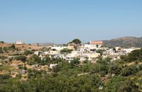 Pediada, Iraklion at 6km (S) Mathia is 11 km to the SE of Kasteli, has 215 inhabitants and lies at 590 m above sea level, in the foothills of the Afendi mountain (1578 m), with the Dikti mountain in the background. The earliest reference to the village can be found in several contracts of 1271 where the notary of Chandax P. Scardon mentions commercial exchanges of grain and wine with residents of the village ‘Mithie’, possibly a misspelling for Mathia. The name derives from the common first name for girls, ‘Mattia’, which in Crete is pronounced ‘Mathia’. Burials in jars of the middle Minoan period were discovered in 1957 close to the village, in a place known as Stavroplaka. To the NW of the village, at Katalimata, a Late Minoan site with important finds and, 200 m further off, a settlement with large walls still in place were also found.There are wonderful Byzantine wall paintings in the two churches of this traditional village, the church of Koimisi tis Panagias (Dormition of Our Lady) and the church of Agios Giorgos. At Metochi, in beautiful surroundings where the historical holm-oak of Ismail Pasha stands among plane trees and running water, there are camping facilities. You can also visit an old factory and several ruined mills. The village boasts of several kapheneions where they serve raki and ‘mezedes’ (tit-bits). There is an active cultural centre, that organizes events especially in the summer, with evenings of Cretan music and theatre plays. The most important and traditional feast is held on the Sunday of Agioi Pantes, 50 days after Easter. Image Library
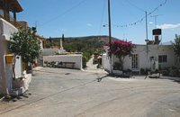 Pediada, Iraklion at 6.5km (S) Village of the area of Kastelli with 115 residents, Agia Paraskevi is situated 5 km northeast of Kastelli at an altitude of 400m. It is first mentioned in the Turkish census of 1671 as Agia Paraskevi tou Xourdou with 17 haratsia (head tax). It is very possible that Santa Venerata, a village mentioned in 1463 by Cardinal Bissarion, is the name by which Agia Paraskevi was known at that period. The Crete Golf Club Hersonissos, Pediada at 6.8km (N) 18 holes in a desert course design. Each hole individually sculptured, seamlessly blending into the existing landscape...The new Bob Hunt masterpiece (head of design at the PGA Golf Management Ltd of Great Britain), is best described as a desert golf course hewn out of rolling landscape little more than half an hour from the international airport of Heraklion. It boasts a series of memorable holes that will test every aspect of a golfer's repertoire and offers stunning views over mountainous landscape that has hardly changed since the Minoan era back in 2600 to 1100 BC. 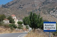 Pediada, Iraklion at 6.9km (S) Armacha (GR: Αρμάχα) lies at 490 m above sea level, at a distance of 7km from Kastelli, with 110 residents (census 2001) and is first referred to by Barozzi in 1577. Armacha is rich in the production of agricultural and livestock products. The Metropolitan Bishop, Tirnovos Voulgaria Ilarionas Kabanaris Sinitis was born, and is also buried here. A man of advanced learning, he wanted to translate the Bible to Demotic Greek. 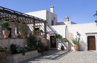 Voritsi, Gouves at 8km (NW) Kyra Eleoússa (GR: Κυρά Ελεούσα) Monastery is located close to the village Voroú or Voritsi. Due to its historical value the monastery and the outside area which covers 1000m has acquired protected status. Kyra Eleoussa is built according to feudal architectural style, and despite some interventions over the years it maintains many original architectural features. It is first referred in a document dating from 1606. At first it belonged to the monastery of Agia Ekaterini of Sinai but later it became part of Agarathos monastery. 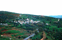 Gouves, Iraklion at 8.1km (NW) Vorou (or Voritsi) lies at a height of 230 m. above sea-level and counted 62 inhabitants in 1981 and 48 in 2001. It is 25 kms away from Heraklion. To get there, you follow the National Road to Aghios Nikolaos and at kms 17.7 turn right, taking the road Gouves-Skotino- Vorou. Nowadays it is known as Voritsi but this name is not official. The name Vorou, on the other hand, in the district of Pediados is mentioned by Barozzi in 1577. At the beginning of this century there lived a wise man and a healer in the village of Voritsi. His name was Giorgos Konstantoulakis and people flocked from all over to Crete to seek his advice.
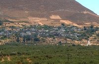 Pediada, Iraklion at 8.3km (S) Geraki (GR: Γεράκι). This lovely village of 375 inhabitants is located on the western slopes of the Lassithi mountains between the peaks of Afendi (1578 m) and Sarakinos (1588 m) in a beautiful glen, 520m above sea level and only 9km SE of Kastelli. It features an interesting Byzantine church, dedicated to the Archangel Michael (Archangelos Michail) with wall paintings that have not been maintained and some interesting (movable) icons by the local painter, Sepis. The active cultural centre of Geraki organizes many events during the summer season. Twice a year the village has a typical Cretan feast in honour of its patron saints: Agia Paraskevi on July 26th and Michail Archangelos on 8th November. The village produces agricultural products and great cheese that led to a specific cheese celebration. From Geraki you can also reach the lovely chapel of Agia Anna, driving through a particularly beautiful landscape with a spectacular view over the Geraki glen and fresh running water, a place ideal for a picnic. Image Library
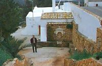 Gouves, Iraklion at 9.1km (NW) At a height of 140m. above sea-level, this village has 142 inhabitants and is 22.5 kms away from Iraklion. According to the villagers, the name comes from the church of Aghios Nikolaos Skotino at the entrance of a cave. It was built at the end of the Venetian period. Today an extra wing has been added, dedicated to Aghios Charalambos. This church of Aghios Nikolaos Skotino presumably functioned as a "Hedge School" (or "Hidden School") under Turkish rule when education had been banned. When the locals said: "We are going to Skotino (which also means "darkness")", they meant they were going to school. Turkish administration refers to this place as Skotino Perasma in 1671. Very close to the village (1.5 km) the cave of Aghia Paraskevi draws crowds of tourists and is well worth a visit.  Seli Ampelou, Lassithi Plateau at 9.2km (E) It is the most significant group of windmills preserved on Crete. It occupies the northern entrance to the Lasithi plateau and is the landmark of the whole area. Today 24 windmills are preserved (out of the original 26), 7 of which extend to the south of the road that enters the plateau while the rest are built to the north of it. All the mills belong to the one-sided type of windmill, that grinds in a standard position, always on the same direction of the wind. Windmills of this type are preserved on Crete and on Carpathos but the Cretan ones are generally more carefully built and more elegant. The group of windmills has been declared a work of art since 1986. The mills belong to individuals and some of them have been restored while others still remain half-ruined. Source: The Hellenic Ministry of Culture 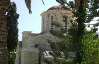 Iraklion at 9.7km (W) The monastery of Agaráthou (GR: Μονή Αγκαράθου), dedicated to the Virgin, stands at an altitude of 538m, on "Soros Panteli", a rocky hill between the villages of Sgourokefali and Sabas, 23 km from Heraklion. During the period of Venetian rule it was a centre of learning, producing many famous churchmen including the Patriarchs Cyril Lucaris, Meletius Pegas and Sylvester the Cretan. The church was rebuilt in 1894 and flourished once more after the end of the Turkish occupation. Young, educated monks with university degrees have recently settled in the monastery, restoring it to its former glory. 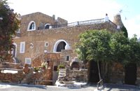 Hersonissos, Iraklion, Crete at 10.1km (NE) The Cretan Open-air Museum 'Lychnostatis' aims to promote the understanding and awareness of the Cretan folk cultural heritage. Its scope lies on the Cretan Folk Tradition and Ethnology, the Cretan Nature and Environment and the Cretan Folk Culture. Located in Hersonissos, one of the principal tourist areas in Crete, the museum is, apart from a valuable tourist asset, an exemplary self - motivated conduct on tradition, culture and environment of the island. 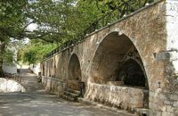 Pediada, Iraklion at 10.1km (E) Krassi is a small village 47 Km's from Iraklion and 17 km from Malia at an altitude of 600 m.asl, on the way to Lassithi plateau, and is administratively part of the Municipality of Malia. The village is one of the prettiest in Crete, with a lot of springs. Due to the free running water , it is covered with walnut trees, plane trees and all kinds of vegetation. Next to the spring in the middle of the village is one of the oldest and biggest plane trees in Crete (its root has a circumference of 22 meters!). 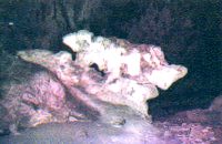 Skotino,Gouves, Iraklion at 10.2km (NW) This is one of the three largest caves in the prefecture of Heraklion. It lies at half an hour distance to the north-west from the village of Skotino and is at a height of 225 m. above sea-level. The entrance to the cave is impressive: a large arch, 27 m wide and 10 m high. To the right one can see the ruins of an ancient chapel on which the modern chapel dedicated to Aghia Paraskevi was built. There is a feast held in front of the chapel on July 26th .
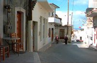 Gouves, Iraklion at 10.2km (NW) Pano Gouves (GR: Πάνω Γούβες) is a village of the district of Pediada in the prefecture of Iraklion at a height of 100 metres above sea-level. It lies twenty kms away from Iraklion, to the right at 17.3 kms on the National Road to Aghios Nikolaos. The village is built on the western flanks of the Ederi hill (322 m.). The name comes from "edera" which means ivy and symbolises affection. The name Gouves, on the other hand, comes from Gouva and means a hollow in the earth. It also means, in Crete, a hole in which during the middle ages, people stored their wheat. The earliest reference we have of the village is that of "Guves" in 1387 documents of the Duke’s archives in Chandax. Later on, in 1577, Fr. Barozzi mentions "Guvos" in the district of Pediados, and then "Guves" in the 1583 Register, with 252 inhabitants. Finally, in 1630, Vassilikata refers to "Vuves’. This is the birthplace of the poet Ioannis Konstantinidis. There are several outstanding churches in the village, among them: Zoodochos Pigis, Aghios Giorgos, Aghios Ioannis and Panayia (dedicated to the birth of Our Lady). 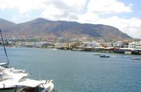 Pediada, North - East Iraklion at 10.5km (N) The most popular tourist resort in Crete. Nice beaches, sights and facilities for all tastes and ages. Together with Malia, are the party places for young visitors. Close to Hersonissos there are three small traditional village, those of Piskopiano, Koutouloufari and Old Hersonissos.
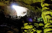 Psychro, Lassithi Plateau at 10.7km (SE) The cave of Psychro is one of the most important cult places of Minoan Crete. The excavators and several scholars identify the cave as the famous "Diktaian Cave", where Zeus was born and brought up with the aid of Amaltheia and the Kouretes, and which is connected with myths as this of the seer Epimenides who "slept" here, or the coupling of Zeus with Europa.
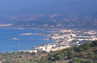 Pediada, North - East Iraklion at 11.3km (NE) The famous tourist resort with all types of accommodations. Great beaches and a lively party atmosphere particularly in August. Becomes pretty quiet and peaceful during the rest of the season and there is a nice and picturesque part of the old village that preserves the traditional character. Malia has also a significant agricultural production and is famous for its bananas, potatoes and bottled water.
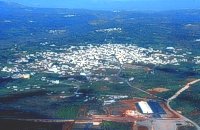 Central Iraklion at 12km (SW) The town of Arkalochori (GR: Αρκαλοχώρι) with a population of 2.881 is located 33km away from Heraklion, on the provincial road linking Heraklion and Viannos, at 395m above sea level. Its inhabitants are mostly involved in agriculture, but in commerce and arts as well. Arkalochori is one of the most developing towns in the prefecture of Iraklion both in economic and cultural sectors and is the administrative center of the area. Events such as the Pancretan Agricultural and Commercial Exhibition, that takes place here are of great significance and interest for the whole island. The town offers a full range of modern facilities to its residents and visitors.
Image Library
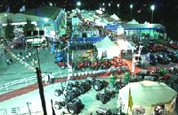 Arkalohori at 12.4km (SW) A modern exhibition and congressional centre offering 8000 square meters of total space, 1500 of them being indoors. Among many events that take place in this centre is the Pancretan Agricultural and Commercial Exhibition of Arkalochori held every two years at the end of August. The exhibition attracts a large number of enterprises, manufacturers and services participating and is being visited by over 30,000 visitors from all over Crete. It is considered to contribute essentially in the rapid commercial and cultural development of the wider area. Photo The Municipal Open Theatre Located in the area of the exhibition centre the theatre is of semicircular shape with a capacity of approximately 1000 seats. The facility offers also a canteen, toilets, dressing-rooms for the actors, store room of scene and backstage.The cultural events that the Municipality organises every summer, attract visitors not only from the wider area but also from Iraklion city. Photo Photo 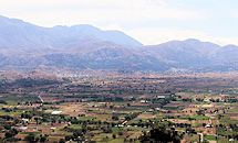 Lassithi, Dikti Mountains at 12.6km (SE) The Lassithi Plateau (GR: Οροπέδιο Λασιθίου, Oropedio Lasithiou), is a high endorheic plateau, located in eastern Crete, Greece on the mountain range of Dikti at an average altitude of 840 m, and in a distance of around 55km from Heraklion and 50km from Agios Nikolaos. The plateau is elliptical in shape with an E-W axis of 11km and the N-S of 7km. The plateau of Lassithi is renowned for its exceptional agricultural produce, the thousands (almost 15000) windmills that used to be there in the past, its significant historical role and for the unique cave of Psychro also known as "Diktaion Andron". Image Library
|
||
|
| ||
C
O
N
T
E
N
T
S
O
N
T
E
N
T
S


