interkriti®
YOUR GATEWAY TO CRETE
|
Crete
: Regional Interest
List Grid Map
Found
101
- Showing :
1 - 20
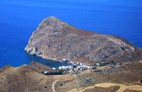 Iraklion South at 0km (N) Léndas or Léntas (GR: Λέντας), positioned almost in the centre of Cretes' south coast, clusters around a pretty bay that's dominated by an enormous rock resembling a lion's head that juts into the sea on one side of the resort. The village offers most facilities you might need during your stay; a choice of tavernas, three or four directly on the beach, two or three bars, mini-markets and even an Internet café. There is a sand/shingle beach and the sea is crystal clear and perfect for snorkeling.
Image Library
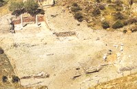 Lentas, South Iraklion at 0km (NW) The first habitation of the site dates from the Neolithic and Early Minoan period (3rd millenium B.C.). In the late Classical period (beginning of the 4th century B.C.) the Gortynians established the sanctuary of Asklepios at the harbour. During the tremendous earthquake of 46 B.C. the city was destroyed and subsequently rebuilt. In the Early Christian and Byzantine periods, a small settlement developed and the basilica was erected. The most important monuments of the site are: The Temple of Asklepios., the "Treasury"., the Fountain, a large, three-aisled basilica, an Early Minoan settlement (2600-2000 B.C.), the West Stoa, the North Stoa, the Nymphaion and two large, mud-brick cisterns. 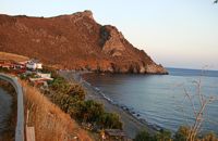 Iraklion South at 0.9km (W) A long beach west of Lendas on the south shores of Iraklion. The name is probably a corruption of Dysikos (GR: Δυσικός) which is the one to the west. There is a small settlement with taverns and accommodation complexes, mostly rooms and apartments for rent. Dyskos used to be popular with nudists and nature lovers in the past and even in present days nudism is tolerated in the western part of the beach. The beach has small pebbles and sand. Those who chose Dyskos for their holidays will have, among other things, the chance to explore the area by small walking tours and enjoy the magnificent sunset.
Image Library
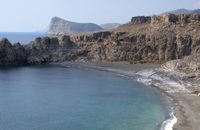 South Iraklion at 3.1km (E) Tráfoulas is a secluded beach, nested in a cove open to the south, at the small promontory of the same name, located between Lendas and Trypiti. You can reach Trafoulas only by boat or on foot via a small canyon. The starting point is around 700m away, to the north, just above the small harbour of Loutras, around 5km east from Lendas, where there is a place for parking. You then follow the hiking path, descending for a while to meet the canyon that leads directly to the beach. The walk takes around 20 minutes and its very nice as there are plenty of oleander and the rocky walls are very spectacular continuing until the sea. Image Library
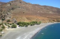 Beach in South Iraklion at 5.2km (E) Tripití (or Trypití GR: Τρυπητή) is a 400m long beach on the southern Asterousia coastline. It is located 57km from Heraklion (west gate, Giofyros) via Agioi Deka - Vagionia - Vassiliki - Trypiti road. The last 10km, from Vassiliki to Trypiti, is a dirt but in fairly good condition road. The road passes over the gorge of Agios Savvas, with spectacular rocky walls, then through a forest of olive and carob trees and finally via the gorge of Trypiti through a very narrow passage reaches the beach. This is a very interesting route with breathtaking views and fantastic scenery. Image Library
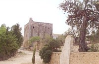 Messara plain, South - East Iraklion at 12.3km (W) The monastery of Odigitria is a monastery of great importance and historical value and one of the oldest in Crete. It is located at the west edge of the Asterousia mountains at an altitude of 250 m. The monastery was surrounded by walls, part of them still stands. The temple of the monastery is dedicated to the assumption of Holly-Mother and to the Saint Apostles (Peter & Paul). Inside the temple there are valuable frescoes, icons of famous painters and iconostasis. The monastery is connected with the legendary freedom fighter 'Ksopateras' (1788 - 1828) In the area of the monastery at Agioi Eftihianoi was found an ancient (Early Minoan) cemetery. 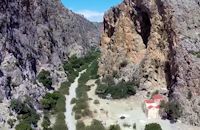 South - coast Iraklion at 13.3km (W) Agiofaraggo (GR: Αγιοφάραγγο the gorge of Saints) is a small gorge at the southern shores of Heraklion close to the village and the beach of Kaloi Limenes and 6 kilometers south of the Monastery of Odigitria. Image Library
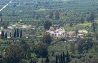 Village in Messara plain at 13.8km (N) Mitropoli (GR: Μητρόπολη) is a small village in the archaeological site of Gortyna in Messara plain. The village is mentioned for the first time in the Ducal archives of Candia in 1368 and later in the census of 1577 by Fr. Barozzi and in 1583 by Castrofylaka. Early mention of the settlement is to document the Ducal Archive of Candia in 1368, also mentioned by Fr. Barozzi in 1577 with the name and the Mitropoli Kastrofilakas in 1583. According to the census of 2001 it has 382 inhabitants. Main occupations of the inhabitants is the cultivation of vines, olives, vegetables, cereals and citrus fruits. At its north borders are located the ruins of the first cathedral of St. Titus, in which it owes its name.(Mitropoli = Cathedral). Image Library
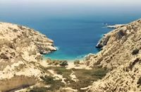 South - coast Iraklion at 13.9km (W) Martsalo (GR: Μάρτσαλο, Mártsalo) is located on the mass of the Asterousia Mountains between Kefali (Cape Lithino) and Agiofarago. It is an impressive gorge about two kilometers long, which belongs to the hermitages of the Holy Monastery of Odigitria. Inside the gorge there is rich vegetation as well as a small palm forest in the middle of its route. The impressive cliffs are home to a large number of caves (similar to eagles' nests) inhabited by many of the area's ascetics. Gorge Martsalo is particularly steep and rough and ends at the Libyan Sea, where there is a small protected cove with a sandy- pebbly beach. Image Library
 Messara plain, South - East Iraklion at 14.1km (N) The administrative center of the Messara Valley. Moires (GR: Μοίρες) is the biggest town in the Messara Valley with a population of approximately 5000 people. It has a police station, magistrate's court,post office, public PTT office, health center, and offices of most Greek major banks.
 Messara, Iraklion South at 14.3km (NW) Its 1000 years history comes to life for the visitor, who has the chance to admire its monuments, and old houses, perfectly preserved through the centuries. In the village square , you can sit and enjoy your coffee in the traditional coffee shop, while children can play in the playground next to the school. You can also visit the church of Agios Ioannis in the same square. There are quite few rooms for rent in the village and tavernas serving traditional Cretan dishes.
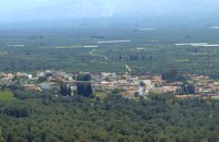 Messara, Iraklion South at 14.5km (N) Agioi Déka (GR: Αγιοι Δέκα) is a town with 820 inhabitants in the plain of Messara, 170m above sea level, 43 km from Heraklion town and very close to the archaeological site of Gortyna. Its people are occupied mostly in agriculture - vines and olive trees. In the area there is is the oldest olive grove in Crete. The town is built on the ruins of the ancient town of Gortyn where the Holy Ten Martyrs have been martyred. 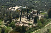 Messara, Iraklion South at 14.6km (N) Located in the valley of Messara, Gortys or Gortyn (GR: Γόρτυς or Γόρτυνα) is a must visit for all visitors to Crete. It was inhabited during Bronze Age times, but its rise to glory came almost a millennium after the downfall of the 'Minoans'. Gortyn was a prosperous city from around the middle of the 5th century BC through to the early 9th century AD, when it was finally destroyed by the Saracens (824AD), never to be rebuilt.
Image Library
 Moires, Messara at 15.7km (NW) The monastery of Panagia Kaliviani is located at the 59th km on the road Iraklion-Phaistos. The monastery was built during the second Byzantine period. The small Byzantine chapel was painted with frescoes but most of them are today destroyed. The chapel was deserted until, during the Turkish occupation in 1873, an old small icon of the Annunciation of the Holy Mother was miraculously found there.and the monastery became a place of worship.  Mires, Messara Valley at 16km (N) It is located north of Mires close to a small gorge, with springs and covered with trees. There are many churches in the village the most important one being the church of Agios Nikolaos, a domed church dated to the 13th century. The walls of the temple are hand painted with biblical scenes and pictures of saints
 Messara, Iraklion South at 16km (NW) The village of Pitsidia is located 65 km southwest of Iraklion at an altitude of 80 m a.s.l, just before the magnificent bay of Messara. The village with aproximately 700 inhabitants is the oldest village of the area and is refered (by S. Spanakis) that it was the place where the soldiers of Nikiforos Fokas, commander of the Byzantine army, settled. The army, famous for its bravery, came from Pisidia of the south Asia Minor, and this is probably the origin of the name Pitsidia.
Image Library
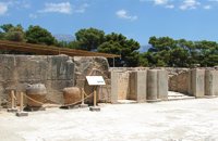 Palace and Archaeological Site at 16.7km (NW) The archaeological site, the palace, the findings - The Festos Disc. According to mythology, Phaistos (or Festos) was the seat of king Radamanthis, brother of king Minos. It was also the city that gave birth to the great wise man and soothsayer Epimenidis, one of the seven wise men of the ancient world.Excavations by archaeologists have unearthed ruins of the Neolithic times (3.000 B.C.).
Image Library
 Messara, Iraklion South at 16.7km (NW) Kamilari is a quiet, traditional village, with a panoramic view to the endless olive groves of the Messara valley on the one side, and to the Libyan sea on the other side. It has been inhabited since the Minoan period. One of the seven wise men of the ancient world, Epimenidis, a great wise man and a soothsayer, lived in a small community outside Kamilari, called Metohi.
 Messara, Iraklion South at 16.9km (N) Gallia is one of the oldest villages of the area. It is mentioned as a location in the Venetian records as early as 1577, and as a village with 120 residents since 1583. The renaissance tower in the village (still imposing although rundown) and the water fountains in the Kapeloniana area are proof of the passing of the Venetians. Part of the village, called Monohoro, is mentioned as early as 800 A.D. 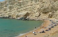 Matala, South - West Iraklion at 17.1km (W) The Red beach is located around 700m south from Matala. It is a beautiful secluded beach with fine reddish sand originating from the rocks of the area. The name "Red Beach" is given by the visitors due to its reddish color while its original name is Ammoúdia (GR: Αμμούδια). The sea gets a lovely blue-green color, making the landscape really unique. The only way to access Red Beach is on foot or by boat from Matala. The walk from Matala takes about 20 minutes and it can't be considered as an easy one. Red Beach however can get pretty crowded in the high season. There is a small stone-wall canteen offering snacks and drinks and a few umbrellas and sun-beds. Nudism is tolerated at the two ends of the beach. Image Library
|
||
|
| ||
C
O
N
T
E
N
T
S
O
N
T
E
N
T
S

