interkriti®
YOUR GATEWAY TO CRETE
|
Crete
List Grid Map
Found
171
- Showing :
101 - 120
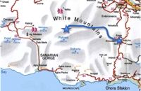 by Richard Ellis at 33.4km (W) 30th August - The day dawned with a cloudless blue sky. I was lucky. The route starts with a gentle two km warm up across the Niato plateau before turning more vicious. The next phase is a very steep 700 meter climb up the north east ridge of Kastro. One of the pluses is that you are doing this in the relative cool of the morning - one of the minuses is that you will probably be carrying something like five litres of water. Distance: 17.0 km Time: 10 hrs. 5mins. Mov av 2.5 km/hr Height overnight: 1,913m. Max. height: 2,060m.  Messara, Iraklion South at 33.5km (SE) Its 1000 years history comes to life for the visitor, who has the chance to admire its monuments, and old houses, perfectly preserved through the centuries. In the village square , you can sit and enjoy your coffee in the traditional coffee shop, while children can play in the playground next to the school. You can also visit the church of Agios Ioannis in the same square. There are quite few rooms for rent in the village and tavernas serving traditional Cretan dishes.
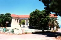 Apokoronas, Hania at 33.7km (NW) The community of Kefalas (GR:Κεφαλάς) is situated in Apokoronas, Hania, approximately 4 km to the east of Vamos. During the Venetian occupation higher and lower Kefalas were classed as two separate villages, however, today they have become one. It is a large village built in an outstanding position facing the sea with architecture dominated by the influence of the early and late years of the Turkish occupation. This influence is well preserved despite the existence of other architectural styles. The church of Timios Stavros (16th century) is the oldest building of the village while the more recent churches of Panagia, Agios Antonios, and Michael the archangel, works of the reputed Kefalas craftsmen, are examples of folk architecture of the 19th century. A further example of the work of the same craftsmen is the Public School of Kefalas, which in accordance with the decision of the county council of Hania will house the Environmental Educational Centre of the prefecture, a foundation that will play a definitive role in the development of the municipality of Vamos. Other interesting communities are Paleloni and Drapanos in the direction of Kokino Horio. The road from Paleloni leads to Embrosgialo, a relatively easily accessible place, along the steep coastline, which extends to Georgioupoli.  Messara, Iraklion South at 34.3km (SE) Gallia is one of the oldest villages of the area. It is mentioned as a location in the Venetian records as early as 1577, and as a village with 120 residents since 1583. The renaissance tower in the village (still imposing although rundown) and the water fountains in the Kapeloniana area are proof of the passing of the Venetians. Part of the village, called Monohoro, is mentioned as early as 800 A.D. 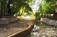 Apokoronas, Hania at 34.8km (NW) The traditional little village of Vrisses lies approx. 35 km from Chania town. The old village square with its tall plane trees, the tavernas and kafenions is the perfect place to relax and enjoy the lush green landscape by the river Vrissanos and taste the renowned and particularly delicious local yogurt.
 Kenouriou, South Iraklion at 35km (E) Zaros (Greek: Ζαρός), at an altitude of 340 metres, is a town with a lake and gorge nearby. It has a couple of hotels and it is 44 km from Heraklion at the southern foothills of Mountain Psiloritis. The population of 3,400, produce olive oil, sultanas, vegetables and spring water. There are a couple of fish farms that serve both trout and salmon. In Zaros, there are cafes near Lake Votomos, as well as a tavern that serves fresh trout called I Limni (The Lake). Close by is Rouvas Gorge, which is part of the Psiloritis mountain range and is on the hiking route known as the E4 European Walking Path. Nearby Zaros are traditional water mills which have been working since the 16th century, as well as archaeological sites and monasteries. Zaros is also famous for its water "ZAROS" bottled by a company called Votomos SA. 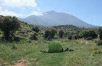 by Richard Ellis at 35.1km (E) 11th, 12th and 13th June- We had made camp in the yard beside the Aghios Ioannis chapel at Rouvas but, the following morning, it was quite clear that I wasn’t going to go any further on foot until the shin splint had settled down a bit. Minor surgery on the blisters exposed the full extent of those problems and I hung them out to dry in the sun while Triantafyllos went off looking for paths to put on his maps. I think I was lucky not to get infected blisters but Betadine is a great resource which I used extensively.
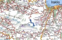 by Richard Ellis at 35.1km (E) 14th June- The walk up from Rouvas is quite straightforward; once you have walked back down the stream from the Rouvas picnic area and turned right (north) up the dry river bed for two hundred yards, you scramble up a short, easy rock section (well sign posted) before the path continues up through open oak woodland (the Rouvas Forest) heading first for the Duo Prinoi chapel, which has a water tap, and then later up and over a ridge, beyond which a small dry water course leads up a steep sided valley to the flat lands of the Nidha plateau. Distance:12 km Time: 4.75 hrs. Mov av 3.7 km/hr Height overnight: 1,360m.  Mires, Messara Valley at 35.9km (SE) It is located north of Mires close to a small gorge, with springs and covered with trees. There are many churches in the village the most important one being the church of Agios Nikolaos, a domed church dated to the 13th century. The walls of the temple are hand painted with biblical scenes and pictures of saints
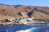 Sfakia at 36km (W) Sfakia are centred around the White Mountains mountain range, Madares, as they are called in Crete with 110 peaks and the most and biggest gorges. Sfakia remain the most wild and unspoiled landscape in all Crete. Hora Sfakion, the seaside capital of the county, is a coastal village located on the Southwestern coast of Crete, 70 km from the city of Hania and 150 km from Iraklion. In its picturesque, enclosed harbor, the small boats from Agia Roumeli dock in the summer, bringing the hikers from the Samaria Gorge. Visitors can enjoy the quiet and calm of the village , on the seaside cafes and tavernas...
 Messara plain, South - East Iraklion at 36.1km (SE) The administrative center of the Messara Valley. Moires (GR: Μοίρες) is the biggest town in the Messara Valley with a population of approximately 5000 people. It has a police station, magistrate's court,post office, public PTT office, health center, and offices of most Greek major banks.
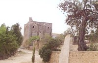 Messara plain, South - East Iraklion at 36.5km (SE) The monastery of Odigitria is a monastery of great importance and historical value and one of the oldest in Crete. It is located at the west edge of the Asterousia mountains at an altitude of 250 m. The monastery was surrounded by walls, part of them still stands. The temple of the monastery is dedicated to the assumption of Holly-Mother and to the Saint Apostles (Peter & Paul). Inside the temple there are valuable frescoes, icons of famous painters and iconostasis. The monastery is connected with the legendary freedom fighter 'Ksopateras' (1788 - 1828) In the area of the monastery at Agioi Eftihianoi was found an ancient (Early Minoan) cemetery. 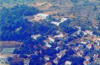 Apokoronas, Hania at 36.6km (NW) Vámos (GR: Βάμος) is the capital of Apokoronas district is an exceptionally interesting village that the Ministry for the Environment, Physical Planning and Public Works has classed as traditional. It is more like a small town, very well preserved, with folk and neoclassical architectural elements. The initiative of a group of inhabitants to create an association for the preservation of the village as well as alternative tourism strategies is already paying off while constituting a model for further local progress. The famous art and cultural festivals are good opportunities for everyone to experience the hospitality and entertainment Vamos can offer.
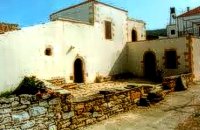 Gavalohori, Vamos, Apokoronas at 37.1km (NW) The exhibition of the objects takes place according to the contemporary museum conception, with explanatory texts, photographs, plans, models, and is enriched with new exhibits every year. The Museum is divided into seven rooms, according to the following units: The Arched House, Silk, Pottery, Lace-making, Masonry and Stone carving, Church and Woodcarving.
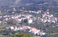 Apokoronas, Hania at 37.1km (NW) Gavalohóri (GR: Γαβαλοχώρι) is an old big traditional village, with fine examples of traditional rural architecture and stone buildings that are well preserved. The village has been declared a traditional settlement and is awarded a protected status. Many interesting buildings still stand, such as the 18th century olive press, the church of Panagia (Virgin Mary) and that of Agios Sergios, the old school and the complex of the wells from the period of the Venetian occupation.
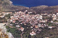 Apokoronas, Hania at 38.1km (NW) Kókino Horio (GR: Κόκκινο Χωρίο), which is located at a higher altitude, has maintained its traditional architectural style even more so than the other villages with its narrow roads, beautiful gates and tiled roofs. A group of cisterns, built in a sloping field, gather the rainwater, an interesting example of local architecture, dealing with the permanent problem of lack of water. Above Kokino Horio one can see the strangely shaped hill Drapanokefala or Calapodha (so named during the venetian occupation). The coastline northwest of the village is an extremely interesting place for a stroll due to the ground formation and the caves, such as the cave of Petsi (or Karavotopos). Another cave called Katalimata, located at the centre of the village, is also an interesting site. At cape Drapano, approximately 10 metres under water, is the impressive Elephant cave, an area 60mx60m full of stalactites and stalagmites of various shapes and colours. Video - The Elephants' Cave 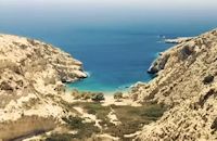 South - coast Iraklion at 38.5km (SE) Martsalo (GR: Μάρτσαλο, Mártsalo) is located on the mass of the Asterousia Mountains between Kefali (Cape Lithino) and Agiofarago. It is an impressive gorge about two kilometers long, which belongs to the hermitages of the Holy Monastery of Odigitria. Inside the gorge there is rich vegetation as well as a small palm forest in the middle of its route. The impressive cliffs are home to a large number of caves (similar to eagles' nests) inhabited by many of the area's ascetics. Gorge Martsalo is particularly steep and rough and ends at the Libyan Sea, where there is a small protected cove with a sandy- pebbly beach. Image Library
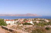 Apokoronas, Hania at 39km (NW) Pláka (GR: Πλάκα) is a lovely village in the Apokoronas area, less than one kilometer away from Almyrida, with interesting architectural style, which is unfortunately changing due to intense building mainly for tourist purposes. Its ~300 permanent inhabitants, occupying mostly with farming, stock-breeding, fishing and lately with tourism. It has all the basic amenities, including excellent tavernas, bars, a grocery store and a kafeneion. Plaka is built on the slope of a hill at 70 m above sea, with a panoramic view of the bay of Souda. The surrounding environment has maintained its character well and is ideal for walks either inland or along the coast. Visitors can also admire a magical sunset from here. Every summer -at about the end of July- a two days traditional feast - The Plakiana - is organized to honour the memory of the great local lyra player Mihalis Papadakis or else Plakianos. During the feast guests enjoy Cretan dances and can visit the textile and ceramics exhibitions. The custom of Klidonas is celebrated at the end of June and the Carnival usually takes place in March. 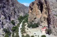 South - coast Iraklion at 39.4km (SE) Agiofaraggo (GR: Αγιοφάραγγο the gorge of Saints) is a small gorge at the southern shores of Heraklion close to the village and the beach of Kaloi Limenes and 6 kilometers south of the Monastery of Odigitria. Image Library
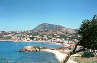 Apokoronas at 39.5km (NW) A beautiful small sea side village with long sandy beach where wind surf, canoes, paddle boats, umbrellas and sun beds can be rented. The place provides all the facilities for the visitors with small hotels, rooms, apartments and many taverns with traditional food and fresh fish. Recent years it became very popular with expatriates and there is a significant development in the real estate sector.
Image Library
|
||
|
| ||
C
O
N
T
E
N
T
S
O
N
T
E
N
T
S


