interkriti®
YOUR GATEWAY TO CRETE
|
Crete
List Grid Map
Found
171
- Showing :
161 - 171
 Malevizi, North - West Iraklion at 45.9km (NE) Ahláda (GR: Αχλάδα) is a small village located 24 kms west of Iraklion at an altitude of 300 meters a.s.l. It is close to the tourist resorts of Agia Pelagia and Ligaria, and it has approximately 500 inhabitants, most of them farmers and stock breeders. The name of the village meaning wild pear tree is given probably due to the huge wild pear tree that used to be at the village.  Kenourgiou, Iraklion at 46.2km (E) Agios Thomás (GR: Αγιος Θωμάς) lies at 530 m above sea level. It is 30 km away from Heraklion and has a panoramic view over the whole area to the SE of Aghia Varvara. Agios Thomas is a very old village and the first reference we have of it, is in a document of 1371, where it is quoted as a feudal property of Petrus de Medio, and again in a document dated 1380. Later, it figures in all the Venetian censi of the 16th and 17th centuries. In 1881, and in 1900, it figures as part of the Megali Vrisi municipality, with 344 inhabitants. From 1920, it figures in all the censi as a community with a continuously growing number of inhabitants. Nowadays there are over 800 inhabitants. 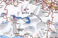 by Richard Ellis at 46.9km (W) 31th August - Katsiveli to Kallerghi via Pachnes- The day dawned with a cloudless blue sky. I was lucky. The route starts with a gentle two km warm up across the Niato plateau before turning more vicious. The next phase is a very steep 700 meter climb up the north east ridge of Kastro. One of the pluses is that you are doing this in the relative cool of the morning - one of the minuses is that you will probably be carrying something like five litres of water. Distance Total (with Pachnes climb): 25.3 km Time: 9 hrs. 30 mins. Mov av 3.3 km/hr Height overnight: 1,518m.(Kalergi) Max. height: 2,453m.(Pachnes) To Pachnes and back:12.1km, time 4hrs 10mins. 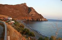 Iraklion South at 47.3km (SE) A long beach west of Lendas on the south shores of Iraklion. The name is probably a corruption of Dysikos (GR: Δυσικός) which is the one to the west. There is a small settlement with taverns and accommodation complexes, mostly rooms and apartments for rent. Dyskos used to be popular with nudists and nature lovers in the past and even in present days nudism is tolerated in the western part of the beach. The beach has small pebbles and sand. Those who chose Dyskos for their holidays will have, among other things, the chance to explore the area by small walking tours and enjoy the magnificent sunset.
Image Library
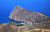 Iraklion South at 47.8km (SE) Léndas or Léntas (GR: Λέντας), positioned almost in the centre of Cretes' south coast, clusters around a pretty bay that's dominated by an enormous rock resembling a lion's head that juts into the sea on one side of the resort. The village offers most facilities you might need during your stay; a choice of tavernas, three or four directly on the beach, two or three bars, mini-markets and even an Internet café. There is a sand/shingle beach and the sea is crystal clear and perfect for snorkeling.
Image Library
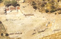 Lentas, South Iraklion at 47.8km (SE) The first habitation of the site dates from the Neolithic and Early Minoan period (3rd millenium B.C.). In the late Classical period (beginning of the 4th century B.C.) the Gortynians established the sanctuary of Asklepios at the harbour. During the tremendous earthquake of 46 B.C. the city was destroyed and subsequently rebuilt. In the Early Christian and Byzantine periods, a small settlement developed and the basilica was erected. The most important monuments of the site are: The Temple of Asklepios., the "Treasury"., the Fountain, a large, three-aisled basilica, an Early Minoan settlement (2600-2000 B.C.), the West Stoa, the North Stoa, the Nymphaion and two large, mud-brick cisterns. 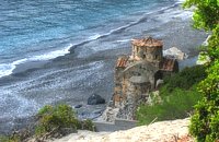 Sfakia, South Hania at 48.3km (W) Ágios Pávlos (GR: Άγιος Παύλος)is a beach on the shores of Sfakiá between Agia Rouméli and Loutró. The pine trees from the high cliffs above almost reach the sea and form a unique landscape. The beach is sandy with pebbles with no facilities except for a small tavern. It can be reached only on foot ( about 1 hour walk from Agia Roumeli) or by boat. The picturesque small church of Agios Pavlos (Saint Paul) a byzantine basilica of the 10th century A.D. with frescoes, lies just a few meters from the sea. It is built with stones from the beach itself on the spot where Saint Paul reportedly baptised people on his way to Rome.
Image Library
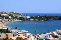 Malevizi, North - West Iraklion at 48.6km (NE) Agia Pelagia lies 20km west of Iraklion. The bay of Agia Pelagia is ideal for combining sea sports with relaxation. The visitor will find well trained instructors that offer lessons for sea sports such as water-ski, wind surf, canoe. Agia Pelagia offers unique high standard hotel facilities as well as many small hotels and pensions.
 Kenouriou, Iraklion at 48.9km (E) Doúli (GR: Δούλι) is a village in Kenouriou county, located 38 km from Iraklion at an altitude of 440 m above sea level. The earliest reference to it, is to be found in the Duke's Archives of 1372, where it is mentioned as the feudal property of Nic. Venerio. The name figures in all the Venetian censi of the 16th and 17th centuries, as well as in the Turkish (1671) and Egyptian (1834) censi. In 1881, Douli forms part of the municipality of Megali Vrisi with about 170 inhabitants, and again in 1900 with only 21 inhabitants. As of 1920, Douli is a commune in its own right, and today Douli has about 240 residents. The patron saint of the village is Aghios Panteleimonas and the feast of the Saint is celebrated on July 27th.A visit to the old church of Aghios Nikolaos is also a must. For those interested in paleontology, there are fossils to be found at the location 'Pirgos'. 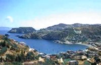 Agia Pelagia, Maleviziou, Iraklion N-W at 49km (NE) Lygaria (also Ligaria GR: Λυγαριά) is a small seaside resort 2 kms to the east of Agia Pelagia. It is built in a small cove with a lovely sandy beach protected from the summer winds (Meltemi). Lygaria started as a residential area comprising of summer houses built mainly by residents of Heraklion but soon it has developed to a tourist resort. It has a couple of small taverns, hotels and cafes by the beach and it is very popular with tourists and locals alike. There is regular public bus transport from Heraklion. The distance from Heraklion is 19 kilometers via the national road.
Image Library
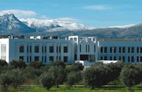 Voutes, Iraklion at 49.7km (E) The Foundation for Research and Technology – Hellas (FORTH) is one of the largest research centers of Greece with well - organised facilities and a highly qualified staff. It functions under the supervision of the General Secretariat for Research and Technology of the Hellenic Ministry of Development and consists of seven Research Institutes, which are located in various regions of Greece: Heraklion, Rethymno, Patras and Ioannina. The Foundation’s headquarters, as well as the Central Administration offices are located in Heraklion, Crete. |
||
|
| ||
C
O
N
T
E
N
T
S
O
N
T
E
N
T
S


