interkriti®
YOUR GATEWAY TO CRETE
|
Crete
List Grid Map
Found
171
- Showing :
141 - 160
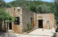 Fodele, Iraklion, Crete at 42km (NE) The museum is located at a place called "Archontiko", around 1000m west from Fodele village and is housed in the house where according to tradition the great painter Doménikos Theotokópoulos (El Greco), was born. The exhibits are mainly photo - reproductions of his paintings and other documents related to the painter's life and work. The house was severely damaged by the passage of time. The restoration began in 1982 with a grant from the Ministry of Culture and the considerable help of the then Minister Melina Mercouri, in collaboration with the community of Fodele. It was reconstructed according to its original design.  Malevizi, Iraklion at 42.2km (E) Dóxa (GR: Δόξα) is a pretty village built on a height of 400 metres above sea-level and 20 kilometres to the west of Heraklion on the road to the mountainous Milopotamos. The historical cave of Dóxa (GR: Δόξα) is located in a short distance from the village of Marathos on the road to Heraklion. It is at a height of 490 metres above sea-level, near a well-known taverna also called DOXA. The cave has a total length of 50 metres and impressive stalactites and stalagmites.  Malevizi, Iraklion at 42.2km (E) Ano Asites (GR: Ανω Ασίτες) lies 24km from Iraklion and 6km from Agios Myron at 480m a.s.l with 423 inhabitants. A big part of the surrounding area is covered by forest on the eastern side of the mountain Psiloritis. Near the village there is the Byzantine chapel of Agios Antonios located in the ravine with the same name a place of exceptional natural beauty. From here passes the European Hiking Path (E4) which leads to the shelter "Prinos" ( of the Mountaineering Club of Iraklion - altitude 1100 m a.s.l.) located in a holly (=prinos) forest.  Malevizi, Iraklion at 42.2km (E) Kato Asites (GR: Κάτω Ασίτες lies 23km from Iraklion and 5km from Agios Myron at 450m a.s.l with 1113 inhabitants. Beautiful town with traditional architecture especially the quarters "Notiko", "Prinos" and "Kastella" close to the monastery of Gorgolaini. Other interesting sights are: The thermae of the king of Prinias, The uninhabited settlement of Nisi with traditional houses, the caves "Lesta spilios" at Marias aloni, "Astirakou spilios", "Sarakina" and "Katsivli spilios" at Lyssogremia and "Melissa", The chapels of "Panagia" aged 800 years, "Agios Antonios" aged 1000 years, "Agios Georgios" and "Agia Paraskevi". The patron Saint is "Agia Paraskevi" celebrated on the 26th July . 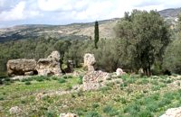 Gortyn archaeological site at 42.2km (SE) It lies at the south eastern part of the city and it is considered to be largest of all theaters in Gortyna. Although it is not yet excavated, it is believed that it had a two storeyed stage and its cavea was supported by 56 arches. The statue of the seated philosopher that we see next to the exhibition hall of the archaeological site was found here.
Image Library
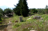 Gortyn archaeological site at 42.2km (SE) The Hippodrome was located in the south part of the city of Gortyn, and was surrounded by columns. The central section was 374 metres long and 60 metres wide. Our information on the site is insufficient for the reason that there was never a systematic survey, or even a small excavation. What we see today of this magnificent monument are only some parts of columns and capitals.
Image Library
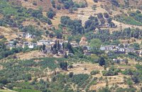 Kenourgiou, Iraklion at 42.3km (E) Priniás (GR: Πρινιάς) is a small village located 35km southwest of Iraklion town and 4km from Agia Varvara, at a height of 610 m above sea level. The village of Prinias lies on the border of three regions: Malevizi, Kenouriou and Monofatsi, and is recorded as forming part of all three regions in the censi. 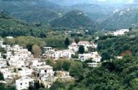 Malevizi, North - West Iraklion at 42.4km (NE) A traditional village - birth place of Domenikos Theotokopoulos (EL GRECO) - with many pottery and weaving workshops. Close to the village is a small beach with taverns and a large hotel resort. Fodele is known also for its quality orange production.
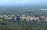 Messara, Iraklion South at 42.6km (SE) Agioi Déka (GR: Αγιοι Δέκα) is a town with 820 inhabitants in the plain of Messara, 170m above sea level, 43 km from Heraklion town and very close to the archaeological site of Gortyna. Its people are occupied mostly in agriculture - vines and olive trees. In the area there is is the oldest olive grove in Crete. The town is built on the ruins of the ancient town of Gortyn where the Holy Ten Martyrs have been martyred.  Kenourgiou, Iraklion at 43.4km (E) Moúlia (GR: Μούλια) is a village in Kenouriou county, located three and a half kilometers away from Agia Varvara town and 32 km from Iraklion at an altitude of 640 m above sea level. Moulia is an old village as we come across a reference to it in a document dated in 1248, where the settlement is recorded as belonging to the archbishopric of Crete. Another reference is found in a legal agreement established in 1411. The name figures in all the Venetian censi of the 16th and 17th centuries, as well as in the Turkish and Egyptian censi. In 1881, it forms part of the municipality of Zaros with about 180 inhabitants, and again in 1900. As of 1920 it is a commune in its own right, and today with the lower village of Kato Moulia it counts over 550 inhabitants. The main church of the village, with wall paintings, is that of the patron saints, Saints Peter and Paul, and there is a village feast on the 29th June, in their honour. The lovely chapel of Zoodochos Pigis is also well worth a visit.
 Kenourgiou, Iraklion at 43.5km (E) Agia Varvára (GR: Αγία Βαρβάρα) is a town built along the road between the Messara plain and the Malevizi region at the highest point (580 m). The town enjoys a unique location with a splendid view into the Malevizi region, and a cool climate, particularly pleasant during the hot summer months. It produces first-rate fruit and vegetables. Because of its strategic location on the main north-south axis, the town was often exposed to fierce battles. A famous warrior, Mathiou Kapitakis or Mathioudakis was born here: he fought side to side with Karaiskakis and was killed at Faliro. His comrade-in-arms, Logios, was the hero of Aghios Thomas. As you reach the village, on the north side there is a rock with a chapel dedicated to Profitis Ilias. On this rock -which used to be twice as large but part of it fell off at the beginning of the 19th century- there used to be an ancient temple. Nowadays, the visitor can find every kind of commodity and facility on hand at the modern town of Aghia Varvara. In summer a special 'tsikoudia' feast, and in early spring a carnival feast are organized by the Cultural Association of the town. At the centre of the town, there are two churches - one old and one new - both dedicated to the patron saint, Aghia Varvara. Three Byzantine churches are also well worth a visit: Profitis Ilias, Aghios Giorgos and Aghios Ioannis, and of course the old monastery of Aghia Pelagia by the cemetery. 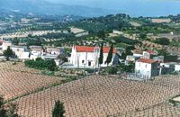 Malevizi, Iraklion at 44.1km (E) Pyrgou lies 20 km from Iraklion and 1km from Agios Myron at 400m a.s.l with 354 inhabitants. It is built on a hillside overlooking the area, with panoramic view to the village of Kroussonas and the ravine of "Agia Irini". At the village's perimeter there are well maintained tower-like houses. 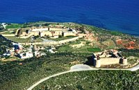 Aptera, Apokoronas, Hania at 44.4km (NW) Those are two Turkish castles that are built in the 19th century using material from the nearby archaeological site of Aptera. The lower castle is that of Itzedin (also known as Kalami fort) named in honour of the son of the Sultan of the time, by the commander of Crete, Reouf Pasha was used in the past as a prison.
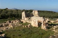 Aptera, Apokoronas, Hania at 44.7km (NW) One of the most important city - states of Crete. The first epigraphic occurence of its name (A-pa-ta-wa) is found in the Linear B tablets found at Knossos. (14th - 13th century B.C.). The history of the city is continued through the centuries untill the 7th century A.D. when a major earthquake destoyed it. Its ideal location, allowed the city to control the naval activity in the bay of Souda, and was determinative for its development in an important commercial center. The era of the city's greatest peak was the early Hellenistic period (late 4th - 3rd century B.C.). At that time Aptera experienced an economical and political floruit, begins to mint its own coins and develops diplomatic relations with important centres of the Hellenistic world.
The most important monuments of the site are: Roman cisterns. Bipartite temple, known as the "bipartite sanctuary", dated to the 5th-4th century B.C. Graves of the Geometric-Roman periods. The fortification wall, preserved to a length of almost 4 kilometres. Part of a Roman bouleuterion. Byzantine buildings. Monastery of Agios Ioannis Theologos. Turkish fortress built in 1866-1869. Source: The Hellenic Ministry of Culture  Malevizi, Iraklion at 44.7km (E) Pentamódi (GR: Πενταμόδι)one of the oldest villages in Crete, is located in the valley of Gazanos river, 17km from Iraklion and 4km from Agios Myron at 350m a.s.l with 278 inhabitants. At "Agia Paraskevi" a place with rich vegetation are organized every summer a series of cultural festivals. A fountain of the 15th century with the blazon of the house of "Quirini" is one of the significant monuments of the area. The patron Saint is "Agios Nikolaos" and there is a village feast on the 26th July in his honour.  Malevizi, Iraklion at 44.9km (E) Agios Myron, with 708 inhabitants, lies 18 km from the city of Iraklion to the south west. Its one of the most important villages of the area with interesting town planning and impressive samples of traditional architecture. Built between two hills it commands a panoramic view and the school's clock, its main characteristic, is visible from almost everywhere in the area of Malevizi.  Tylissos at 45km (E) The houses of Tylissos were built during the LM I period (16th-15th century B.C.). Additions were made on House A in the LM II (15th-14th century B.C.) and on House C during the LM III period (14th century B.C.). The site was destroyed by fire in the 14th century B.C. and re - inhabited in historic times as is attested by ruins of later houses over the Minoan ones. Tylissos was excavated by Joseph Chatzidakis in 1902-1913. In 1954, in the course of restorations, parts of a paved court were revealed to the west, and a small stoa with five columns to the north of the Square of the Altar. The monuments were restored by the Archaeological Service (under the direction of Nicolaos Platon) in the period between 1954 and 1962. All three houses were again restored in 1990-1994. Source: The Hellenic Ministry of Culture 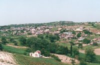 Kenouriou, Iraklion at 45.1km (E) Megali Vrissi (GR: Μεγάλη Βρύση) lies 32km south of Heraklion, at 620 m above sea level. In the Barozzi document of 1577, it is mentioned as forming part of the province of Monofatsi and, in the Archives of Megalo Kastro (Heraklion), it is quoted in 1583 as having 71 inhabitants; there is also a reference to the village in the Basilicata document of 1630. The Turkish census records it with 47 families in 1671, and in the Egyptian one in 1834, it figures with 27 families. In the censi of 1881 and 1900 it is mentioned as a municipality in its own right with, respectively, 240 inhabitants and 307 inhabitants. As of 1928, it becomes a commune and today it counts over 900 inhabitants. Saint Constantine is the patron saint of the village. The churches of Aghia Anna and of the Panagia Almiri are worth visiting. The Aeolian Park, one of the islands pioneering projects, has been installed in Megali Vrisi and produces electricity of 5MW. 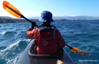 article by Stelios Asmargianakis at 45.1km (NW) An article where Stelios Asmargianakis describes his experience of sea kayak, through a two-day trip to the north of Chania as it took place in mid February 2012. The whole journey is about 40 km, and is characterized by the absence of beaches for easy approaching and relaxing as well as exposure to the elements of the Cretan Sea.
 Malevizi, Iraklion at 45.8km (E) Petrokéfalo (GR: Πετροκέφαλο) lies 16km from Iraklion and 3km from Agios Myron at 340m a.s.l with 248 inhabitants. It is built on a rocky hillside. The hill' shape resembles to a human head and it is supposed that the village owes its name to this (petrokefali = stone head) . The settlement was fortified and lately were discovered significant ancient findings. The patron Saint is "Agia Paraskevi" and there is a village feast on the 8th September in her honour.
|
|||
|
| |||
C
O
N
T
E
N
T
S
O
N
T
E
N
T
S

